Category:Locator maps of Victoria, Australia
Jump to navigation
Jump to search
States of Australia: New South Wales · Queensland · South Australia · Victoria · Western Australia
Internal territories of Australia: Northern Territory
External territories of Australia: Ashmore and Cartier Islands · Christmas Island · Cocos (Keeling) Islands · Coral Sea Islands · Heard Island and McDonald Islands · Norfolk Island
Internal territories of Australia: Northern Territory
External territories of Australia: Ashmore and Cartier Islands · Christmas Island · Cocos (Keeling) Islands · Coral Sea Islands · Heard Island and McDonald Islands · Norfolk Island
Subcategories
This category has the following 2 subcategories, out of 2 total.
B
- Locator maps of Ballarat (3 F)
- Locator maps of Bendigo (4 F)
Media in category "Locator maps of Victoria, Australia"
The following 7 files are in this category, out of 7 total.
-
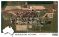 Aerial image of Serviceton, Victoria, Australia, 2020.tif 2,156 × 1,363; 11.21 MB
-
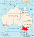 Aus VIC map.png 328 × 352; 26 KB
-
 Hamilton, Victoria.png 800 × 535; 143 KB
-
 Australia Melbourne Inner Locator.PNG 613 × 378; 23 KB
-
 Morwell, Victoria.png 800 × 535; 141 KB
-
 Robinvale,Victoria.png 800 × 535; 142 KB
-
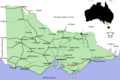
 Victoria map Melbourne inset.png 563 × 369; 38 KB


