Category:Locator maps of municipalities in Landkreis Neustadt an der Waldnaab
Jump to navigation
Jump to search
Urban districts (cities):
Subcategories
This category has only the following subcategory.
Media in category "Locator maps of municipalities in Landkreis Neustadt an der Waldnaab"
The following 49 files are in this category, out of 49 total.
-
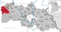
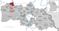
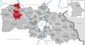
 Altenstadt an der Waldnaab in NEW.svg 1,000 × 532; 740 KB
-
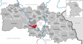
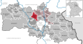
 Bechtsrieth in NEW.svg 1,000 × 532; 740 KB
-
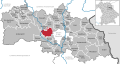
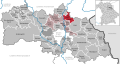
 Eschenbach in der Oberpfalz in NEW.svg 1,000 × 532; 740 KB
-
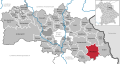
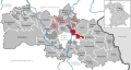
 Eslarn in NEW.svg 1,000 × 532; 740 KB
-
 Etzenricht in NEW.svg 1,000 × 532; 740 KB
-
 Flossenbürg in NEW.svg 1,000 × 532; 740 KB
-
 Floß in NEW.svg 1,000 × 532; 740 KB
-
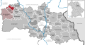
 Georgenberg in NEW.svg 1,000 × 532; 740 KB
-
 Grafenwöhr in NEW.svg 1,000 × 532; 740 KB
-
 Irchenrieth in NEW.svg 1,000 × 532; 740 KB
-
 Kirchendemenreuth in NEW.svg 1,000 × 532; 740 KB
-
 Kirchenthumbach in NEW.svg 1,000 × 532; 740 KB
-
 Kohlberg in NEW.svg 1,000 × 532; 740 KB
-
 Leuchtenberg in NEW.svg 1,000 × 532; 740 KB
-
 Luhe-Wildenau in NEW.svg 1,000 × 532; 740 KB
-
 Mantel in NEW.svg 1,000 × 532; 740 KB
-
 Manteler Forst in NEW.svg 1,000 × 532; 740 KB
-
 Moosbach in NEW.svg 1,000 × 532; 740 KB
-
 Municipalities in NEW.svg 1,000 × 532; 740 KB
-
 Neustadt am Kulm in NEW.svg 1,000 × 532; 740 KB
-
 Neustadt an der Waldnaab in NEW.svg 1,000 × 532; 740 KB
-
 Parkstein in NEW.svg 1,000 × 532; 740 KB
-
 Pirk in NEW.svg 1,000 × 532; 740 KB
-
 Pleystein in NEW.svg 1,000 × 532; 740 KB
-
 Pressath in NEW.svg 1,000 × 532; 740 KB
-
 Püchersreuth in NEW.svg 1,000 × 532; 740 KB
-
 Schirmitz in NEW.svg 1,000 × 532; 740 KB
-
 Schlammersdorf in NEW.svg 1,000 × 532; 740 KB
-
 Schwarzenbach in NEW.svg 1,000 × 532; 740 KB
-
 Speinshart in NEW.svg 1,000 × 532; 740 KB
-
 Speinsharter Forst in NEW.svg 1,000 × 532; 740 KB
-
 Störnstein in NEW.svg 1,000 × 532; 740 KB
-
 Theisseil in NEW.svg 1,000 × 532; 740 KB
-
 Trabitz in NEW.svg 1,000 × 532; 740 KB
-
 Tännesberg in NEW.svg 1,000 × 532; 740 KB
-
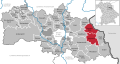
 Verwaltungsgemeinschaft Eschenbach in der Oberpfalz in NEW.svg 1,000 × 532; 740 KB
-
 Verwaltungsgemeinschaft Kirchenthumbach in NEW.svg 1,000 × 532; 740 KB
-
 Verwaltungsgemeinschaft Neustadt an der Waldnaab in NEW.svg 1,000 × 532; 740 KB
-
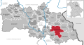
 Verwaltungsgemeinschaft Pleystein in NEW.svg 1,000 × 532; 740 KB
-
 Verwaltungsgemeinschaft Pressath in NEW.svg 1,000 × 532; 740 KB
-
 Verwaltungsgemeinschaft Schirmitz in NEW.svg 1,000 × 532; 740 KB
-
 Verwaltungsgemeinschaft Tännesberg in NEW.svg 1,000 × 532; 740 KB
-
 Verwaltungsgemeinschaft Weiherhammer in NEW.svg 1,000 × 532; 740 KB
-
 Vohenstrauß in NEW.svg 1,000 × 532; 740 KB
-
 Vorbach in NEW.svg 1,000 × 532; 740 KB
-
 Waidhaus in NEW.svg 1,000 × 532; 740 KB
-
 Waldthurn in NEW.svg 1,000 × 532; 740 KB
-
 Weiherhammer in NEW.svg 1,000 × 532; 740 KB
-
 Windischeschenbach in NEW.svg 1,000 × 532; 740 KB


