Category:Lower Broadheath
Jump to navigation
Jump to search
village in Worcestershire, United Kingdom  | |||||
| Upload media | |||||
| Instance of | |||||
|---|---|---|---|---|---|
| Location | Malvern Hills, Worcestershire, West Midlands, England | ||||
 | |||||
Subcategories
This category has the following 2 subcategories, out of 2 total.
C
E
- Elgar Birthplace Museum (15 F)
Media in category "Lower Broadheath"
The following 124 files are in this category, out of 124 total.
-
 An oilseed rape field - geograph.org.uk - 5743951.jpg 1,024 × 680; 323 KB
-
 Ankerdine Road - geograph.org.uk - 6132296.jpg 1,024 × 768; 346 KB
-

-
 Autumn colour with distant Malvern Hills - geograph.org.uk - 6012054.jpg 1,600 × 1,200; 328 KB
-
 B4204, Broadheath - geograph.org.uk - 6132380.jpg 1,024 × 768; 327 KB
-
 Bell Lane, Broadheath - geograph.org.uk - 6132322.jpg 1,024 × 768; 466 KB
-
 Bell Lane, Lower Broadheath - geograph.org.uk - 2769753.jpg 1,024 × 673; 203 KB
-
 Birthplace of Sir Edward Elgar, Lower Broadheath - geograph.org.uk - 2863662.jpg 1,600 × 1,067; 278 KB
-
 Boundary stone - geograph.org.uk - 5743386.jpg 680 × 1,024; 399 KB
-
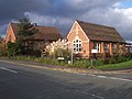 Broadheath C of E Primary School - geograph.org.uk - 77450.jpg 640 × 479; 76 KB
-

-

-

-

-
 Broadheath Common - geograph.org.uk - 6132320.jpg 1,024 × 768; 300 KB
-
 Broadheath Common - geograph.org.uk - 903317.jpg 640 × 480; 103 KB
-
 Broadheath Stores and Post Office - geograph.org.uk - 989336.jpg 640 × 480; 81 KB
-

-
 Broadheath Village Hall - geograph.org.uk - 77451.jpg 640 × 479; 126 KB
-
 Cheap bus stop - geograph.org.uk - 903302.jpg 640 × 480; 93 KB
-
 Christ Church (1), Church Lane, Lower Broadheath - geograph.org.uk - 2769485.jpg 1,024 × 675; 213 KB
-
 Christ Church (2), Church Lane, Lower Broadheath - geograph.org.uk - 2769508.jpg 719 × 1,024; 193 KB
-

-
 Church - Lower Broadheath - geograph.org.uk - 4306874.jpg 640 × 480; 63 KB
-
 Churchyard, Lower Broadheath - geograph.org.uk - 6132389.jpg 1,024 × 768; 387 KB
-
 Cover crop at Temple Laugherne Farm - geograph.org.uk - 5633500.jpg 1,600 × 901; 831 KB
-
 Cut out sculpture at Elgar's birthplace - geograph.org.uk - 5743961.jpg 768 × 1,024; 278 KB
-

-
 Elgar's Birthplace And Adjoining Coach House And Stables.jpg 1,632 × 918; 1.1 MB
-

-
 Elgar's Birthplace Museum Visitor Centre - geograph.org.uk - 5827909.jpg 4,096 × 2,304; 4.95 MB
-
 Elgar's Birthplace Museum Visitor Centre - geograph.org.uk - 5827930.jpg 4,096 × 2,304; 4.67 MB
-
 Elgar's Birthplace Museum Visitor Centre - geograph.org.uk - 5827975.jpg 4,096 × 2,048; 3.86 MB
-
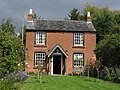 Elgar's Cottage, Lower Broadheath near Worcester - geograph.org.uk - 3288005.jpg 1,024 × 768; 247 KB
-
 Entrance to The Elms - geograph.org.uk - 5743381.jpg 1,024 × 680; 377 KB
-
 Entrance to Upper Lightwood Farm on a foggy morning - geograph.org.uk - 6074718.jpg 1,600 × 1,200; 242 KB
-
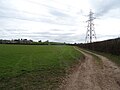
 Farm road and footpath - geograph.org.uk - 5633506.jpg 1,600 × 901; 714 KB
-
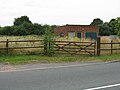
 Field gate for access to footpath from Ankerdine Road - geograph.org.uk - 3069648.jpg 3,648 × 2,736; 3.16 MB
-
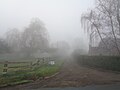
 Foggy morning by Broadheath Common - geograph.org.uk - 6074716.jpg 1,600 × 1,200; 315 KB
-
 Frenchlands Lane - geograph.org.uk - 5743382.jpg 1,024 × 680; 387 KB
-
 Grave of Marco ^ Mina (Lower Broadheath) - geograph.org.uk - 5827964.jpg 2,048 × 1,360; 1.32 MB
-
 House overlooking Hallow Lane - geograph.org.uk - 5743388.jpg 1,024 × 680; 256 KB
-
 Houses on the hill - geograph.org.uk - 850743.jpg 640 × 480; 91 KB
-

-
 Lower Broadheath - derelict structure - geograph.org.uk - 904431.jpg 640 × 480; 75 KB
-
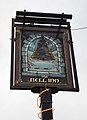
 Lower Broadheath - The Bell Inn - geograph.org.uk - 904435.jpg 640 × 480; 58 KB
-
 Lower Broadheath church - geograph.org.uk - 5743383.jpg 1,024 × 680; 257 KB
-
 Lower Broadheath church - geograph.org.uk - 5743384.jpg 680 × 1,024; 243 KB
-

-
 Lower Broadheath Village Centre - geograph.org.uk - 77288.jpg 640 × 479; 83 KB
-
 Malvern Hills , Polythene Tunnels - geograph.org.uk - 3969923.jpg 4,288 × 2,632; 6.6 MB
-
 Malvern Hills District , Country Lane - geograph.org.uk - 3969973.jpg 4,288 × 2,848; 5.82 MB
-
 Malvern Hills District , Farm Buildings - geograph.org.uk - 3969969.jpg 4,288 × 2,848; 7.54 MB
-
 Malvern Hills District , Farm Track - geograph.org.uk - 3969910.jpg 4,288 × 2,848; 5.64 MB
-
 Malvern Hills District , Field ^ Footpath - geograph.org.uk - 3969921.jpg 4,288 × 2,848; 7.67 MB
-
 Malvern Hills District , Field ^ Footpath - geograph.org.uk - 3969930.jpg 4,288 × 2,640; 8 MB
-
 Malvern Hills District , Footpath - geograph.org.uk - 3969864.jpg 4,288 × 2,848; 6.54 MB
-
 Malvern Hills District , Footpath - geograph.org.uk - 3969865.jpg 4,288 × 2,848; 6.23 MB
-
 Malvern Hills District , Grassy Field - geograph.org.uk - 3969861.jpg 4,245 × 2,820; 7.22 MB
-
 Malvern Hills District , Grassy Field - geograph.org.uk - 3969897.jpg 4,288 × 2,848; 6.21 MB
-
 Malvern Hills District , Grassy Field - geograph.org.uk - 3969948.jpg 3,976 × 2,642; 5.68 MB
-
 Malvern Hills District , Grassy Field - geograph.org.uk - 3969953.jpg 4,288 × 2,848; 5.72 MB
-
 Malvern Hills District , Grassy Field - geograph.org.uk - 3969955.jpg 4,288 × 2,848; 6.3 MB
-
 Malvern Hills District , Grassy Field - geograph.org.uk - 3969965.jpg 4,288 × 2,848; 7.28 MB
-
 Malvern Hills District , Grassy Field - geograph.org.uk - 3969976.jpg 4,288 × 2,848; 5.84 MB
-
 Malvern Hills District , Grassy Field - geograph.org.uk - 3969979.jpg 4,288 × 2,848; 5.89 MB
-
 Malvern Hills District , Grassy Field - geograph.org.uk - 3969983.jpg 4,288 × 2,848; 6.79 MB
-
 Malvern Hills District , Grassy Field ^ Horse - geograph.org.uk - 3969959.jpg 3,096 × 2,056; 5.22 MB
-
 Malvern Hills District , Hedgerow ^ Gate - geograph.org.uk - 3969936.jpg 4,200 × 2,790; 5.21 MB
-
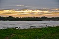
 Malvern Hills District , Laugherne Brook - geograph.org.uk - 3970006.jpg 4,001 × 2,657; 7.68 MB
-
 Malvern Hills District , Laugherne Brook - geograph.org.uk - 3970015.jpg 2,848 × 4,288; 6.28 MB
-
 Malvern Hills District , Martley Road B4204 - geograph.org.uk - 3969944.jpg 4,288 × 2,848; 5.8 MB
-
 Malvern Hills District , Ploughed Field - geograph.org.uk - 3969887.jpg 4,288 × 2,848; 5.98 MB
-
 Malvern Hills District , Polythene Tunnels - geograph.org.uk - 3969914.jpg 4,288 × 2,780; 7.55 MB
-
 Malvern Hills District , Temple Laugherne Farm - geograph.org.uk - 3969881.jpg 4,113 × 2,731; 4.64 MB
-
 Malvern Hills District , Temple Laugherne Farm - geograph.org.uk - 3969892.jpg 4,181 × 2,777; 5.8 MB
-
 Malvern Walk, Lower Broadheath - geograph.org.uk - 904419.jpg 640 × 480; 71 KB
-
 Martley Road, Lower Broadheath - geograph.org.uk - 6132385.jpg 640 × 480; 73 KB
-
 New houses at Lower Broadheath - geograph.org.uk - 4578082.jpg 800 × 531; 102 KB
-
 Oldbury Farm crops - geograph.org.uk - 903320.jpg 640 × 480; 112 KB
-
 Oldbury Grange, Oldbury, Lower Broadheath - geograph.org.uk - 6012043.jpg 1,600 × 1,200; 371 KB
-
 Part of Broadheath Common - geograph.org.uk - 3242701.jpg 640 × 480; 100 KB
-
 Pasture by Broadheath - geograph.org.uk - 6132295.jpg 1,024 × 768; 416 KB
-
 Peachley Leisure - geograph.org.uk - 837562.jpg 640 × 480; 141 KB
-
 Picture of Elgar - geograph.org.uk - 5743233.jpg 768 × 1,024; 240 KB
-
 Power line, Lower Broadheath - geograph.org.uk - 6132390.jpg 1,024 × 768; 267 KB
-
 Scarlet Pippin Orchard development - geograph.org.uk - 4578075.jpg 800 × 531; 108 KB
-
 Scarlet Pippin Orchard sales office - geograph.org.uk - 4578078.jpg 800 × 531; 98 KB
-
 Southbury in Broadheath Common - geograph.org.uk - 3242685.jpg 640 × 480; 125 KB
-

-

-
 Statue of Sir Edward Elgar - geograph.org.uk - 5743769.jpg 680 × 1,024; 237 KB
-
 Statue of Sir Edward Elgar - geograph.org.uk - 5743770.jpg 680 × 1,024; 246 KB
-
 Statue of Sir Edward Elgar - geograph.org.uk - 5743774.jpg 680 × 1,024; 384 KB
-
 Statue of Sir Edward Elgar - geograph.org.uk - 6166096.jpg 1,024 × 768; 358 KB
-
 Statue of Sir Edward Elgar - geograph.org.uk - 6166115.jpg 768 × 1,024; 254 KB
-
 Summerhouse in the garden at Elgar's birthplace - geograph.org.uk - 5743782.jpg 1,024 × 680; 406 KB
-
 Telephone kiosk in Bell Lane, Lower Broadheath - geograph.org.uk - 2769772.jpg 640 × 1,024; 178 KB
-
 The Bell Inn (1), Martley Road, Lower Broadheath - geograph.org.uk - 2769806.jpg 1,024 × 673; 159 KB
-
 The Bell Inn (2), Martley Road, Lower Broadheath - geograph.org.uk - 2769814.jpg 1,024 × 687; 151 KB
-
-

-
 The Bell Inn - Lower Broadheath - geograph.org.uk - 4306879.jpg 640 × 480; 70 KB
-

-
 The Dewdrop Inn, Broadheath Common - geograph.org.uk - 3242694.jpg 640 × 480; 71 KB
-
 The Firs - Elgar's birthplace - geograph.org.uk - 5743754.jpg 800 × 531; 155 KB
-
 The Firs - Elgar's birthplace - geograph.org.uk - 5743755.jpg 680 × 1,024; 333 KB
-
 The Firs - Elgar's birthplace - geograph.org.uk - 6166083.jpg 1,024 × 768; 348 KB
-
 The Firs-Elgar's Birthplace (Lower Broadheath) - geograph.org.uk - 5827936.jpg 4,096 × 2,304; 3.7 MB
-
 The Firs-Elgar's Birthplace (Lower Broadheath) - geograph.org.uk - 5827969.jpg 2,048 × 1,360; 1.35 MB
-

-

-

-
 The Plough, Lower Broadheath - geograph.org.uk - 3242706.jpg 640 × 480; 68 KB
-
 The Road to Broadheath - geograph.org.uk - 903287.jpg 640 × 480; 80 KB
-
 The spire of Hallow church reflected in a pond - geograph.org.uk - 5743387.jpg 1,024 × 680; 308 KB
-
 The visitor centre at Elgar's Birthplace museum - geograph.org.uk - 5743947.jpg 1,024 × 576; 261 KB
-
 View from The Firs-Elgar's Birthplace (Lower Broadheath) - geograph.org.uk - 5827967.jpg 2,048 × 1,360; 1.39 MB
-
 View from The Firs-Elgar's Birthplace (Lower Broadheath) - geograph.org.uk - 5827968.jpg 2,048 × 1,360; 1.36 MB
-
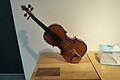 Violin inside Elgar's Birthplace Museum Visitor Centre - geograph.org.uk - 5827960.jpg 2,048 × 1,360; 1.22 MB
-
 Waste ground near Hallow - geograph.org.uk - 850739.jpg 640 × 480; 82 KB
-
 Wheatfield behind The Firs - geograph.org.uk - 6166108.jpg 1,024 × 768; 326 KB
-

-
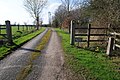
 Footpath to Oldbury Grange - geograph.org.uk - 77823.jpg 640 × 479; 79 KB


,_Sailor%27s_Bank,_Lower_Broadheath_-_geograph.org.uk_-_2769556.jpg)
,_Sailor%27s_Bank,_Lower_Broadheath_-_geograph.org.uk_-_2769567.jpg)
_-_sign,_Sailor%27s_Bank,_Lower_Broadheath_-_geograph.org.uk_-_2769586.jpg)


,_Church_Lane,_Lower_Broadheath_-_geograph.org.uk_-_2769485.jpg)
,_Church_Lane,_Lower_Broadheath_-_geograph.org.uk_-_2769508.jpg)
_-_lychgate,_Church_Lane,_Lower_Broadheath_-_geograph.org.uk_-_2769528.jpg)


_-_geograph.org.uk_-_5827964.jpg)


_-_geograph.org.uk_-_5827940.jpg)


,_Martley_Road,_Lower_Broadheath_-_geograph.org.uk_-_2769806.jpg)
,_Martley_Road,_Lower_Broadheath_-_geograph.org.uk_-_2769814.jpg)
_-_sign,_Martley_Road,_Lower_Broadheath_-_geograph.org.uk_-_2769898.jpg)
_-_West_Country_Ales_plaque,_Martley_Road,_Lower_Broadheath_-_geograph.org.uk_-_2769908.jpg)

_-_sign,_Bell_Lane,_Lower_Broadheath_-_geograph.org.uk_-_2742301.jpg)


_-_geograph.org.uk_-_5827936.jpg)
_-_geograph.org.uk_-_5827969.jpg)
,_Crown_East_Lane,_Lower_Broadheath_-_geograph.org.uk_-_2753602.jpg)
,_Crown_East_Lane,_Lower_Broadheath_-_geograph.org.uk_-_2753618.jpg)
_-_sign,_Crown_East_Lane,_Lower_Broadheath_-_geograph.org.uk_-_2753626.jpg)


_-_geograph.org.uk_-_5827967.jpg)
_-_geograph.org.uk_-_5827968.jpg)


