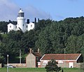
Category:Lowestoft Lighthouse
Jump to navigation
Jump to search
| Object location | | View all coordinates using: OpenStreetMap |
|---|
English: Lowestoft Lighthouse
lighthouse in Waveney, Suffolk, England, UK | |||||
| Upload media | |||||
| Instance of | |||||
|---|---|---|---|---|---|
| Location | |||||
| Operator | |||||
| Heritage designation |
| ||||
| Service entry |
| ||||
| Inception |
| ||||
| Significant event |
| ||||
| Height |
| ||||
 | |||||
Media in category "Lowestoft Lighthouse"
The following 18 files are in this category, out of 18 total.
-
ECR(1851) p55b - (Lowestoft) High Light.jpg 919 × 807; 241 KB
-
Caroline Adams Lowestoft Lighthouse, Suffolk.jpg 1,400 × 1,022; 273 KB
-
Detail of Lowestoft Lighthouse - geograph.org.uk - 5805570.jpg 2,592 × 1,878; 2.01 MB
-
High Lighthouse, Lowestoft, England-LCCN2002696983.jpg 3,691 × 2,748; 3.66 MB
-
High Lighthouse, Lowestoft, England-LCCN2002696983.tif 3,691 × 2,748; 29.02 MB
-
Lighthouse at Lowestoft Denes - geograph.org.uk - 223524.jpg 640 × 480; 134 KB
-
Lighthouse Score Lowestoft England.jpg 1,075 × 843; 189 KB
-
Lighthouse Score, Lowestoft, England-LCCN2002696984.jpg 3,700 × 2,770; 3.27 MB
-
Lowestoft Denes lighthouse - geograph.org.uk - 229057.jpg 640 × 542; 66 KB
-
Lowestoft high light - geograph.org.uk - 479740.jpg 640 × 427; 86 KB
-
Lowestoft High Lighthouse 1797.jpg 675 × 477; 304 KB
-
Lowestoft lighthouse (geograph 5804184).jpg 2,592 × 3,456; 2.83 MB
-
Lowestoft Lighthouse - geograph.org.uk - 764574.jpg 3,072 × 2,304; 1.18 MB
-
Lowestoft Lighthouse from the promenade (geograph 3985740).jpg 640 × 480; 76 KB
-
Lowestoft Low Lighthouse 1797.jpg 378 × 378; 111 KB
-
Lowestoft Old High and Low Lighthouses.tif 852 × 381; 540 KB
-
The lighthouse at Lowestoft - geograph.org.uk - 2150570.jpg 640 × 480; 106 KB
-
The lighthouse in Lowestoft - geograph.org.uk - 2214005.jpg 1,500 × 1,000; 141 KB


