Category:Macizo de Anaga
Jump to navigation
Jump to search
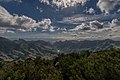
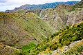
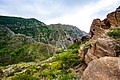
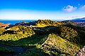
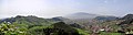
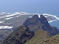
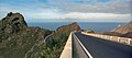
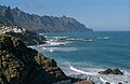
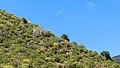
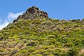
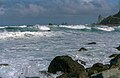
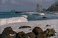
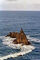
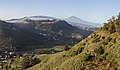
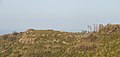
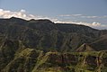
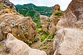
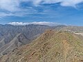
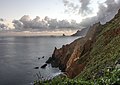
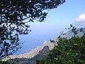
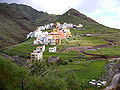
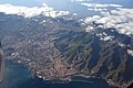
English: Pictures of the Anaga Massif (Macizo de Anaga), a mountain range in the northeastern part of the island of Tenerife one of the islands of the Canary Islands in Spain
Español: El macizo de Anaga es una formación montañosa y región histórica del nordeste de la isla canaria de Tenerife, España
mountain range in the northeastern part of the island of Tenerife in the Canary Islands  | |||||
| Upload media | |||||
| Instance of | |||||
|---|---|---|---|---|---|
| Made from material | |||||
| Location | Santa Cruz de Tenerife Province, Canary Islands, Spain | ||||
| Area |
| ||||
| Elevation above sea level |
| ||||
 | |||||
Subcategories
This category has the following 16 subcategories, out of 16 total.
A
B
- Barranco del Río (La Laguna) (4 F)
C
L
- La Cumbrilla (1 F)
- Las Palmas (Anaga) (6 F)
M
- Mercedeswald (20 F)
P
- Playa de Almáciga (5 F)
R
- Roque Anambro (7 F)
- Roque Chinobre (3 F)
- Roque de Taborno (18 F)
T
- Tahodio Valley (9 F)
- TF-136 (2 F)
V
- Valle Brosque (6 F)
Media in category "Macizo de Anaga"
The following 200 files are in this category, out of 207 total.
(previous page) (next page)-
 1987 wurde der Naturpark Anaga-Gebierge gegründet. 01.jpg 1,225 × 816; 604 KB
-
 1987 wurde der Naturpark Anaga-Gebierge gegründet. 02.jpg 1,225 × 816; 513 KB
-
 1987 wurde der Naturpark Anaga-Gebierge gegründet. 03.jpg 1,329 × 752; 459 KB
-
 1987 wurde der Naturpark Anaga-Gebierge gegründet. 04.jpg 816 × 1,225; 563 KB
-
 1987 wurde der Naturpark Anaga-Gebierge gegründet. 05.jpg 1,218 × 821; 1.32 MB
-
 1987 wurde der Naturpark Anaga-Gebierge gegründet. 06.jpg 1,452 × 689; 582 KB
-
 1987 wurde der Naturpark Anaga-Gebierge gegründet. 07.jpg 876 × 1,142; 603 KB
-
 1987 wurde der Naturpark Anaga-Gebierge gegründet. 08.jpg 1,293 × 774; 582 KB
-
 1987 wurde der Naturpark Anaga-Gebierge gegründet. 09.jpg 816 × 1,225; 641 KB
-
 1987 wurde der Naturpark Anaga-Gebierge gegründet. 10.jpg 816 × 1,225; 783 KB
-
 1987 wurde der Naturpark Anaga-Gebierge gegründet. 11.jpg 816 × 1,225; 590 KB
-
 1987 wurde der Naturpark Anaga-Gebierge gegründet. 12.jpg 816 × 1,225; 667 KB
-
 1987 wurde der Naturpark Anaga-Gebierge gegründet. 13.jpg 816 × 1,225; 614 KB
-
 700 Menschen leben im größten Ort des Anaga Gebirges. 01.jpg 1,319 × 758; 557 KB
-
 700 Menschen leben im größten Ort des Anaga Gebirges. 02.jpg 1,235 × 810; 625 KB
-
 700 Menschen leben im größten Ort des Anaga Gebirges. 03.jpg 858 × 1,165; 657 KB
-
 700 Menschen leben im größten Ort des Anaga Gebirges. 04.jpg 834 × 1,199; 497 KB
-
 700 Menschen leben im größten Ort des Anaga Gebirges. 05.jpg 816 × 1,225; 502 KB
-
 700 Menschen leben im größten Ort des Anaga Gebirges. 06.jpg 1,225 × 816; 460 KB
-
 700 Menschen leben im größten Ort des Anaga Gebirges. 07.jpg 1,225 × 816; 430 KB
-
 700 Menschen leben im größten Ort des Anaga Gebirges. 08.jpg 1,318 × 759; 491 KB
-
 700 Menschen leben im größten Ort des Anaga Gebirges. 09.jpg 853 × 1,172; 486 KB
-
 700 Menschen leben im größten Ort des Anaga Gebirges. 10.jpg 828 × 1,208; 449 KB
-
 700 Menschen leben im größten Ort des Anaga Gebirges. 11.jpg 1,225 × 816; 505 KB
-
 700 Menschen leben im größten Ort des Anaga Gebirges. 12.jpg 816 × 1,225; 582 KB
-
 700 Menschen leben im größten Ort des Anaga Gebirges. 13.jpg 845 × 1,183; 695 KB
-
 700 Menschen leben im größten Ort des Anaga Gebirges. 14.jpg 1,295 × 772; 1.18 MB
-
 700 Menschen leben im größten Ort des Anaga Gebirges. 15.jpg 1,380 × 725; 490 KB
-
 700 Menschen leben im größten Ort des Anaga Gebirges. 16.jpg 1,225 × 816; 572 KB
-
 700 Menschen leben im größten Ort des Anaga Gebirges. 17.jpg 1,358 × 737; 588 KB
-
 700 Menschen leben im größten Ort des Anaga Gebirges. 18.jpg 1,296 × 772; 542 KB
-
 Aguaide.JPG 640 × 480; 162 KB
-
 Anaga (Tenerife).jpg 863 × 585; 98 KB
-
 Anaga 2006.jpg 2,592 × 1,944; 970 KB
-
 Anaga Gebirge (151552199).jpeg 960 × 641; 141 KB
-
 Anaga Massif and Teide volcano on Tenerife.jpg 4,272 × 2,848; 8.75 MB
-
 Anaga Massif on Tenerife 2018 B.jpg 4,272 × 2,848; 9.01 MB
-
 Anaga Massif on Tenerife 2018 C.jpg 4,272 × 2,848; 8.78 MB
-
 Anaga Massif on Tenerife 2018 D.jpg 4,272 × 2,848; 8.54 MB
-
 Anaga Massif on Tenerife 2018.jpg 4,164 × 2,776; 7.6 MB
-
 Anaga Mountains 100.jpg 3,648 × 2,432; 3.53 MB
-
 Anaga Mountains(1).jpg 3,230 × 2,153; 1.2 MB
-
 Anaga Mountains(10).jpg 3,333 × 2,222; 1.16 MB
-
 Anaga Mountains(12).jpg 3,322 × 2,215; 3.04 MB
-
 Anaga Mountains(14).jpg 3,549 × 2,366; 3.01 MB
-
 Anaga Mountains(15).jpg 3,648 × 2,432; 3.86 MB
-
 Anaga Mountains(16).jpg 3,648 × 2,432; 3.82 MB
-
 Anaga Mountains(17).jpg 3,648 × 2,432; 3.85 MB
-
 Anaga Mountains(18).jpg 3,648 × 2,432; 3.25 MB
-
 Anaga Mountains(19).jpg 3,627 × 2,418; 3.78 MB
-
 Anaga Mountains(2).jpg 3,379 × 2,253; 1.19 MB
-
 Anaga Mountains(20).jpg 3,468 × 2,312; 3.48 MB
-
 Anaga Mountains(21).jpg 3,563 × 2,375; 3.66 MB
-
 Anaga Mountains(22).jpg 3,644 × 2,429; 3.61 MB
-
 Anaga Mountains(25).jpg 2,322 × 3,483; 2.01 MB
-
 Anaga Mountains(26).jpg 2,322 × 3,483; 3.65 MB
-
 Anaga Mountains(28).jpg 2,322 × 3,483; 3.09 MB
-
 Anaga Mountains(3).jpg 3,648 × 2,432; 1.58 MB
-
 Anaga Mountains(30).jpg 3,483 × 2,322; 3.04 MB
-
 Anaga Mountains(33).jpg 3,264 × 2,176; 1.52 MB
-
 Anaga Mountains(4).jpg 3,648 × 2,432; 1.56 MB
-
 Anaga Mountains(6).jpg 3,543 × 2,362; 1.66 MB
-
 Anaga Mountains(7).jpg 2,432 × 1,621; 613 KB
-
 Anaga Mountains(8).jpg 3,392 × 2,261; 1.37 MB
-
 Anaga Mountains(9).jpg 3,568 × 2,378; 1.56 MB
-
 Anaga Rainforest(27).jpg 3,483 × 2,322; 3.28 MB
-
 Anaga Rainforest(31).jpg 3,483 × 2,322; 2.97 MB
-
 Anaga Rainforest(32).jpg 3,174 × 2,116; 1.19 MB
-
 Anaga.jpg 836 × 516; 304 KB
-
 Anagagebirge1.jpg 1,144 × 856; 903 KB
-
 Barranco de Ijuana (Tenerife).JPG 2,112 × 2,816; 1.25 MB
-
 Begia.jpg 1,600 × 1,066; 293 KB
-
 Bosque, Macizo de Anaga, Tenerife, España, 2015.JPG 4,000 × 3,000; 4.59 MB
-
 Camino La Punta del Hidalgo.JPG 640 × 480; 159 KB
-
 Camino y matorral, Macizo de Anaga, Tenerife, España, 2015.JPG 4,000 × 3,000; 5.03 MB
-
 Casa y nubes, Macizo de Anaga, Tenerife, España, 2015.JPG 4,000 × 3,000; 4.52 MB
-
 Casas en Batán de Arriba.JPG 3,648 × 2,736; 1.52 MB
-
 Casas Heleras y casas del Batán de Abajo..JPG 3,648 × 2,736; 1.52 MB
-
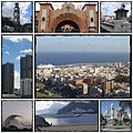 Collage Santa Cruz de Tenerife.jpg 404 × 404; 83 KB
-
 Desde la cresta, Macizo de Anaga, Tenerife, España, 2015.JPG 4,000 × 3,000; 4.49 MB
-
 Desde un avión, vista de Santa Cruz de Tenerife. Canarias. España. Spain.jpg 6,120 × 8,160; 9.86 MB
-
 Dársena pesquera, Macizo de Anaga, Tenerife, España, 2015.JPG 4,000 × 3,000; 4.6 MB
-
 El Frontón, Macizo de Anaga, Tenerife, Spain 11.jpg 3,043 × 3,831; 8.2 MB
-
 El Roque Milano, visto desde la carretera del Batán.JPG 3,648 × 2,736; 1.62 MB
-
 Euphorbia canariensis - Macizo de Anaga.jpg 3,869 × 4,476; 17.56 MB
-
 Gallotia galloti eisentrauti - Macizo de Anaga 01.jpg 3,832 × 2,104; 5.86 MB
-
 Gallotia galloti eisentrauti - Macizo de Anaga 02.jpg 5,875 × 2,449; 9.96 MB
-
 Goats, Macizo de Anaga, Tenerife, Spain 32.jpg 4,970 × 3,227; 11.99 MB
-
 Goats, Macizo de Anaga, Tenerife, Spain 34.jpg 5,184 × 2,753; 8.14 MB
-
 J00 690 Jardina, Valleseco.jpg 5,622 × 3,748; 8.43 MB
-
 J00 691 Mirador Llano de los Loros.jpg 5,706 × 3,804; 6.81 MB
-
 J00 692 Embalse de Tahodio.jpg 5,658 × 3,772; 7.52 MB
-
 J00 693 camino real, Baumheide.jpg 5,934 × 3,956; 10.3 MB
-
 J00 694 camino real, Baumheide.jpg 5,934 × 3,956; 12.71 MB
-
 J00 695 camino de madera (Holzweg).jpg 5,850 × 3,900; 10.07 MB
-
 J00 705 Abzw carretera antigua de norte.jpg 5,934 × 3,956; 9.63 MB
-
 J00 710 Roque Lombarda, Cumbre dorsal.jpg 5,931 × 3,954; 6.1 MB
-
 J00 711 Cabeza del Viento.jpg 5,850 × 3,900; 6.45 MB
-
 J00 716 carretera antigua.jpg 5,661 × 3,774; 10.18 MB
-
 J00 717 carretera antigua.jpg 3,956 × 5,934; 10.48 MB
-
 J00 718 carretera antigua.jpg 5,937 × 3,958; 11 MB
-
 J00 719 carretera antigua.jpg 5,604 × 3,736; 7.96 MB
-
 J00 720 Löwenzahn.jpg 3,750 × 5,625; 8.33 MB
-
 J00 724 Roque Chiguel, Gran Canaria.jpg 5,604 × 3,736; 8.17 MB
-
 La Laguna Panorama BW.jpg 9,125 × 2,449; 3.96 MB
-
 La punta.JPG 640 × 480; 150 KB
-
 Las Casas Heleras, en el Batán.JPG 3,648 × 2,736; 1.52 MB
-
 Las Casillas (Anaga, Tenerife).JPG 2,816 × 2,112; 1.36 MB
-
 Lighthouse, Macizo de Anaga, Tenerife, Spain 33.jpg 5,184 × 3,120; 8.67 MB
-
 Macizo de Anaga 01(js).jpg 5,621 × 3,648; 5.45 MB
-
 Macizo de Anaga 01.jpg 5,736 × 3,468; 18.78 MB
-
 Macizo de Anaga 02(js).jpg 8,058 × 3,562; 7.34 MB
-
 Macizo de Anaga 02.jpg 5,184 × 3,255; 13.49 MB
-
 Macizo de Anaga 03(js).jpg 5,596 × 3,648; 5.09 MB
-
 Macizo de Anaga 03.jpg 5,574 × 3,180; 19.37 MB
-
 Macizo de Anaga 04(js).jpg 5,256 × 3,504; 6.26 MB
-
 Macizo de Anaga 04.jpg 6,000 × 4,000; 24.88 MB
-
 Macizo de Anaga 06(js).jpg 5,601 × 3,658; 5.77 MB
-
 Macizo de Anaga 07(js).jpg 5,596 × 3,648; 5.14 MB
-
 Macizo de Anaga 08(js).jpg 5,446 × 3,246; 5.25 MB
-
 Macizo de Anaga 09(js).jpg 3,648 × 5,607; 6.75 MB
-
 Macizo de Anaga 10(js).jpg 3,221 × 4,832; 4.99 MB
-
 Macizo de Anaga 11(js).jpg 5,611 × 3,684; 5.16 MB
-
 Macizo de Anaga, Tenerife, Spain 01.jpg 5,184 × 3,025; 9.86 MB
-
 Macizo de Anaga, Tenerife, Spain 02.jpg 5,183 × 2,473; 6.74 MB
-
 Macizo de Anaga, Tenerife, Spain 03.jpg 4,391 × 2,640; 9.65 MB
-
 Macizo de Anaga, Tenerife, Spain 04.jpg 3,073 × 3,628; 8.79 MB
-
 Macizo de Anaga, Tenerife, Spain 05.jpg 5,184 × 2,661; 7.16 MB
-
 Mar y montaña, Macizo de Anaga, Tenerife, España, 2015.JPG 4,000 × 3,000; 4.76 MB
-
 Mirador de Aguaide.jpg 1,600 × 1,065; 292 KB
-
 Montes-anaga.JPG 1,024 × 768; 174 KB
-
 Mountains of Cruz de Carmen walk in Anaga Massif on Tenerife 2018 B.jpg 4,053 × 2,702; 8.41 MB
-
 Mountains of Cruz de Carmen walk in Anaga Massif on Tenerife 2018.jpg 4,272 × 2,848; 9.84 MB
-
 Mountains Tenerife north.jpg 3,987 × 2,990; 4.76 MB
-
 North coast of Macizo de Anaga, Tenerife, Spain 21.jpg 4,463 × 3,151; 6.6 MB
-
 North coast of Macizo de Anaga, Tenerife, Spain 25.jpg 3,091 × 3,392; 5.4 MB
-
 Nubes, Macizo de Anaga, Tenerife, España, 2015.JPG 4,000 × 3,000; 4.68 MB
-
 Nublado, Macizo de Anaga, Tenerife, España, 2015.JPG 4,000 × 3,000; 4.52 MB
-
 Panorámica de Los Batanes.JPG 3,648 × 2,736; 1.57 MB
-
 Parque Rural de Anaga - Reserva de la Biosfera Macizo de Anaga 01.jpg 5,472 × 3,648; 11.07 MB
-
 Parque Rural de Anaga - Reserva de la Biosfera Macizo de Anaga 02.jpg 5,472 × 3,648; 13.14 MB
-
 Parque Rural de Anaga - Reserva de la Biosfera Macizo de Anaga 03.jpg 5,472 × 3,648; 13.25 MB
-
 Parque Rural de Anaga - Reserva de la Biosfera Macizo de Anaga 04.jpg 5,472 × 3,648; 16.53 MB
-
 Parque Rural de Anaga - Reserva de la Biosfera Macizo de Anaga 05.jpg 5,472 × 3,648; 15 MB
-
 Parque Rural de Anaga - Reserva de la Biosfera Macizo de Anaga 06.jpg 5,472 × 3,648; 16.9 MB
-
 Parque Rural de Anaga - Reserva de la Biosfera Macizo de Anaga 07.jpg 5,472 × 3,648; 12.45 MB
-
 Parque Rural de Anaga - Reserva de la Biosfera Macizo de Anaga 08.jpg 5,472 × 3,648; 12.98 MB
-
 Parque Rural de Anaga - Reserva de la Biosfera Macizo de Anaga 09.jpg 5,472 × 3,648; 14.99 MB
-
 Parque Rural de Anaga - Reserva de la Biosfera Macizo de Anaga 10.jpg 5,472 × 3,648; 14.94 MB
-
 Parque Rural de Anaga - Reserva de la Biosfera Macizo de Anaga 11.jpg 5,472 × 3,648; 14.06 MB
-
 Parque Rural de Anaga - Reserva de la Biosfera Macizo de Anaga 12.jpg 5,472 × 3,648; 11.48 MB
-
 Parque Rural de Anaga - Reserva de la Biosfera Macizo de Anaga 13.jpg 5,472 × 3,648; 12.5 MB
-
 Parque Rural de Anaga - Reserva de la Biosfera Macizo de Anaga 14.jpg 5,472 × 3,648; 18.96 MB
-
 Parque Rural de Anaga - Reserva de la Biosfera Macizo de Anaga 15.jpg 5,472 × 3,648; 14.23 MB
-
 Parque Rural de Anaga - Reserva de la Biosfera Macizo de Anaga 16.jpg 5,472 × 3,648; 11.91 MB
-
 Parque Rural de Anaga - Reserva de la Biosfera Macizo de Anaga 17.jpg 5,472 × 3,648; 16.27 MB
-
 Parque Rural de Anaga - Reserva de la Biosfera Macizo de Anaga 18.jpg 5,472 × 3,648; 16.66 MB
-
 Parque Rural de Anaga - Reserva de la Biosfera Macizo de Anaga 19.jpg 5,472 × 3,648; 17.46 MB
-
 Parque Rural de Anaga - Reserva de la Biosfera Macizo de Anaga 20.jpg 5,472 × 3,648; 13.08 MB
-
 Parque Rural de Anaga - Reserva de la Biosfera Macizo de Anaga 21.jpg 5,472 × 3,648; 13.15 MB
-
 Parque Rural de Anaga - Reserva de la Biosfera Macizo de Anaga 22.jpg 5,472 × 3,648; 13.48 MB
-
 Parque Rural de Anaga - Reserva de la Biosfera Macizo de Anaga 23.jpg 5,472 × 3,648; 13.56 MB
-
 Parque Rural de Anaga - Reserva de la Biosfera Macizo de Anaga 24.jpg 5,472 × 3,648; 14.31 MB
-
 Parque Rural de Anaga - Reserva de la Biosfera Macizo de Anaga 25.jpg 3,648 × 5,472; 12.28 MB
-
 Parque Rural de Anaga - Reserva de la Biosfera Macizo de Anaga 26.jpg 5,472 × 3,648; 12.22 MB
-
 Parque Rural de Anaga - Reserva de la Biosfera Macizo de Anaga 27.jpg 5,472 × 3,648; 12.35 MB
-
 Parque Rural de Anaga - Reserva de la Biosfera Macizo de Anaga 28.jpg 5,472 × 3,648; 14.51 MB
-
 Parque Rural de Anaga - Reserva de la Biosfera Macizo de Anaga 29.jpg 5,472 × 3,648; 9.46 MB
-
 Pico El Ingles (panoramica de Los Roques).jpg 1,280 × 960; 570 KB
-
 Plantas de Anaga.JPG 600 × 450; 96 KB
-
 Playa de Afur, Macizo de Anaga, Tenerife, Spain 20.jpg 4,931 × 2,557; 7.03 MB
-
 Playa de antekera.JPG 314 × 228; 8 KB
-
 Playa de Benijo (Parque Rural de Anaga - Reserva de la Biosfera Macizo de Anaga) 01.jpg 5,472 × 3,648; 15.16 MB
-
 Playa de Benijo (Parque Rural de Anaga - Reserva de la Biosfera Macizo de Anaga) 02.jpg 5,472 × 3,648; 13.12 MB
-
 Playa de Benijo (Parque Rural de Anaga - Reserva de la Biosfera Macizo de Anaga) 03.jpg 5,472 × 3,648; 13.61 MB
-
 Playa de Benijo (Parque Rural de Anaga - Reserva de la Biosfera Macizo de Anaga) 04.jpg 5,472 × 3,648; 14.74 MB
-
 Playa de Benijo (Parque Rural de Anaga - Reserva de la Biosfera Macizo de Anaga) 05.jpg 5,472 × 3,648; 14.79 MB
-
 Playa de Benijo (Parque Rural de Anaga - Reserva de la Biosfera Macizo de Anaga) 06.jpg 5,472 × 3,648; 13.63 MB
-
 Playa de Benijo (Parque Rural de Anaga - Reserva de la Biosfera Macizo de Anaga) 07.jpg 5,472 × 3,648; 14.31 MB
-
 Playa de Benijo (Parque Rural de Anaga - Reserva de la Biosfera Macizo de Anaga) 08.jpg 5,472 × 3,648; 13.47 MB
-
 Playa de Benijo (Parque Rural de Anaga - Reserva de la Biosfera Macizo de Anaga) 09.jpg 5,472 × 3,648; 12.7 MB
-
 Playa de Benijo (Parque Rural de Anaga - Reserva de la Biosfera Macizo de Anaga) 10.jpg 5,472 × 3,648; 12.32 MB
-
 Playa de Benijo (Parque Rural de Anaga - Reserva de la Biosfera Macizo de Anaga) 11.jpg 5,472 × 3,648; 14.09 MB
-
 Playa de Benijo (Parque Rural de Anaga - Reserva de la Biosfera Macizo de Anaga) 12.jpg 5,472 × 3,648; 13.91 MB
-
 Playa de Benijo (Parque Rural de Anaga - Reserva de la Biosfera Macizo de Anaga) 13.jpg 5,472 × 3,648; 13.7 MB
-
 Playa de Benijo (Parque Rural de Anaga - Reserva de la Biosfera Macizo de Anaga) 14.jpg 5,472 × 3,648; 11.37 MB
-
 Playa de Benijo (Parque Rural de Anaga - Reserva de la Biosfera Macizo de Anaga) 15.jpg 5,472 × 3,648; 11.24 MB
-
 Playa de Benijo (Parque Rural de Anaga - Reserva de la Biosfera Macizo de Anaga) 16.jpg 5,472 × 3,648; 12.58 MB
-
 Playa de Benijo (Parque Rural de Anaga - Reserva de la Biosfera Macizo de Anaga) 17.jpg 5,472 × 3,648; 11.8 MB
-
 Playa de Cueva del Agua y costa sur de Anaga (Tenerife).JPG 2,736 × 3,648; 2.09 MB
-
 Poco soleado, Macizo de Anaga, Tenerife, España, 2015.JPG 4,000 × 3,000; 4.5 MB
-
 Poste del sendero en una intercesión del sendero PR TF-10 y PR TF-10.1.jpg 2,048 × 1,536; 1.33 MB
-
 Poste del sendero en una intercesión del sendero PR TF-12.JPG 2,048 × 1,536; 1.38 MB
-
 Punta del Frontón.JPG 640 × 480; 155 KB
-
 Riscos pelados, Macizo de Anaga, Tenerife, España, 2015.JPG 4,000 × 3,000; 4.93 MB
-
 Roca y matorral, Macizo de Anaga, Tenerife, España, 2015.JPG 4,000 × 3,000; 4.86 MB
-
 Roques de Anaga, Macizo de Anaga, Tenerife, Spain 29.jpg 3,076 × 1,735; 2.84 MB
-
 Roques de Anaga.jpg 1,280 × 960; 584 KB
-
 San José de El Suculum.JPG 2,816 × 2,112; 1.32 MB
-
 Santa Cruz from the air (401032514).jpg 3,456 × 2,304; 3.88 MB


.jpg)

.jpeg)


.jpg)
.jpg)
.jpg)
.jpg)
.jpg)
.jpg)
.jpg)
.jpg)
.jpg)
.jpg)
.jpg)
.jpg)
.jpg)
.jpg)
.jpg)
.jpg)
.jpg)
.jpg)
.jpg)
.jpg)
.jpg)
.jpg)
.jpg)
.jpg)
.jpg)
.jpg)
.jpg)

.JPG)


.jpg)


.JPG)

.jpg)

.jpg)

.jpg)

.jpg)

.jpg)
.jpg)
.jpg)
.jpg)
.jpg)
.jpg)


.jpg)


_01.jpg)
_02.jpg)
_03.jpg)
_04.jpg)
_05.jpg)
_06.jpg)
_07.jpg)
_08.jpg)
_09.jpg)
_10.jpg)
_11.jpg)
_12.jpg)
_13.jpg)
_14.jpg)
_15.jpg)
_16.jpg)
_17.jpg)
.JPG)


.jpg)