Category:Maida Vale
Jump to navigation
Jump to search
English: Maida Vale is a residential district in West London between St John's Wood and Kilburn.
residential district comprising the northern part of Paddington in west London  | |||||
| Upload media | |||||
| Instance of | |||||
|---|---|---|---|---|---|
| Location | City of Westminster, Greater London, London, England | ||||
 | |||||
Subcategories
This category has the following 19 subcategories, out of 19 total.
C
- Clifton Road, London (2 F)
E
- Elgin Mews North (4 F)
- Elgin Mews South (4 F)
L
- Lauderdale Road Synagogue (4 F)
M
- Maida Vale Studios (9 F)
P
R
- Randolph Avenue (3 F)
S
- St Saviour Warwick Avenue (15 F)
- Shirland Road, London (9 F)
- St George's Catholic School (3 F)
W
Media in category "Maida Vale"
The following 65 files are in this category, out of 65 total.
-
 12 Park Place Villas, Maida Vale, April 2021.jpg 3,024 × 4,032; 5.03 MB
-
 15 and 16 Park Place Villas, Maida Vale, April 2021.jpg 3,024 × 4,032; 4.97 MB
-
 23 Maida Avenue, Maida Vale, April 2021.jpg 3,024 × 4,032; 5.75 MB
-
 A4207, Westbourne Park Road - geograph.org.uk - 1161292.jpg 640 × 480; 80 KB
-
 Alpha Place - geograph.org.uk - 588313.jpg 640 × 480; 107 KB
-
 Any Old Iron^ - geograph.org.uk - 713166.jpg 640 × 423; 200 KB
-
 Apartment block, Randolph Gardens, Maida Vale - geograph.org.uk - 4752577.jpg 1,600 × 1,200; 1.71 MB
-
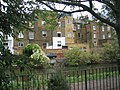
 Atherstone Court - geograph.org.uk - 1465703.jpg 441 × 640; 172 KB
-
 BBC Music Building on Delaware Road.jpg 1,936 × 2,576; 950 KB
-
 Biddulph Road - geograph.org.uk - 4378335.jpg 4,167 × 2,632; 2.3 MB
-
 Bloomfield Road - geograph.org.uk - 4777867.jpg 640 × 427; 119 KB
-
 Bourne Terrace, Paddington - geograph.org.uk - 618951.jpg 640 × 480; 158 KB
-
 Bowling Green, Maida Vale - geograph.org.uk - 4989744.jpg 1,600 × 1,121; 474 KB
-
 Bus stop on Maida Vale (A5) - geograph.org.uk - 5316732.jpg 640 × 451; 93 KB
-
 Canalside back gardens of Hornmead Road - geograph.org.uk - 325898.jpg 640 × 480; 106 KB
-
 Carlton Vale - geograph.org.uk - 2324288.jpg 800 × 600; 529 KB
-
 Carlton Vale - geograph.org.uk - 4511411.jpg 640 × 480; 313 KB
-
 Carlton Vale at junction of Maida Vale - geograph.org.uk - 2223031.jpg 1,600 × 1,200; 416 KB
-
-
 Chippenham Road and Elgin Avenue Junction - geograph.org.uk - 629317.jpg 635 × 470; 105 KB
-
 Clifton Court, Maida Vale - geograph.org.uk - 690622.jpg 480 × 640; 115 KB
-
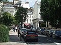
 Clifton Road, W9 - geograph.org.uk - 215914.jpg 640 × 480; 132 KB
-

-
 CropthorneCourt.jpg 771 × 628; 70 KB
-
 Derelict house on Randolph Gardens - geograph.org.uk - 753773.jpg 480 × 640; 90 KB
-
 Essendine School - geograph.org.uk - 1409398.jpg 640 × 428; 108 KB
-
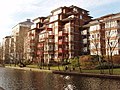 Flats by Grand Union Canal, Maida Vale - geograph.org.uk - 325875.jpg 640 × 480; 130 KB
-
 Flats in Senior Street - geograph.org.uk - 325871.jpg 640 × 480; 105 KB
-
 Football pitch, Forty Tree Green - geograph.org.uk - 753777.jpg 640 × 480; 97 KB
-
 Formosa Street - geograph.org.uk - 2420918.jpg 800 × 600; 454 KB
-
 Formosa Street footbridge, W9 - geograph.org.uk - 678713.jpg 640 × 480; 134 KB
-
 Forty Tree Green - geograph.org.uk - 753769.jpg 640 × 480; 112 KB
-

-
-
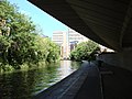
 Grand Union Canal in Paddington - geograph.org.uk - 531884.jpg 640 × 480; 133 KB
-
 Grantully Road, Maida Vale - geograph.org.uk - 520152.jpg 640 × 480; 138 KB
-
 Great Western Main Line - geograph.org.uk - 694778.jpg 640 × 480; 100 KB
-
 Hall Road - geograph.org.uk - 857705.jpg 640 × 437; 226 KB
-
 Harrow Road bridge crosses the Paddington Arm of the Grand Union Canal.jpg 3,264 × 2,448; 1.37 MB
-
 Joseph Spiers Maida Vale family vault Kensal Green Cemetery.JPG 3,000 × 4,000; 4.3 MB
-
 Lanark Road, Maida Vale - geograph.org.uk - 2223547.jpg 1,600 × 1,200; 573 KB
-
 London Buses route 6 Shirland Rd.jpg 1,600 × 1,200; 568 KB
-
 London2007 img 5403.jpg 2,048 × 1,536; 1.85 MB
-
 Maida Vale - Sandringham Court - geograph.org.uk - 4661571.jpg 1,563 × 1,600; 625 KB
-
 Maida Vale - Sandringham Court.jpg 1,920 × 1,966; 2.82 MB
-
 Maida Vale, Lauderdale Avenue - geograph.org.uk - 4511165.jpg 640 × 480; 321 KB
-
 Malvern Road, NW6 - geograph.org.uk - 418083.jpg 640 × 480; 156 KB
-
 Mansion flats in Maida Vale - geograph.org.uk - 21760.jpg 640 × 480; 162 KB
-
 Marylebone, April 2021 13.jpg 4,032 × 3,024; 4.82 MB
-
 Marylebone, April 2021 17.jpg 4,032 × 3,024; 6.51 MB
-

-
 Railway Mews, W10 - geograph.org.uk - 697027.jpg 640 × 480; 115 KB
-
 Randolph Avenue - geograph.org.uk - 2324274.jpg 800 × 600; 475 KB
-
 Randolph Avenue, London W9 - geograph.org.uk - 2418007.jpg 4,320 × 3,240; 4.11 MB
-
 Randolph Avenue, W9 - geograph.org.uk - 215908.jpg 640 × 480; 125 KB
-
 Saltram Crescent, London W9 - geograph.org.uk - 2398658.jpg 4,320 × 3,240; 4.21 MB
-

-
 Swiss Cinco at BBC Maida Vale recording studios May 2023.jpg 4,000 × 6,000; 6.19 MB
-
 System No. 12, Maida Vale.JPG 2,448 × 3,264; 3.3 MB
-
 Tall Phone Box - geograph.org.uk - 442336.jpg 480 × 640; 102 KB
-
 Tall Red K6 Phone Box.jpg 2,736 × 3,648; 4.17 MB
-
 Terrace houses, Hornmead Road - geograph.org.uk - 325896.jpg 640 × 480; 111 KB
-
-
 Westway over canal, Trellick Tower beyond - geograph.org.uk - 325884.jpg 640 × 480; 251 KB
-
 Woodfield Road - geograph.org.uk - 694722.jpg 640 × 480; 77 KB


_-_geograph.org.uk_-_5316732.jpg)


_-_geograph.org.uk_-_446647.jpg)
,_looking_east_-_geograph.org.uk_-_574747.jpg)


.jpg)

