Category:Maps about Peace of Westphalia
Jump to navigation
Jump to search
Media in category "Maps about Peace of Westphalia"
The following 22 files are in this category, out of 22 total.
-

-
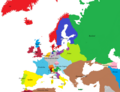
 Avrupa harita 1648.png 1,894 × 1,367; 195 KB
-
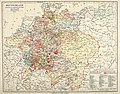
 Brockhaus' Konversations-Lexikon (1892) (14594679187).jpg 1,622 × 2,536; 1.01 MB
-
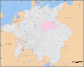 Electorate of Saxony within the Holy Roman Empire 1648.svg 2,283 × 1,810; 2.12 MB
-
 Europa 1648 klar.png 1,106 × 846; 456 KB
-
 Europa, 1648 copy.jpg 800 × 577; 303 KB
-
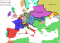
 Europe après les Traités de Westphalie - 1648.png 870 × 691; 40 KB
-
 Europe map 1648 ko.PNG 1,894 × 1,367; 134 KB
-
 Europe map 1648-es.png 1,894 × 1,367; 141 KB
-
 Europe map 1648.PNG 1,894 × 1,367; 195 KB
-
 Germany 1648 after the Peace of Westphalia.jpg 3,221 × 2,498; 4.38 MB
-
 Germany at the Peace of Westphalia (1648).jpg 4,014 × 3,110; 4.19 MB
-
 Holy Roman Empire 1648-sr.svg 2,283 × 1,810; 3.01 MB
-
 Holy Roman Empire 1648.svg 2,283 × 1,810; 3.07 MB
-
 Mediæval and modern history (1920) (14587106210).jpg 1,626 × 2,282; 819 KB
-
 Mediæval and modern history (1920) (14771449184).jpg 1,588 × 2,274; 747 KB
-
 Meyers b4 s0870a.jpg 2,048 × 1,667; 776 KB
-
 Meyers Hist Handatlas 1911 Nr 31.jpg 3,791 × 2,966; 2.39 MB
-
 Spruner-Menke Handatlas 1880 Karte 45.jpg 10,449 × 8,673; 27.38 MB
-
 SueciaDeWestfalia1648.svg 734 × 729; 454 KB
-
 Historical atlas of modern Europe 1903 (135895383).jpg 9,176 × 7,025; 65.95 MB
-
 Historical atlas of modern Europe 1903 (135895430).jpg 9,163 × 6,915; 66.08 MB
_(14586908880).jpg)

_(14594679187).jpg)


.jpg)


_(14587106210).jpg)
_(14771449184).jpg)


.jpg)
.jpg)