Category:Maps showing 1648
Jump to navigation
Jump to search
| ← 1644 1645 1646 1648 1649→ |
English: Maps showing the year 1648 (i.e. history maps)
See also category: 1648 maps. and 1640s maps for more maps showing this year usually created not long after the given year.
See also category: 1648 maps. and 1640s maps for more maps showing this year usually created not long after the given year.
Subcategories
This category has the following 2 subcategories, out of 2 total.
M
Media in category "Maps showing 1648"
The following 18 files are in this category, out of 18 total.
-
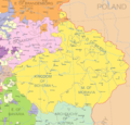
Crown of Bohemia 1648.png 1,134 × 1,084; 593 KB
-
Diocèses et provinces ecclésiastiques de France en 1648 selon les frontières de 1789.svg 2,000 × 1,922; 784 KB
-
Europe après les Traités de Westphalie - 1648.png 870 × 691; 40 KB
-
Europe in 1648 (Peace of Westphalia).jpg 1,577 × 1,091; 442 KB
-
Europe map 1648.PNG 1,894 × 1,367; 195 KB
-
Historische Karte CH 1648.png 2,500 × 1,768; 1.43 MB
-
Koruna ceska 1648.png 481 × 475; 24 KB
-
Lossy-page1-1171px-Kongo 1648 coloured 2.png 1,171 × 1,024; 182 KB
-
Ngoyo carte 1648.jpg 331 × 272; 34 KB
-
Polish-Lithuanian Commonwealth in 1648.PNG 2,000 × 1,568; 804 KB
-
Rákóczi estates.jpg 1,104 × 786; 211 KB
-
Skandinavien mellan 1397 och 1815.jpg 3,474 × 2,747; 3.45 MB
-
Solmser Herrschaftsgebiet 1648.png 481 × 416; 239 KB
-
The Counterreformation - ar.svg 2,045 × 1,720; 7.82 MB
-
The Counterreformation.svg 2,045 × 1,720; 7.71 MB
-
World map 1648.png 2,476 × 1,391; 248 KB


