Category:Maps of French Indochina
Jump to navigation
Jump to search
Wikimedia category | |||||
| Upload media | |||||
| Instance of | |||||
|---|---|---|---|---|---|
| Category combines topics | |||||
| French Indochina | |||||
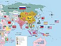
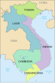
Federal state in Southeast Asia     .svg) | |||||
| Instance of |
| ||||
| Part of |
| ||||
| Location |
| ||||
| Capital |
| ||||
| Basic form of government | |||||
| Currency |
| ||||
| Inception |
| ||||
| Dissolved, abolished or demolished date |
| ||||
| Population |
| ||||
| Area |
| ||||
| Replaces |
| ||||
| Different from | |||||
 | |||||
Subcategories
This category has the following 7 subcategories, out of 7 total.
Media in category "Maps of French Indochina"
The following 73 files are in this category, out of 73 total.
-
 Abornement frontière Fromentin embouchure 05114.jpg 4,912 × 3,264; 4.4 MB
-
 Asia (late 19th century- early 20th century).jpg 1,857 × 1,387; 773 KB
-
 Bán đảo đông dương 1950.png 3,142 × 4,754; 631 KB
-
 Cochinch-tonkin.JPG 1,401 × 2,371; 947 KB
-
 Colonial Boundaries in Southeast Asia.jpg 1,229 × 898; 220 KB
-
 Dissident Activities in Indochina.svg 754 × 1,140; 392 KB
-
 French Indochina (1945).svg 538 × 536; 511 KB
-
 French Indochina 1900-1945 location map.svg 703 × 1,013; 1.92 MB
-
 French Indochina 1900-1945 relief location map.svg 703 × 1,013; 4.2 MB
-
 French Indochina 1900-1945-fr.svg 703 × 1,013; 1.75 MB
-
 French Indochina 1900-1946-es.svg 703 × 1,013; 683 KB
-
 French Indochina 1937.png 1,292 × 2,000; 515 KB
-
 French Indochina expansion.jpg 596 × 1,019; 215 KB
-
 French Indochina locator.svg 250 × 120; 166 KB
-
 French indochina map.png 1,000 × 1,000; 297 KB
-
 French Indochina Phan Xich Long no.svg 667 × 1,017; 77 KB
-
 French Indochina Phan Xich Long.svg 667 × 1,017; 77 KB
-
 French Indochina post partition.png 300 × 457; 15 KB
-
 French Indochina subdivisions Ce.svg 667 × 1,017; 143 KB
-
 French Indochina subdivisions Ru.svg 667 × 1,017; 154 KB
-
 French Indochina subdivisions sr.svg 667 × 1,017; 151 KB
-
 French Indochina subdivisions ww2-es.svg 667 × 1,017; 547 KB
-
 French Indochina subdivisions ww2.svg 667 × 1,017; 81 KB
-
 French Indochina subdivisions-es.svg 667 × 1,017; 374 KB
-
 French Indochina subdivisions.svg 667 × 1,017; 150 KB
-
 French indochina.svg 667 × 1,017; 113 KB
-
 Flag Map of French Indochina (1887 - 1954).png 1,855 × 2,946; 171 KB
-
 Flag map of French Indochina (France).png 2,000 × 3,049; 172 KB
-
 Indochine Francaise 1937.png 1,292 × 2,000; 516 KB
-
 Indochine francaise de.svg 667 × 1,017; 41 KB
-
 Indochine francaise.svg 667 × 1,017; 113 KB
-
 Indochine française ce.svg 667 × 1,017; 87 KB
-
 Indochine française es.svg 667 × 1,017; 100 KB
-
 Indochine française ru.svg 667 × 1,017; 102 KB
-
 Indochine française.svg 667 × 1,017; 101 KB
-
 Kingdom of Kampuchea (Japanese puppet state).png 1,280 × 640; 119 KB
-

-
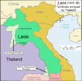 Laos 1941-46.png 1,003 × 996; 162 KB
-
 Le Tour du monde-01-p061.jpg 826 × 1,234; 262 KB
-
 LocalisationIndochine.png 247 × 154; 6 KB
-
 Location Guangzhou Wan.png 250 × 115; 6 KB
-
 Location of Bolaven Plateau on Indochina topographic map.png 1,687 × 2,436; 4 MB
-
 Locationfrenchindochina.PNG 250 × 115; 5 KB
-
 LocationFrenchIndochina.svg 1,000 × 500; 807 KB
-
 Map of French Indochina expansion.svg 675 × 970; 733 KB
-
 Map of Siam (territorial cessions).svg 656 × 1,243; 760 KB
-
 Map of Siam and French Indochina -by Milenioscuro- (modified Thai language).png 1,039 × 1,726; 586 KB
-
 Map of Siam and French Indochina.svg 748 × 1,243; 1,014 KB
-

-

-

-

-

-

-

-

-

-
 Map of the Rattanakosin Kingdom.svg 656 × 1,243; 686 KB
-
 Map of Tibet in 1932 (cropped).jpg 2,676 × 1,687; 1.86 MB
-
 Nguyễn Dynasty, administrative divisions map (1937).svg 1,086 × 1,100; 1.7 MB
-
 PacificTheaterAug1942.jpg 1,199 × 873; 256 KB
-
 Provinces of Cambodia loss to Thailand during Franco-Thai War Km.png 1,200 × 900; 4.14 MB
-
 Provinces of Cambodia loss to Thailand during Franco-Thai War.png 1,200 × 900; 187 KB
-
 RC4 vietnam-es.svg 703 × 1,013; 919 KB
-
 RC4 vietnam.jpg 277 × 598; 23 KB
-
 Route of the French Mekong Expedition 1866-1868.jpg 2,299 × 2,347; 2.4 MB
-
 Siamese territorial concessions (1867-1909) with flags.gif 301 × 514; 32 KB
-
 Siamese territorial concessions (1867-1909).gif 301 × 514; 36 KB
-
 SuddivisioniIndocinafrancese.png 800 × 1,220; 171 KB
-
 Французский Вьетнам.png 330 × 713; 55 KB
-
 暹罗的领土丧失(1867-1909).png 300 × 730; 99 KB
-
 프랑스령 인도차이나 반도.png 1,024 × 1,020; 269 KB
-
 프랑스령 인도차이나 지도.jpg 1,024 × 1,020; 167 KB

.jpg)


.png)
.png)


.png)
_-_Fort_Bayard_-_P%C3%A9ninsule_de_Leizhou.png)


.svg)
.png)

.png)
.png)
.png)
.png)
.png)
.png)
.png)
.png)
.png)

.jpg)
.svg)


_with_flags.gif)
.gif)


