Category:Maps of German New Guinea
Jump to navigation
Jump to search
Media in category "Maps of German New Guinea"
The following 47 files are in this category, out of 47 total.
-
-
 113 kaiser-wilhelms-land-bismarck-archipel-und-samoa-inseln (1905).png 1,761 × 1,094; 1.23 MB
-

-
 1888년과 1899년 독일령 뉴기니.png 756 × 706; 62 KB
-

-
 Alexishafen, Astrolabe Bay, 1883.jpg 1,882 × 2,141; 887 KB
-
 Bita paka location 1914.jpg 350 × 384; 109 KB
-
 Die Deutschen Besitzungen im Stillen Ocean 11657068.jpg 13,359 × 10,744; 45.89 MB
-

-
 Die deutschen Besitzungen im Stillen Ozean.png 7,400 × 8,274; 84.73 MB
-

-
 Die Gartenlaube (1886) b 111.jpg 1,158 × 974; 185 KB
-
 Die Gartenlaube (1887) b 460 1.jpg 1,696 × 980; 321 KB
-
 Fly River 1876.tif 1,742 × 1,435; 7.18 MB
-
 Fly River Map 1876 NLA.jpg 1,950 × 1,300; 475 KB
-
 German New Guinea (1914; orthographic projection).png 1,024 × 1,024; 230 KB
-
 German new guinea 1888 1899-ar.png 642 × 600; 77 KB
-
 German new guinea 1888 1899.png 756 × 706; 74 KB
-
 German New Guinea.png 1,000 × 1,000; 196 KB
-
 German Oceania, 1914.jpg 1,094 × 876; 224 KB
-
 Kaiser Wilhelms-Land Ost Neu Guinea 1884-1885 map.jpg 516 × 384; 273 KB
-
 Kaiser-Wilhelms-Land (crop from Brockhaus).jpg 2,852 × 2,016; 2.97 MB
-
 Kaiser-Wilhelms-Land-Brockhaus b10 nr0030a hfid 5181872.jpg 5,480 × 2,805; 5.75 MB
-
 Kiriwina Group (Trobriand Islands) 1891 map nla obj-231909085-1 (retouched).jpg 5,000 × 6,147; 10.4 MB
-
 Kiriwina Group (Trobriand Islands) 1891 map nla.obj-231909085-1.jpg 5,000 × 6,147; 11.13 MB
-
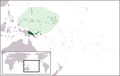 LocationGermanNewGuinea.png 250 × 158; 6 KB
-
 Map of British New-Guinea, shewing part of Kaiser Wilhelm land.png 11,967 × 8,381; 98.37 MB
-
 Map of Finschhafen - Papua New Guinea - 1884 - 1885.jpg 442 × 676; 70 KB
-
 Map of Germany's western Pacific colonies as of 1910 (map0005325727).jpg 3,000 × 2,073; 5.97 MB
-
 Map of Huon Gulf from Samoafahrten by Otto Finsch.jpg 458 × 575; 191 KB
-
 Map-Kaiser-Wilhelms-Land-und-Bismarck-Archipel-2.png 1,284 × 810; 701 KB
-
 Map-Kaiser-Wilhelms-Land-und-Bismarck-Archipel.png 2,314 × 1,456; 2.14 MB
-
 Neu-Mecklenburg.jpg 710 × 500; 334 KB
-
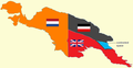 New Guinea (1884-1919) w contested boundary.png 618 × 319; 25 KB
-
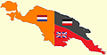 New Guinea (1884-1919).png 618 × 319; 60 KB
-
 New Guinea 1884-1919 w contested boundary.png 618 × 319; 26 KB
-
 New Guinea and New Caledonia 1884 (Papua New Guinea).jpg 1,600 × 1,083; 347 KB
-
 NuevGuineaAlemana1888-1899.svg 505 × 395; 1.61 MB
-
 Ohos et Ouhas.jpg 1,742 × 1,435; 2.59 MB
-
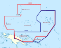
 Operation Typhoon.png 979 × 923; 660 KB
-
 Pacific-German-Colonies-es.svg 3,057 × 2,000; 249 KB
-
 Pacific-German-Colonies.svg 789 × 516; 66 KB
-
 Territorios coloniales de Nueva Guinea.PNG 789 × 330; 34 KB
-
 Wirtschafts-Atlas der deutschen Kolonien - 24.jpg 2,521 × 3,352; 754 KB
-
 Deutscher Kolonialatlas mit Jahrbuch 1910 (133566329).jpg 7,155 × 7,217; 53.96 MB
-
 Übersicht Der Deutschen Besitzungen im Stillen Ozean.jpg 1,019 × 1,029; 391 KB
-
 독일령 뉴기니.png 1,000 × 1,000; 201 KB
.jpg)
.png)
.jpg)

.jpg)


.jpg)


_b_111.jpg)
_b_460_1.jpg)

.png)


.jpg)

_1891_map_nla_obj-231909085-1_(retouched).jpg)
_1891_map_nla.obj-231909085-1.jpg)


.jpg)


_w_contested_boundary.png)
.png)

.jpg)


.jpg)

