Category:Maps of Kantens
Jump to navigation
Jump to search
Wikimedia category | |||||
| Upload media | |||||
| Instance of | |||||
|---|---|---|---|---|---|
| Category combines topics | |||||
| Kantens | |||||
farm village and former municipality of the Netherlands   | |||||
| Spoken text audio | |||||
| Instance of | |||||
| Location |
| ||||
| Population |
| ||||
| Area |
| ||||
 | |||||
Media in category "Maps of Kantens"
The following 2 files are in this category, out of 2 total.
-
 Kantens, Gemeenteatlas van Nederland.jpg 2,684 × 2,190; 1.83 MB
-
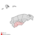 Map - NL - Eemsmond - Wijk 02 - Buurt 00 Kantens.svg 375 × 375; 40 KB

