Category:Maps of Leon County, Florida
Jump to navigation
Jump to search
Counties of Florida: Alachua · Baker · Bay · Bradford · Brevard · Broward · Calhoun · Charlotte · Citrus · Clay · Collier · Columbia · DeSoto · Dixie · Duval · Escambia · Flagler · Franklin · Gadsden · Gilchrist · Glades · Gulf · Hamilton · Hardee · Hendry · Hernando · Highlands · Hillsborough · Holmes · Indian River · Jackson · Jefferson · Lafayette · Lake · Lee · Leon · Levy · Liberty · Madison · Manatee · Marion · Martin · Miami-Dade · Monroe · Nassau · Okaloosa · Okeechobee · Orange · Osceola · Palm Beach · Pasco · Pinellas · Polk · Putnam · Santa Rosa · Sarasota · Seminole · St. Johns · St. Lucie · Sumter · Suwannee · Taylor · Union · Volusia · Wakulla · Walton · Washington
Wikimedia category | |||||
| Upload media | |||||
| Instance of | |||||
|---|---|---|---|---|---|
| Category combines topics | |||||
| Leon County | |||||
County in Florida, United States .JPG)     | |||||
| Instance of | |||||
| Named after | |||||
| Location | Florida | ||||
| Capital | |||||
| Inception |
| ||||
| Population |
| ||||
| Area |
| ||||
| Different from | |||||
| official website | |||||
 | |||||
Subcategories
This category has the following 4 subcategories, out of 4 total.
D
M
Media in category "Maps of Leon County, Florida"
The following 18 files are in this category, out of 18 total.
-
 Bradfordville School Map.png 595 × 500; 173 KB
-
 Florida -Hamilton County - Sarasota County (part)- - NARA - 17474775 (page 528).jpg 4,152 × 3,352; 2.3 MB
-
 GW Holland Plantation2.png 283 × 246; 3 KB
-
 Kleman Plaza area map.JPG 4,320 × 3,240; 4.44 MB
-
 Kleman Plaza map.JPG 4,320 × 3,240; 4.46 MB
-
 Leon County Florida exploding 600px.png 624 × 600; 102 KB
-
 Leon County Florida geological.png 741 × 580; 198 KB
-
 Leon County Geological.png 427 × 280; 5 KB
-
 Map of Florida highlighting Leon County.svg 1,130 × 1,126; 179 KB
-
 Map of Leon County, Florida LOC 2012592402.jpg 13,081 × 8,945; 12.35 MB
-
 Map of Leon County, Florida LOC 2012592402.tif 13,081 × 8,945; 334.77 MB
-
 Orchard Pond Plantation01.png 469 × 300; 12 KB
-
 Plank Road Wildlife Management Area map.jpg 799 × 1,034; 206 KB
-
 Tallahassee Fire Department map.png 286 × 190; 5 KB
-
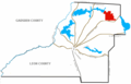
 Tallahassee Metropolitan Area.png 511 × 499; 25 KB
-
 Visitor Location Map near Florida’s Historic Capitol.JPG 4,320 × 3,240; 4.52 MB
-
 W G Ponder Plantation.png 469 × 300; 12 KB
-
 Wadesboro Florida.png 429 × 389; 6 KB

-_-_NARA_-_17474775_(page_528).jpg)


