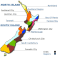
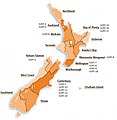
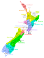
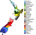
Category:Maps of New Zealand
Bước tới điều hướng
Bước tới tìm kiếm
Các nước Châu Đại Dương: Fiji · Kiribati · Micronesia · Nauru · New Zealand · Palau · Papua New Guinea · Quần đảo Marshall · Quần đảo Solomon · Samoa · Tonga · Tuvalu · Úc · Vanuatu
Các lãnh thổ khác: Clipperton · Đảo Norfolk · Guam · Hawaii · Niue · Nouvelle-Calédonie · Polynésie thuộc Pháp · Quần đảo Bắc Mariana · Quần đảo Cocos (Keeling) · Quần đảo Cook · Quần đảo Pitcairn · Samoa thuộc Mỹ · Tokelau · Wallis và Futuna – Partly: Các tiểu đảo xa của Hoa Kỳ · Indonesia · Lãnh thổ hải ngoại thuộc Anh · Tỉnh hải ngoại và lãnh thổ hải ngoại thuộc Pháp · Vùng đất phía Nam và châu Nam Cực thuộc Pháp
Các lãnh thổ khác: Clipperton · Đảo Norfolk · Guam · Hawaii · Niue · Nouvelle-Calédonie · Polynésie thuộc Pháp · Quần đảo Bắc Mariana · Quần đảo Cocos (Keeling) · Quần đảo Cook · Quần đảo Pitcairn · Samoa thuộc Mỹ · Tokelau · Wallis và Futuna – Partly: Các tiểu đảo xa của Hoa Kỳ · Indonesia · Lãnh thổ hải ngoại thuộc Anh · Tỉnh hải ngoại và lãnh thổ hải ngoại thuộc Pháp · Vùng đất phía Nam và châu Nam Cực thuộc Pháp
thể loại Wikimedia | |||||
| Tải lên phương tiện | |||||
| Là một | |||||
|---|---|---|---|---|---|
| Thể loại kết hợp các chủ đề | |||||
 | |||||
Use the appropriate category for maps showing all or a large part of New Zealand. See subcategories for smaller areas:
| If the map shows | Category to use |
|---|---|
| New Zealand on a recently created map | Category:Maps of New Zealand or its subcategories |
| New Zealand on a map created more than 70 years ago | Category:Old maps of New Zealand or its subcategories |
| the history of New Zealand on a recently created map | Category:Maps of the history of New Zealand or its subcategories |
| the history of New Zealand on a map created more than 70 years ago | Category:Old maps of the history of New Zealand or its subcategories |
Thể loại con
Thể loại này có 34 thể loại con sau, trên tổng số 34 thể loại con.
!
*
A
B
C
D
F
G
H
M
- Maps of Marlborough Sounds (7 F)
- Maps of Mayor Island (2 F)
- Maps of New Zealand by region (empty)
O
P
R
- Radio maps of New Zealand (21 F)
S
T
W
- Wine maps of New Zealand (5 F)
Trang trong thể loại “Maps of New Zealand”
Thể loại này chứa 2 trang sau, trên tổng số 2 trang.
Tập tin trong thể loại “Maps of New Zealand”
163 tập tin sau nằm trong thể loại này, trong tổng số 163 tập tin.
-

-
 Admiralty Chart No 2574 Mercury Bay, Published 1940.jpg 11.049×8.086; 21,56 MB
-
 AirNZCup.JPG 401×470; 28 kB
-
 Antipodes Europe New Zealand.svg 543×534; 78 kB
-
 Apteryx australis Distribution.jpg 409×339; 16 kB
-
 Apteryx haastii Distribution.jpg 409×337; 15 kB
-
 Apteryx owenii Distribution.jpg 409×344; 15 kB
-
 Bar-tailed Godwit migration-ar.jpg 416×408; 41 kB
-
 Bar-tailed Godwit migration.jpg 416×408; 31 kB
-
 BendigoNZGoldfieldsLocationMap.png 3.506×2.481; 848 kB
-

-
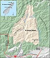
 Burnham Railway Station.png 3.507×2.480; 1,15 MB
-
 Canterbury Papers 0011.jpg 3.402×1.629; 652 kB
-
 Catlinsmap.jpg 635×567; 85 kB
-
 Christchurch.png 480×599; 246 kB
-
 Cities of New Zealand.png 475×599; 71 kB
-
 Counties Manukau District Health Board map.svg 650×846; 133 kB
-
 Cromwell Gorge Map.png 2.481×3.506; 3,39 MB
-
 Distribution of the upland bully.png 725×688; 25 kB
-
 Dunstan Mountains.png 2.481×3.506; 5,88 MB
-
 Eccremocarpus scaber New Zealand Range.png 368×431; 34 kB
-
 ECDM 20161114 NewZealand-Earthquake Tsunami.pdf 1.625×1.125; 815 kB
-
 ECDM 20180430 South-Pacific TC-Season.pdf 2.479×1.754; 1.024 kB
-
 Empodisma minus distribution map.jpg 2.080×1.354; 104 kB
-
 Finger fern distribution2.png 549×565; 45 kB
-
 FLII NewZealand.png 795×860; 186 kB
-
 Furneaux Map.png 1.408×1.170; 356 kB
-
 GMT nz mercator.png 800×1.055; 94 kB
-
 GolubMapa.png 1.241×1.754; 351 kB
-
 Hawke's Bay District Health Board map.svg 650×846; 133 kB
-
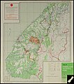
 HawkesBaymap00001.JPG 1.600×1.280; 563 kB
-
 Hilfe gmt beispiel neuseeland.png 1.214×1.512; 59 kB
-
 Hokianga.jpg 1.152×784; 270 kB
-
 HokiangaLiteSml.jpg 510×634; 284 kB
-
 Hope-River-Tasman.png 530×599; 38 kB
-
 Hornby Railway Station Map.png 3.507×2.480; 608 kB
-
 Hot Lake District of the North Island (cropped).jpg 4.629×2.228; 7,83 MB
-
 Hot Lake District of the North Island.jpg 5.240×3.399; 5,17 MB
-
 Hutt Valley District Health Board map.svg 650×846; 133 kB
-
 Kahungunu revised.png 695×794; 11 kB
-
 Kainga Railway Station.png 3.507×2.480; 1,17 MB
-
 Karta NZ Subantarctic islands.PNG 350×350; 6 kB
-
 KNS Map.jpg 972×1.620; 59 kB
-
 Koppen-Geiger Map NZL present.svg 1.271×850; 2 MB
-
 Kraljevstvo Novi Zeland.png 538×273; 14 kB
-
 Kupe.png 960×720; 128 kB
-
 Ladbrooks Railway Station.png 3.507×2.480; 576 kB
-
 Lake Rotorua (Canterbury).jpg 2.666×4.933; 9,77 MB
-
 Lakes District Health Board map.svg 650×846; 133 kB
-
 Leiopelma hochstetteri range.PNG 405×590; 11 kB
-
 Location.png 475×599; 46 kB
-
 Map in Arthur's Pass Village Train Station.jpg 4.032×3.024; 2,29 MB
-
 Map of Access Radio Network.png 398×563; 78 kB
-

-
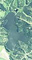
 Map of Fiordland National Park (12485990223).jpg 7.129×8.057; 41,17 MB
-
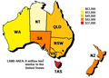 Map of median household income in Australia.PNG 491×353; 15 kB
-
 Map of New Zealand (Urdu).jpg 927×1.280; 169 kB
-
 Map of New Zealand(GN04704).jpg 2.448×3.264; 1,09 MB
-
 Marlborough base map.png 3.000×3.861; 53 kB
-
 MidCentral District Health Board map.svg 650×846; 133 kB
-
 MiniWikiAtlas screenshot.png 1.262×810; 623 kB
-
 Māori Land March (1975) - Route of March (20631264354).jpg 4.622×4.002; 1,84 MB
-
 National sa2 20211027 940px.png 940×1.329; 359 kB
-
 National sa2 20211117 940px.png 940×1.329; 365 kB
-
 Nelson City Council region.png 390×302; 36 kB
-
 Nelson Marlborough District Health Board map.svg 650×846; 133 kB
-
 Neuseeland mit Auckland Inseln.png 365×522; 61 kB
-
 New Zealand - DPLA - 42caadba61185db4630ef507e1a4fd1c.jpg 2.552×3.258; 5,83 MB
-
 New Zealand Administrative Divisions - DPLA - cffd372131307e39ddf1d0626410faee.jpg 2.554×3.256; 5,44 MB
-
 New Zealand Catholic Dioceses.png 602×854; 73 kB
-
 New Zealand disputed w1 countrymap.svg 1.000×1.000; 20 kB
-
 New Zealand Map (4347707680).jpg 1.800×1.200; 1,84 MB
-
 New Zealand Map - Councils - Grey with White Borders.svg 476×508; 890 kB
-
 New Zealand Map - Provinces - Grey with White Borders.svg 532×568; 821 kB
-
 New Zealand North Island Counties and Districts Map 1981.jpg 8.192×9.884; 93,66 MB
-
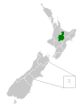
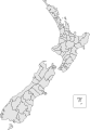
 New Zealand Regions.PNG 405×590; 6 kB
-
 New Zealand Simplified.svg 1.311×1.616; 50 kB
-
 New Zealand slope map.png 7.452×10.533; 13,36 MB
-
 New Zealand South Island Counties and Districts Map 1981.jpg 8.192×9.864; 34,14 MB
-
 New Zealand Territorial Authorities 2017, Chathams inset.svg 1.454×2.103; 881 kB
-
 New Zealand Territorial Authorities 2017.svg 2.005×2.103; 870 kB
-
 New Zealand Timaru locator map.svg 1.052×744; 100 kB
-
 New Zealand towns and cities copy.jpg 480×599; 135 kB
-
 New Zealand's Benthic Protection Areas and seamount trawling closures.tif 2.060×2.501; 1,59 MB
-
 New Zealand-map.png 5.000×7.064; 2,79 MB
-
 NewZealandCatholicism2006.png 810×1.140; 23 kB
-
 NewZealandEmbassies.png 1.357×628; 71 kB
-
 NewZealandRailNetwork.png 376×462; 29 kB
-
 NgatiPorou (1).png 695×794; 11 kB
-
 Niue (New Zealand) Population Density, 2000 (5457016943).jpg 2.507×3.265; 610 kB
-
 Niue Population Density, 2000 (6172444532).jpg 2.324×3.161; 488 kB
-
 North Island - New Zealand.svg 1.140×1.554; 303 kB
-
 Novy Zeland.png 323×590; 46 kB
-
 NZ 6324 Akaroa Harbour.jpg 458×600; 55 kB
-
 NZ Realm of New Zealand cropped.png 765×288; 15 kB
-
 NZ Regional Councils and Territorial Authorities 2017.svg 1.380×1.746; 1,82 MB
-
 NZ Regional Councils.svg 1.668×1.748; 400 kB
-
 NZ Regions.svg 800×600; 194 kB
-
 NZ residency by country of citizenship 2004-5FY.PNG 1.357×628; 62 kB
-
 NZ-Birkenhead.png 589×701; 97 kB
-
 NZ-Eden Valley.png 589×701; 121 kB
-
 NZ-Glendene.png 435×519; 95 kB
-
 NZ-Greenwoods Corner.png 588×700; 92 kB
-
 NZ-GreyLynn.png 589×701; 104 kB
-
 NZ-Henderson.png 589×701; 104 kB
-
 NZ-kiwimap-mi.png 824×1.180; 102 kB
-
 NZ-Manurewa.png 589×701; 104 kB
-
 NZ-Masterton-kakapo-he.PNG 633×922; 88 kB
-
 NZ-MtAlbert.png 589×701; 104 kB
-
 NZ-Northcote.png 589×701; 104 kB
-
 NZ-Otara.png 589×701; 104 kB
-
 NZ-Remuera.png 589×701; 104 kB
-
 NZ-Takapuna.png 589×701; 104 kB
-
 NZ-TamakiR.png 589×701; 104 kB
-
 NZ-Waitemata H.png 405×590; 117 kB
-
 NZ-Whangaparaoa P fr.png 405×590; 79 kB
-
 NZAsianPopulationPercentage.png 1.500×2.086; 357 kB
-
 Nzmapcol.gif 437×415; 20 kB
-
 NZOMC.PNG 941×1.298; 87 kB
-
 Nzrt-locations-may12 ResizedImageWzQwMCw0MTBd.jpg 400×410; 33 kB
-
 NZTerritorialAuthorities-1-zh.png 872×1.142; 118 kB
-
 NZTerritorialAuthorities.png 872×1.142; 68 kB
-
 NZunions.png 600×581; 31 kB
-
 OceanGroveNZmap.png 440×441; 423 kB
-
 Orthographic projection centred over the Bounty Islands.png 488×487; 20 kB
-

-
 Pacific Ocean laea Oceanian countries map.jpg 1.165×1.070; 542 kB
-
 Pan Am Holiday phamplet (11090320936).jpg 2.888×1.317; 456 kB
-
 PAT - New Zealand.gif 690×1.200; 77 kB
-
 PisaRange.png 2.481×3.506; 5,29 MB
-
 Position of Nelson Region.png 405×590; 7 kB
-

-
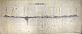
 Railways Timetable (19573056451).jpg 7.152×2.842; 3,42 MB
-
 Realm of New Zealand-2.PNG 540×269; 12 kB
-
 Realm of New Zealand.png 740×272; 10 kB
-
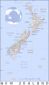
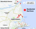 Red Zone map first upload.png 2.757×2.230; 1,45 MB
-
 Redfin bully, Gobiomorphus huttoni.png 712×691; 21 kB
-
 Regions of New Zealand by HDI (2018).svg 532×568; 821 kB
-
 Regions of New Zealand.png 405×590; 15 kB
-
 River water quality. Macroinvertebrate community index.png 1.436×792; 157 kB
-
 Sinking of the 'Rangitane' (10952711016).jpg 2.514×2.068; 361 kB
-
 Sketch map of the Brynderwyn accident (12211245726).jpg 3.016×3.810; 3,05 MB
-
 South East Australia and New Zealand locator map.png 682×512; 29 kB
-
 SouthCoastTrackNZ.png 1.208×525; 963 kB
-
 St James Station, 2008.jpg 2.018×2.355; 1.012 kB
-
-
 Tablecloth, souvenir (AM 2003.15.1-2).jpg 2.272×1.704; 528 kB
-
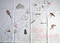 Tablecloth, souvenir (AM 2003.15.1-3).jpg 2.272×1.626; 489 kB
-
 Territorial Authorities of New Zealand.svg 329×475; 52 kB
-
 Territorial-Waters-New-Zealand.png 811×441; 29 kB
-
 The Kea, a New Zealand problem (1909) · Marriner · 153.jpg 2.017×2.221; 297 kB
-
 Timaru suburb map.png 3.507×2.480; 1,38 MB
-
 Tongariro-Nationalpark.png 510×518; 229 kB
-
 Transactions of the Royal Society of New Zealand (1920) (14742063226).jpg 3.904×2.530; 1,83 MB
-
 Txu-oclc-6654394-sj-60-1st-ed.jpg 4.367×6.295; 5,38 MB
-
 VialikiBaryernyvostrau.png 1.130×1.600; 362 kB
-
 Waihi-Waikino Gold Tramway, The Rake, Victoria-Battery, map.jpg 622×800; 194 kB
-
 Waikato.png 576×516; 510 kB
-
 Wainuirivermap.jpg 462×458; 128 kB
-
 Walking Access map.jpg 1.666×379; 457 kB
-
 Wonderland, the hot lakes region, New Zealand.jpg 1.337×2.276; 2,59 MB
-
 Der Brockhaus Atlas - die Welt Bild und Karte 1937 (136214991).jpg 3.620×6.006; 20,46 MB
-
 Der Brockhaus Atlas - die Welt Bild und Karte 1937 (136214992).jpg 3.715×6.001; 16,76 MB


.jpg)


.jpg)


.jpg)

.jpg)
.jpg)


_-_Route_of_March_(20631264354).jpg)


.jpg)


.png)
_Population_Density,_2000_(5457016943).jpg)
.jpg)


.jpg)

.jpg)


.svg)


.jpg)
.jpg)


.jpg)
.jpg)
.jpg)


_%C2%B7_Marriner_%C2%B7_153.jpg)


.jpg)
.jpg)
_by_MacDonald_Gil._Original_from_Museum_of_New_Zealand._Digitally_enhanced_by_rawpixel._(50623609486).jpg)
.jpg)
_(14742063226).jpg)