Category:Maps of Nubia
Jump to navigation
Jump to search
Wikimedia category | |||||
| Upload media | |||||
| Instance of | |||||
|---|---|---|---|---|---|
| Category combines topics | |||||
| Nubia | |||||
region along the Nile river, which is located in northern Sudan and southern Egypt  | |||||
| Instance of | |||||
| Location |
| ||||
| Different from | |||||
 | |||||
Subcategories
This category has the following 4 subcategories, out of 4 total.
Media in category "Maps of Nubia"
The following 53 files are in this category, out of 53 total.
-
 Description de l'univers (1683) (14783942932).jpg 2,080 × 2,954; 1,008 KB
-
 Emap1683.jpg 1,326 × 1,800; 662 KB
-
 1701 Guillaume Delisle map of the Ottoman and Persian Empires (Nubia).jpg 1,782 × 1,838; 2.79 MB
-

-

-
 1831 Judda map Africa by Tanner BPL m0612002 detail.png 1,062 × 748; 1.41 MB
-
 ACSIE003 - Map of Egypt, Abyssinia, and the Soudan.jpg 650 × 787; 85 KB
-
 Al-Abwab.jpg 1,025 × 904; 191 KB
-
 Anglo-Egyptian Sudan 1911.png 635 × 721; 251 KB
-
 Approximate extension of Alodia based on accounts of Ibn Hawqal.png 813 × 590; 106 KB
-
 Karte von Aethiopien (NYPL b14291191-37504).jpg 5,024 × 6,299; 5.68 MB
-
 Karte von Aethiopien (NYPL b14291191-37504).tiff 5,024 × 6,299; 90.56 MB
-
 D225-Du Temple d’Ombos à celui de Soleb.-L2-Ch6.png 1,446 × 1,424; 274 KB
-
 Karte von Nubien.jpg 6,910 × 9,250; 14.73 MB
-
 Kerma locator map-hu.jpg 180 × 218; 25 KB
-
 Lower Nubia Map, 1738.jpg 774 × 808; 228 KB
-
 Map dar almanasir shiri.JPG 1,600 × 1,067; 254 KB
-
 Map of Egypt Nubia Sudan Darfur 1844.jpg 1,024 × 764; 190 KB
-
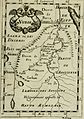
 Map of Nubia, 1683.jpg 933 × 1,404; 334 KB
-
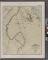
 Map of Nubia, 1719.jpg 725 × 1,078; 169 KB
-
 Mapa Aniba Baixa Nubia.gif 345 × 371; 44 KB
-
 MapaDeNubia-es.svg 600 × 1,243; 3.76 MB
-
 Meroe city map de.svg 400 × 261; 30 KB
-
 Meroe city map es.svg 427 × 278; 130 KB
-
 Meroe city map HE.svg 400 × 261; 29 KB
-
 Meroe gesamt new.gif 2,424 × 1,580; 40 KB
-
 Meroe locator map-hu.png 180 × 218; 14 KB
-
 Meroe locator map.svg 728 × 613; 30 KB
-
 Migration of Arabs into Sudan.jpg 818 × 674; 100 KB
-
 Napata english2.jpg 911 × 975; 74 KB
-
 Napata locator map-hu.jpg 180 × 218; 36 KB
-
 Napata Map German.png 906 × 969; 60 KB
-
 Napata Map-es.svg 574 × 614; 92 KB
-
 NileCataractReaches.jpg 659 × 1,024; 220 KB
-
 Nubia be.png 604 × 635; 1.1 MB
-
 Nubia before the Turko-Egyptian Conquest.png 716 × 900; 138 KB
-
 Nubia blank.png 288 × 600; 74 KB
-
 Nubia NASA-WW.jpg 472 × 724; 42 KB
-
 Nubia portuguese.svg 288 × 600; 110 KB
-
 Nubia primeira e segunda cataratas.svg 486 × 258; 106 KB
-
 Nubia spanish.png 288 × 600; 125 KB
-
 Nubia today-ar.png 495 × 1,035; 139 KB
-
 Nubia today.png 495 × 1,035; 142 KB
-
 Nubia za Nowego Państwa.png 600 × 800; 55 KB
-
 Nubian map (1).png 645 × 578; 70 KB
-
 Nubias map.png 800 × 406; 77 KB
-
 Outline of Nubia.png 350 × 542; 73 KB
-
 River War 1-7 Rail and River.jpg 1,407 × 2,010; 308 KB
-
 Sudan Nile River 17oct2001 Nubia.jpg 1,166 × 948; 138 KB
-
 The Kingdom of Makuria at its peak-ar.jpg 495 × 1,035; 192 KB
-
 The Nile - notes for travellers in Egypt (1895) (14782811825).jpg 2,104 × 3,432; 1.41 MB
-
 The Quarterly journal of the Geological Society of London (12894016824).jpg 1,203 × 1,888; 383 KB
-
 Nubia. Chiquet L'Afrique 1719 UTA (cropped).jpg 324 × 287; 124 KB
_(14783942932).jpg)

.jpg)
,_Sudan_%5E_Nubia_-_Geographicus_-_Abysinnia-pinkerton-1818.jpg)


.jpg)


.png)


_(14782811825).jpg)
.jpg)
.jpg)