Category:Maps of Oresund by Braun & Hogenberg
Jump to navigation
Jump to search
Media in category "Maps of Oresund by Braun & Hogenberg"
The following 9 files are in this category, out of 9 total.
-
 Freti Danici Or Sundt accuratiss. delineatio - btv1b532358420 (2 of 3).jpg 11,585 × 8,442; 16.49 MB
-
 Helsingborg 1589 Georg Braun.jpg 1,916 × 1,260; 1.32 MB
-
 Helsingborg and Elsinore when they controlled the Sound Dues in 1588.webp 1,080 × 772; 121 KB
-
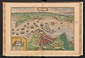
 Helsingor 1588.jpg 449 × 321; 71 KB
-
 Kronborg Braun-Hogenberg.jpg 1,754 × 1,276; 563 KB
-

-
 Civitates orbis terrarum. Urbium praecipuarum totius mundi. Liber quartus (page 56).jpg 5,000 × 3,459; 3.31 MB
-
 Liber qvartvs Vrbivm praecipvarvm totivs Mvndi 1612 (112047656).jpg 7,970 × 5,344; 7.35 MB
-
 Öresund Kupferstich Georg Braun Franz Hogenberg 1572-94.jpg 1,024 × 720; 338 KB
.jpg)


.jpg)
.jpg)
