Category:Old maps of Oresund
Jump to navigation
Jump to search
Subcategories
This category has the following 3 subcategories, out of 3 total.
Media in category "Old maps of Oresund"
The following 18 files are in this category, out of 18 total.
-

-

-
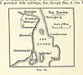 122 of 'A School Geography' (11158156576).jpg 965 × 866; 194 KB
-
 A chart of the BELT and SOUND NYPL1640725.tiff 7,230 × 5,428; 112.28 MB
-

-
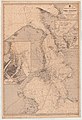 Admiralty Chart No 2115 Entrance to the Baltic The Sound, Published 1886.jpg 8,318 × 12,168; 16.29 MB
-
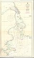 Admiralty Chart No 2115 The Sound, Published 1971.jpg 11,220 × 19,020; 29.17 MB
-
 Admiralty Chart No 2595 The Sound Southern Portion, Published 1950.jpg 11,300 × 18,608; 66.8 MB
-

-
-
 Karte der Umgebung von Kopenhagen.jpg 461 × 745; 97 KB
-
 Karte Sunde 1801.jpg 900 × 1,290; 893 KB
-
 Koebenhavnsamt.jpg 4,986 × 4,500; 11.42 MB
-
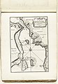
 Map of Oresund 1705.jpg 2,174 × 3,000; 5.8 MB
-

-
 Special Retvisende Siöe Kaart fra Cronborg (Andreas Lous).jpg 4,238 × 6,900; 5.82 MB
-
 Werming Malmö och Köpenhamn.png 4,022 × 3,100; 9.87 MB
-
 Карта к статье «Зунд». Военная энциклопедия Сытина (Санкт-Петербург, 1911-1915).jpg 1,043 × 1,810; 340 KB
.jpg)
_(14595102268).jpg)
.jpg)


_Les_Forces_de_l%27Europe,_Asie,_Afrique_et_Amerique_Comme_aussi_les_Cartes_des_C%C3%B4tes_de_France_et_d%27Espagne_(serietitel_op_object),_RP-P-OB-83.036-201.jpg)
_Les_Forces_de_l%27Europe,_Asie,_Afrique_et_Amerique,_ou_description_des_principales_villes_avec_leurs_fortifications._Dessign%C3%A9,_RP-P-OB-83.034-149.jpg)


_(14756509596).jpg)
.jpg)

.jpg)