Category:Maps of Perrysburg, Ohio
Jump to navigation
Jump to search
- 100 most populous cities of the United States
- 1–25
- Austin
- Boston
- Charlotte
- Chicago
- Columbus
- Dallas
- Denver
- El Paso
- Fort Worth
- Houston
- Indianapolis
- Jacksonville
- Los Angeles
- Nashville
- New York City
- Oklahoma City
- Philadelphia
- Phoenix
- Portland
- San Antonio
- San Diego
- San Francisco
- San Jose
- Seattle
- Washington, D.C.
- 26–50
- Arlington
- Atlanta
- Bakersfield
- Colorado Springs
- Detroit
- Fresno
- Kansas City
- Las Vegas
- Long Beach
- Louisville
- Memphis
- Miami
- Minneapolis
- Oakland
- Omaha
- Raleigh
- Sacramento
- Tucson
- Tulsa
- Wichita
- 51–75
- Anaheim
- Anchorage
- Cincinnati
- Cleveland
- Corpus Christi
- Durham
- Greensboro
- Honolulu
- Irvine
- Jersey City
- Lexington
- Lincoln
- Newark
- New Orleans
- Orlando
- Pittsburgh
- Plano
- Saint Paul
- Santa Ana
- St. Louis
- Tampa
- 76–100
- Boise
- Buffalo
- Chesapeake
- Chula Vista
- Fort Wayne
- Laredo
- Lubbock
- Madison
- Norfolk
- Richmond
- Santa Clarita
- Scottsdale
- St. Petersburg
- Spokane
- Toledo
- Winston-Salem
Subcategories
This category has the following 2 subcategories, out of 2 total.
O
Media in category "Maps of Perrysburg, Ohio"
The following 11 files are in this category, out of 11 total.
-
 1805 Survey - Twelve Mile Square Reserve.png 1,854 × 1,854; 1.16 MB
-
 1813 Map of the Rapids of Miami, showing Fort Meigs.jpg 1,397 × 930; 193 KB
-
 1816 Perrysburg, OH, Original Plat.jpg 1,120 × 1,400; 465 KB
-
 1827 Plat - Twelve Square Miles Reserve.jpg 3,500 × 4,656; 1.49 MB
-
 Lucas County Ohio map by Riley, 1855.jpg 7,708 × 5,363; 7.58 MB
-
 1875 Ross & Perrysburg Township, Ohio.jpg 3,540 × 2,256; 1.95 MB
-
 1886 Perrysburg Ohio map.jpg 3,148 × 4,932; 3.27 MB
-
 1886 Perrysburg Ohio.jpg 4,915 × 3,210; 2.72 MB
-
 1888 Map of Lucas and parts of Wood, Ottawa and Sandusky Counties, Ohio.jpg 17,370 × 11,606; 42.59 MB
-
 1912 Perrysburg Ohio map.jpg 2,315 × 2,724; 1.5 MB
-
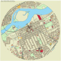 Perrysburg map.png 864 × 864; 926 KB


