Category:Maps of Ruinen
Jump to navigation
Jump to search
Wikimedia category | |||||
| Upload media | |||||
| Instance of | |||||
|---|---|---|---|---|---|
| Category combines topics | |||||
| Ruinen | |||||
cadastral populated place in the Netherlands    | |||||
| Instance of | |||||
| Location |
| ||||
| Population |
| ||||
 | |||||
Media in category "Maps of Ruinen"
The following 2 files are in this category, out of 2 total.
-
 Map - NL - De Wolden - Wijk 08 Ruinen.svg 625 × 575; 23 KB
-
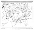 Ruinen, Gemeenteatlas van Nederland.jpg 750 × 658; 56 KB

