Category:Maps of Sindh
Jump to navigation
Jump to search
Provinces of Pakistan: Balochistan · Khyber Pakhtunkhwa · Punjab · Sindh ·
Territories: Azad Kashmir · Gilgit-Baltistan · Islamabad Capital Territory ·
Territories: Azad Kashmir · Gilgit-Baltistan · Islamabad Capital Territory ·
Wikimedia category | |||||
| Upload media | |||||
| Instance of | |||||
|---|---|---|---|---|---|
| Category combines topics | |||||
| Sindh | |||||
province of Pakistan | |||||
| Instance of | |||||
| Part of | |||||
| Location | Pakistan | ||||
| Located in or next to body of water |
| ||||
| Capital | |||||
| Legislative body | |||||
| Executive body |
| ||||
| Official language | |||||
| Head of government |
| ||||
| Inception |
| ||||
| Population |
| ||||
| Area |
| ||||
| official website | |||||
 | |||||
Subcategories
This category has the following 7 subcategories, out of 7 total.
Media in category "Maps of Sindh"
The following 36 files are in this category, out of 36 total.
-
Administrative Divisions of Sindh.jpg 830 × 1,105; 268 KB
-
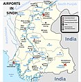
Airports in Sindh.jpg 983 × 1,004; 412 KB
-
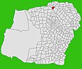
Area of Union council Haji Abdullah Shah badin sindh Pakistan.jpg 1,200 × 1,000; 151 KB
-
Ber Kamber.jpg 903 × 729; 187 KB
-
Bhada Kamber.jpg 862 × 685; 196 KB
-
Bhangar Acha.jpg 872 × 744; 184 KB
-
BlankMap-Sindh(Pak)2.92.PNG 770 × 916; 39 KB
-
Deh Abri Kamber.jpg 869 × 670; 181 KB
-
Deh Aheer Kamber.jpg 1,080 × 833; 251 KB
-
Deh Bharmi Kamber.jpg 873 × 694; 193 KB
-
Deh Ghaibi Dero Jagir 6 Chak 1.jpg 924 × 719; 194 KB
-
Deh Shahdadkot.jpg 1,027 × 879; 219 KB
-
Deh Sial Sdkt.jpg 1,079 × 917; 276 KB
-
Dialects of Sindhi language-neutral.svg 323 × 392; 65 KB
-
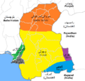
Dialects of Sindhi.PNG 499 × 474; 24 KB
-
Kakar Range.jpg 300 × 241; 11 KB
-
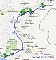
KHI - SHK - DHR.jpg 362 × 391; 31 KB
-
Lakhpur Map.png 556 × 599; 147 KB
-
Map of Vedic India.png 683 × 489; 424 KB
-
New Sukkur Taluka.jpg 342 × 272; 34 KB
-
Baloch map.jpg 709 × 505; 77 KB
-
Pakistan Sindh.PNG 441 × 474; 32 KB
-
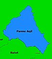
Pano Aqil Taluka.jpg 387 × 440; 51 KB
-
Peoples of South Asia Sindhi Sumra.png 970 × 733; 404 KB
-
Physical Map of SIndh.jpg 829 × 1,106; 209 KB
-
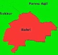
Rohri Taluka.jpg 346 × 328; 39 KB
-
Saleh Pat Taluka.jpg 721 × 530; 88 KB
-
Sind Eighth Century.svg 600 × 450; 428 KB
-
Sindh 2.jpg 1,117 × 1,331; 354 KB
-
Sindh 700ad-ar.png 720 × 473; 685 KB
-
Sindh 700ad.jpg 720 × 473; 432 KB
-
Sindh.gif 250 × 277; 12 KB
-
Sindhi dialect borders.png 905 × 835; 15 KB
-
Sukkur Express Route Map.png 3,032 × 2,572; 451 KB
-
Talpur Map 1823.png 624 × 496; 46 KB
-
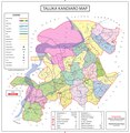
Taluka Kandiaro Map.pdf 7,425 × 7,641; 877 KB


