<nowiki>Category:Maps of Zamość; categoría de Wikimedia; катэгорыя ў праекце Вікімедыя; κατηγορία εγχειρημάτων Wikimedia; катэгорыя ў праекце Вікімэдыя; kategorija na Wikimediji; kategória projektov Wikimedia; Wîkîmediya:Kategorî; kategori Wikimedia; kategori Wikimedia; Wikimedia:Ronnaghys; Wikimedia-categorie; Wikimédia-kategória; Wikimedia category; Wikimedia:Klassys; категория на Уикимедия; jamii ya Wikimedia; Vikimedya kategorisi; ویکیمیڈیا زمرہ; kategori Wikimedia; 維基媒體分類; Wikimedia-kategori; kategori e Wikimedias; категорія проєкту Вікімедіа; kawan Wikimèdia; гурӯҳи Викимедиа; 维基媒体分类; Wikimedia-Kategorie; 위키미디어 분류; Wikimedia-bólkur; kategorio en Vikimedio; Викимедиина категорија; Wikimedia-Kategorie; विकिपीडिया:श्रेणी; উইকিমিডিয়া বিষয়শ্রেণী; page de catégorie de Wikimedia; kategori Wikimedia; kategorija na Wikimediji; kategorya ng Wikimedia; 维基媒体分类; 維基媒體分類; pajenn rummata eus Wikimedia; विकिपीडिया वर्ग; kategorija w projektach Wikimedije; thể loại Wikimedia; 维基媒体分类; Wikimedia projekta kategorija; kategoria ti Wikimedia; категорија на Викимедији; विकिमिडिया श्रेणी; 維基媒體分類; categoria de um projeto da Wikimedia; 维基媒体分类; категорияд Ангилал; Wikimedia-kategori; Wikimedia-kategori; kategori Wikimédia; kategori Wikimedia; Wikimedia-Kategorie; kategorie na projektech Wikimedia; پۆلی ویکیمیدیا; Wikimedia category; تصنيف ويكيميديا; Vikimédia ñemohenda; דף קטגוריה; Wikimedia:ကဏ္ဍခွဲခြင်း; 維基媒體分類; Wikimedia категориясы; વિકિપીડિયા શ્રેણી; categoría de Wikimedia; Wikimediako kategoria; د ويکيمېډيا وېشنيزه; categoría de Wikimedia; categoria de Wikimedia; Викимедиа категорияһы; Wikimedia-Kategorie; विकिमीडिया श्रेणी; Viciméid catagóir; Վիքիմեդիայի նախագծի կատեգորիա; Wikimedia-kategorie; Wikimedia-kategory; विकिमिडिया श्रेणी; ウィキメディアのカテゴリ; categoria Wikimedia; categorie în cadrul unui proiect Wikimedia; تصنيف بتاع ويكيميديا; Wikimedia kategooria; විකිමීඩියා ප්රභේද පිටුව; categoria Vicimediorum; gurühi Vikimedia; Vikipidiya:Shopni; категория в проекте Викимедиа; Wikimedia-luokka; гурӯҳ дар лоиҳаи Викимедиа; Wikimedia category; Wikimedia-categorie; விக்கிமீடியப் பகுப்பு; categoria di un progetto Wikimedia; categurìa 'e nu pruggette Wikimedia; Wikimedia-categorie; Wikimedia-kategoriija; 維基媒體分類; ردهٔ ویکیپدیا; Викимедиа проектындагы төркем; Wikimedia-Kategorie; Викимедиа проектындагы төркем; ẹ̀ka Wikimedia; catigurìa di nu pruggettu Wikimedia; categoria de um projeto da Wikimedia; ვიკიპედია:კატეგორიზაცია; Wikimedia-kategori; tumbung Wikimedia; Kategoriya ning Wikimedia; kategorija Wikimedije; Wikimedia proyektındağı törkem; tudalen categori Wikimedia; Wikimedia-Kategorie; หน้าหมวดหมู่วิกิมีเดีย; kategoria w projekcie Wikimedia; വിക്കിമീഡിയ വർഗ്ഗം; Wikimedia:Kategorija; kategori Wikimedia; Wikimedia-Kategorie; زمرو:وڪيپيڊيا زمرا بندي; Wikimedia-Kategorie; categoría de Wikimedia; Wikimedia-kategorie; 维基媒体分类; Wikimedia category</nowiki>
Category:Maps of Zamość Wikimedia category |
| Upload media |
|
| Instance of | |
|---|
| Category combines topics | |
|---|
| Zamość |
|---|
historical city in the Lublin Voivodeship of southeastern Poland  image image  flag image flag image  coat of arms image coat of arms image  locator map image locator map image |
|
| Instance of | - city with powiat rights
- city
|
|---|
| Location | |
|---|
| Inception | |
|---|
| Population | |
|---|
| Area | |
|---|
| Elevation above sea level | |
|---|
| Different from | - Zamość, Konin County
- Zamość, Kuyavian-Pomeranian Voivodeship
- Zamość, Maków County
- Zamość, Nowy Dwór Mazowiecki County
- Zamość, Ostrów Wielkopolski County
- Zamość, Piotrków County
- Zamość, Pomeranian Voivodeship
- Zamość, Sierpc County
- Zamość, Września County
- Zamość, powiat wyszkowski
- Zamość, Łask County
- Zamość, Ostrołęka County
|
|---|
| Said to be the same as | Zamość, Zamość |
|---|
| official website |
 50° 43′ 14″ N, 23° 15′ 31″ E 50° 43′ 14″ N, 23° 15′ 31″ E |
 |
|
|
Subcategories
This category has the following 3 subcategories, out of 3 total.


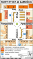 Nowy Rynek Zamość plan.PNG 667 × 1,186; 183 KB
 Obwodnica hetmańska.png 1,994 × 1,614; 1.09 MB
 Obwodnica zachodnia Zamościa.png 1,994 × 1,614; 841 KB
 Obwodnica śródmiejska Zamościa.png 1,994 × 1,614; 864 KB
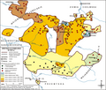 Ordynacja Zamojska.PNG 1,488 × 1,261; 538 KB
 POL Zamość map.svg 497 × 463; 47 KB
 Zamojszczyzna map.png 1,508 × 1,028; 443 KB
 Zamosc 4.png 2,137 × 1,633; 856 KB
 Zamosc osiedla2.png 1,038 × 816; 481 KB
 Zamosc Voivodship 1975.png 474 × 437; 8 KB
 Zamość główne ulice.png 2,492 × 2,017; 1.91 MB
 Zamość location map.png 1,057 × 822; 848 KB
 Zamość plan miasta.png 2,685 × 2,011; 1.56 MB
 Zamość ulice wg kategorii.png 1,994 × 1,614; 722 KB


.jpg)
.jpg)