Category:Maps of census statistical areas in Georgia (U.S. state)
Jump to navigation
Jump to search
States of the United States: Alabama · Alaska · Arizona · Arkansas · California · Colorado · Connecticut · Delaware · Florida · Georgia · Idaho · Illinois · Indiana · Iowa · Kansas · Kentucky · Louisiana · Maine · Maryland · Massachusetts · Michigan · Minnesota · Mississippi · Missouri · Montana · Nebraska · Nevada · New Hampshire · New Jersey · New Mexico · New York · North Carolina · North Dakota · Ohio · Oklahoma · Oregon · Pennsylvania · Rhode Island · South Carolina · South Dakota · Tennessee · Texas · Utah · Vermont · Virginia · Washington · West Virginia · Wisconsin
Puerto Rico
Puerto Rico
Media in category "Maps of census statistical areas in Georgia (U.S. state)"
The following 37 files are in this category, out of 37 total.
-
 Albany, GA MSA.png 400 × 441; 10 KB
-
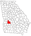 Americus Micropolitan Area.png 424 × 503; 39 KB
-
 Athens-Clarke County MSA.png 400 × 441; 10 KB
-
 Atlanta-metroclean.png 258 × 300; 7 KB
-

-

-
 Augusta Metro and CSRA Map.gif 1,560 × 1,283; 187 KB
-
 Augusta MSA Map.gif 1,560 × 1,283; 179 KB
-
 Augusta, Georgia Metropolitan Area.png 2,048 × 1,684; 586 KB
-
 Augusta-Richmond County MSA.png 2,048 × 1,684; 587 KB
-

-
 Brunswick MSA.PNG 400 × 441; 18 KB
-
 Brunswick-metroclean.png 258 × 300; 20 KB
-
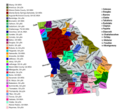
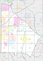 Census 2000 Block Map DeKalb County, Georgia, United States.jpg 2,082 × 2,900; 2.02 MB
-
 Central Savannah River Area County Map.gif 1,560 × 1,283; 180 KB
-
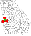
 Chattanooga-Cleveland-Athens Combined Statistical Area.png 760 × 644; 67 KB
-
 Chattanooga-Cleveland-Dalton, TN-GA CSA.png 760 × 644; 96 KB
-
 Chattanooga-Cleveland-Dalton, TN-GA-AL CSA.png 760 × 644; 107 KB
-
 Columbus, Georgia-Alabama Metropolitan Statistical Area.svg 749 × 853; 182 KB
-
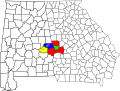
 Columbus-Auburn-Opelika, GA-AL CSA.png 276 × 300; 19 KB
-
 Columbus-Auburn-Opelika, Georgia-Alabama Combined Statistical Area.svg 1,186 × 895; 313 KB
-
 Dalton Metropolitan Area.png 424 × 503; 39 KB
-
 Douglas Micropolitan Area.png 424 × 503; 39 KB
-
 Dublin Micropolitan Area.png 424 × 503; 39 KB
-
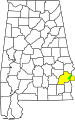 Eufaula, Alabama-Georgia Micropolitan Statistical Area.svg 558 × 887; 112 KB
-
 Fitzgerald Micropolitan Area.png 424 × 503; 39 KB
-
 Georgia CBSAs 2020.png 5,364 × 4,928; 2.51 MB
-
 Hinesville-Fort Stewart, Georgia Metropolitan Statistical Area.svg 423 × 501; 177 KB
-
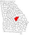
 Macon, Georgia Metropolitan Statistical Area.svg 423 × 501; 182 KB
-
 Macon-Warner Robins-Fort Valley CSA.png 424 × 503; 39 KB
-
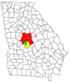
 Macon-Warner Robins-Fort Valley, Georgia Combined Statistical Area.svg 423 × 501; 201 KB
-
 Milledgeville Micropolitan Area.png 424 × 503; 39 KB
-
 Savannah, Georgia Metropolitan Statistical Area.svg 423 × 501; 185 KB
-
 Savannah-Hinesville-Fort Stewart CSA.png 424 × 503; 40 KB
-
 Savannah-Hinesville-Fort Stewart, Georgia Combined Statistical Area.svg 423 × 501; 190 KB
-
 Vidalia Micropolitan Area.png 424 × 503; 39 KB
-
 Waycross Micropolitan Area.png 424 × 503; 39 KB


