Category:Maps of census statistical areas in Pennsylvania
Jump to navigation
Jump to search
States of the United States: Alabama · Alaska · Arizona · Arkansas · California · Colorado · Connecticut · Delaware · Florida · Georgia · Idaho · Illinois · Indiana · Iowa · Kansas · Kentucky · Louisiana · Maine · Maryland · Massachusetts · Michigan · Minnesota · Mississippi · Missouri · Montana · Nebraska · Nevada · New Hampshire · New Jersey · New Mexico · New York · North Carolina · North Dakota · Ohio · Oklahoma · Oregon · Pennsylvania · Rhode Island · South Carolina · South Dakota · Tennessee · Texas · Utah · Vermont · Virginia · Washington · West Virginia · Wisconsin
Puerto Rico
Puerto Rico
Subcategories
This category has only the following subcategory.
Media in category "Maps of census statistical areas in Pennsylvania"
The following 15 files are in this category, out of 15 total.
-
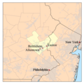
Allentown-Bethlehem-Easton metropolitan area map.png 500 × 500; 51 KB
-
Bloomsburg-Berwick Micropolitan Area.png 565 × 361; 27 KB
-
DelawareValley.jpg 924 × 805; 158 KB
-
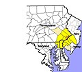
Delawarevalleymap.png 300 × 300; 29 KB
-
Map of Washington-Baltimore-Arlington CSA, 2012.jpg 2,256 × 2,943; 3.1 MB
-
Pennsylvania CBSAs 2020.png 6,504 × 4,664; 1.6 MB
-
Pittsburgh Metropolitan Area and Pittsburgh-New Castle CSA.png 565 × 361; 28 KB
-
Scranton-Wilkes-Barre Metropolitan Area.png 565 × 361; 28 KB
-
Sunbury-Lewisburg-Selinsgrove CSA.png 565 × 361; 28 KB
-
Williamsport-Lock Haven CSA.png 565 × 361; 27 KB
-
York-Hanover-Gettysburg CSA.png 565 × 361; 28 KB
-
Youngstown Metro Counties.PNG 293 × 173; 11 KB
-
Youngstown Metro2.PNG 293 × 173; 11 KB
-
Youngstownmetro.svg 1,059 × 829; 98 KB


