Category:Maps of groups of communes in Maine-et-Loire
Jump to navigation
Jump to search
Departments of Metropolitan France: Ain [01] · Aisne [02] · Allier [03] · Alpes-de-Haute-Provence [04] · Hautes-Alpes [05] · Alpes-Maritimes [06] · Ardèche [07] · Ardennes [08] · Ariège [09] · Aube [10] · Aude [11] · Aveyron [12] · Bouches-du-Rhône [13] · Calvados [14] · Cantal [15] · Charente [16] · Charente-Maritime [17] · Cher [18] · Corrèze [19] · Corse-du-Sud [2A]† · Haute-Corse [2B]† · Côte-d’Or [21] · Côtes-d'Armor [22] · Creuse [23] · Dordogne [24] · Doubs [25] · Drôme [26] · Eure [27] · Eure-et-Loir [28] · Finistère [29] · Gard [30] · Haute-Garonne [31] · Gers [32] · Gironde [33] · Hérault [34] · Ille-et-Vilaine [35] · Indre [36] · Indre-et-Loire [37] · Isère [38] · Jura [39] · Landes [40] · Loir-et-Cher [41] · Loire [42] · Haute-Loire [43] · Loire-Atlantique [44] · Loiret [45] · Lot [46] · Lot-et-Garonne [47] · Lozère [48] · Maine-et-Loire [49] · Manche [50] · Marne [51] · Haute-Marne [52] · Mayenne [53] · Meurthe-et-Moselle [54] · Meuse [55] · Morbihan [56] · Moselle [57] · Nièvre [58] · Nord [59] · Oise [60] · Orne [61] · Pas-de-Calais [62] · Puy-de-Dôme [63] · Pyrénées-Atlantiques [64] · Hautes-Pyrénées [65] · Pyrénées-Orientales [66] · Bas-Rhin [67] · Haut-Rhin [68] · departmental district of the Rhône [69] · Rhône [69D]‡ · Haute-Saône [70] · Saône-et-Loire [71] · Sarthe [72] · Savoie [73] · Haute-Savoie [74] · Seine-Maritime [76] · Seine-et-Marne [77] · Yvelines [78] · Deux-Sèvres [79] · Somme [80] · Tarn [81] · Tarn-et-Garonne [82] · Var [83] · Vaucluse [84] · Vendée [85] · Vienne [86] · Haute-Vienne [87] · Vosges [88] · Yonne [89] · Territoire de Belfort [90] · Essonne [91] · Hauts-de-Seine [92] · Seine-Saint-Denis [93] · Val-de-Marne [94] · Val-d'Oise [95]
Overseas departments and regions: Guadeloupe [971] · Martinique [972] · French Guiana [973] · Réunion [974] · Mayotte [976]
Sui generis territories: New Caledonia [988]
Overseas departments and regions: Guadeloupe [971] · Martinique [972] · French Guiana [973] · Réunion [974] · Mayotte [976]
Sui generis territories: New Caledonia [988]
| NO WIKIDATA ID FOUND! Search for Maps of groups of communes in Maine-et-Loire on Wikidata | |
| Upload media |
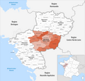
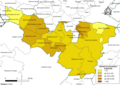
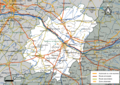
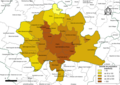
Français : Cartes des établissements publics de coopération intercommunale (communautés de communes, d’agglomération ou urbaines, métropoles, syndicats intercommunaux) et syndicats mixtes (dont les pôles métropolitains) du département français de Maine-et-Loire.

Subcategories
This category has the following 6 subcategories, out of 6 total.
2
Media in category "Maps of groups of communes in Maine-et-Loire"
The following 70 files are in this category, out of 70 total.
-
 Gemeindeverbände im Département Maine-et-Loire 2024.png 3,500 × 3,362; 2.08 MB
-
 49-Intercos2019-200060010-Densités.png 3,519 × 2,480; 1.78 MB
-
 49-Intercos2019-200068955-Densités.png 3,519 × 2,480; 1.61 MB
-
 49-Intercos2019-200071553-Densités.png 3,519 × 2,480; 1.38 MB
-
 49-Intercos2019-200071678-Densités.png 3,519 × 2,480; 1.52 MB
-
 49-Intercos2019-200071868-Densités.png 3,519 × 2,480; 1.69 MB
-
 49-Intercos2019-200071876-Densités.png 3,519 × 2,480; 2.21 MB
-
 49-Intercos2019-200071876.png 3,519 × 2,480; 4.51 MB
-
 49-Intercos2019-244900015-Densités.png 3,519 × 2,480; 1.66 MB
-
 49-Intercos2019-244900809-Densités.png 3,519 × 2,480; 1.32 MB
-
 49-Intercos2019-244900882-Densités.png 3,519 × 2,480; 1.24 MB
-
 49-Maine-et-Loire-intercos-2019.png 3,507 × 2,480; 2.44 MB
-
 Gemeindeverband Angers Loire Métropole 2019.png 3,500 × 3,362; 2.05 MB
-
 Gemeindeverband Anjou Bleu Communauté 2019.png 3,500 × 3,362; 2.04 MB
-
 Gemeindeverband Anjou Loir et Sarthe 2019.png 3,500 × 3,362; 2.04 MB
-
 Gemeindeverband Baugeois Vallée 2019.png 3,500 × 3,362; 2.04 MB
-
 Gemeindeverband Cholet Agglomération 2024.png 3,500 × 3,362; 2.05 MB
-
 Intercos2019-200060010.png 3,519 × 2,480; 4.17 MB
-
 Intercos2019-200068955.png 3,519 × 2,480; 3.23 MB
-
 Intercos2019-200071553.png 3,519 × 2,480; 3.48 MB
-
 Intercos2019-200071678.png 3,519 × 2,480; 3.54 MB
-
 Intercos2019-200071868.png 3,519 × 2,480; 3.47 MB
-
 Intercos2019-244900015.png 3,519 × 2,480; 3.84 MB
-
 Intercos2019-244900809.png 3,519 × 2,480; 2.46 MB
-
 Intercos2019-244900882.png 3,519 × 2,480; 2.58 MB
-
 Localisation CA Mauges Communauté en Maine-et-Loire, France.svg 1,000 × 780; 269 KB
-
 Localisation CC du pays d'Ancenis dans la Loire-Atlantique, France.svg 742 × 637; 273 KB
-
 Localisation EPCI Angers Loire Métropole en Maine-et-Loire, France.svg 1,197 × 936; 6.36 MB
-
 Localisation EPCI Anjou Bleu Communaute en Maine-et-Loire, France.svg 1,067 × 832; 149 KB
-
 Localisation EPCI Anjou Loir et Sarthe en Maine-et-Loire, France.svg 1,000 × 780; 263 KB
-
 Localisation EPCI Baugeois Vallée en Maine-et-Loire, France.svg 1,000 × 780; 260 KB
-
 Localisation EPCI de Beaufort en Anjou en Maine-et-Loire, France.svg 1,000 × 780; 144 KB
-
 Localisation EPCI de la région de Chemillé en Maine-et-Loire, France.svg 1,000 × 780; 167 KB
-
 Localisation EPCI de la région de Doué-la-Fontaine en Maine-et-Loire, France.svg 1,000 × 780; 167 KB
-

-
 Localisation EPCI de la région du Lion-d'Angers en Maine-et-Loire, France.svg 1,000 × 780; 167 KB
-
 Localisation EPCI de la vallée Loire - Authion en Maine-et-Loire, France.svg 1,000 × 780; 167 KB
-
 Localisation EPCI des coteaux du Layon en Maine-et-Loire, France.svg 1,000 × 780; 167 KB
-
 Localisation EPCI des Vallées du Haut-Anjou en Maine-et-Loire, France.svg 1,000 × 780; 264 KB
-
 Localisation EPCI du bocage en Maine-et-Loire, France.svg 1,000 × 780; 167 KB
-
 Localisation EPCI du canton de Baugé en Maine-et-Loire, France.svg 1,000 × 780; 167 KB
-
 Localisation EPCI du canton de Candé en Maine-et-Loire, France.svg 1,000 × 780; 167 KB
-
 Localisation EPCI du canton de Champtoceaux en Maine-et-Loire, France.svg 1,000 × 780; 167 KB
-
 Localisation EPCI du canton de Noyant en Maine-et-Loire, France.svg 1,000 × 780; 167 KB
-

-
 Localisation EPCI du canton de Segré en Maine-et-Loire, France.svg 1,000 × 780; 167 KB
-
 Localisation EPCI du centre Mauges en Maine-et-Loire, France.svg 1,000 × 780; 167 KB
-
 Localisation EPCI du Choletais en Maine-et-Loire, France au 1er janvier 2017.svg 1,000 × 780; 150 KB
-
 Localisation EPCI du Choletais en Maine-et-Loire, France.svg 1,000 × 780; 276 KB
-
 Localisation EPCI du Gennois en Maine-et-Loire, France.svg 1,000 × 780; 167 KB
-
 Localisation EPCI du haut Anjou en Maine-et-Loire, France.svg 1,000 × 780; 167 KB
-
 Localisation EPCI du Loir en Maine-et-Loire, France.svg 1,000 × 780; 167 KB
-
 Localisation EPCI du Vihiersois haut-Layon en Maine-et-Loire, France.svg 1,000 × 780; 167 KB
-
 Localisation EPCI Les portes de l'Anjou en Maine-et-Loire, France.svg 1,000 × 780; 167 KB
-
 Localisation EPCI Loir et Sarthe en Maine-et-Loire, France.svg 1,000 × 780; 167 KB
-
 Localisation EPCI Loire - Longué en Maine-et-Loire, France.svg 1,000 × 780; 167 KB
-
 Localisation EPCI Loire Aubance en Maine-et-Loire, France.svg 1,000 × 780; 167 KB
-
 Localisation EPCI Loire Layon Aubance en Maine-et-Loire, France.svg 1,000 × 780; 268 KB
-
 Localisation EPCI Loire Layon en Maine-et-Loire, France.svg 1,000 × 780; 167 KB
-
 Localisation EPCI Maine-et-Loire, France.svg 1,000 × 780; 150 KB
-
 Localisation EPCI Moine et Sèvre en Maine-et-Loire, France.svg 1,000 × 780; 167 KB
-
 Localisation EPCI Montrevault communauté en Maine-et-Loire, France.svg 1,000 × 780; 167 KB
-
 Localisation EPCI Ouest Anjou en Maine-et-Loire, France.svg 1,000 × 780; 167 KB
-
 Localisation EPCI Saumur Loire développement en Maine-et-Loire, France.svg 1,000 × 780; 168 KB
-
 Localisation EPCI Saumur Val de Loire en Maine-et-Loire, France.svg 1,000 × 780; 296 KB
-
 Gemeindeverband Loire Layon Aubance 2019.png 3,500 × 3,362; 2.04 MB
-
 Gemeindeverband Mauges Communauté 2019.png 3,500 × 3,362; 2.04 MB
-
 Gemeindeverband Pays d’Ancenis 2024.png 3,500 × 3,362; 2.06 MB
-
 Gemeindeverband Saumur Val de Loire 2019.png 3,500 × 3,362; 2.05 MB
-
 Gemeindeverband Vallées du Haut-Anjou 2024.png 3,500 × 3,362; 2.06 MB


