Category:Maps of municipalities in the district of Hochdorf
Jump to navigation
Jump to search
Subcategories
This category has the following 7 subcategories, out of 7 total.
2
Media in category "Maps of municipalities in the district of Hochdorf"
The following 14 files are in this category, out of 14 total.
-
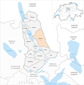
 Karte Gemeinden des Wahlkreis Hochdorf 2021.png 1,476 × 1,485; 434 KB
-
 Karte Gemeinde Aesch LU 2021.png 1,476 × 1,485; 435 KB
-
 Karte Gemeinde Ballwil 2021.png 1,476 × 1,485; 435 KB
-
 Karte Gemeinde Emmen 2021.png 1,476 × 1,485; 435 KB
-
 Karte Gemeinde Ermensee 2021.png 1,476 × 1,485; 435 KB
-
 Karte Gemeinde Eschenbach LU 2021.png 1,476 × 1,485; 435 KB
-
 Karte Gemeinde Hitzkirch 2021.png 1,476 × 1,485; 435 KB
-
 Karte Gemeinde Hochdorf 2021.png 1,476 × 1,485; 435 KB
-
 Karte Gemeinde Hohenrain 2021.png 1,476 × 1,485; 435 KB
-
 Karte Gemeinde Inwil 2021.png 1,476 × 1,485; 435 KB
-
 Karte Gemeinde Rain 2021.png 1,476 × 1,485; 435 KB
-
 Karte Gemeinde Rothenburg 2021.png 1,476 × 1,485; 435 KB
-
 Karte Gemeinde Römerswil 2021.png 1,476 × 1,485; 435 KB
-
 Karte Gemeinde Schongau 2021.png 1,476 × 1,485; 435 KB


