Category:Maps of municipalities in the district of Hochdorf to 2012
Jump to navigation
Jump to search
Media in category "Maps of municipalities in the district of Hochdorf to 2012"
The following 15 files are in this category, out of 15 total.
-
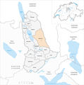
 Karte Gemeinden des Bezirks Hochdorf 2009.png 1,476 × 1,485; 556 KB
-
 Karte Gemeinde Aesch LU 2009.png 1,476 × 1,485; 372 KB
-
 Karte Gemeinde Altwis 2009.png 1,476 × 1,485; 557 KB
-
 Karte Gemeinde Ballwil 2009.png 1,476 × 1,485; 557 KB
-
 Karte Gemeinde Emmen 2009.png 1,476 × 1,485; 557 KB
-
 Karte Gemeinde Ermensee 2009.png 1,476 × 1,485; 557 KB
-
 Karte Gemeinde Eschenbach LU 2009.png 1,476 × 1,485; 558 KB
-
 Karte Gemeinde Hitzkirch 2009.png 1,476 × 1,485; 558 KB
-
 Karte Gemeinde Hochdorf 2009.png 1,476 × 1,485; 557 KB
-
 Karte Gemeinde Hohenrain 2009.png 1,476 × 1,485; 558 KB
-
 Karte Gemeinde Inwil 2009.png 1,476 × 1,485; 557 KB
-
 Karte Gemeinde Rain 2009.png 1,476 × 1,485; 557 KB
-
 Karte Gemeinde Rothenburg 2009.png 1,476 × 1,485; 557 KB
-
 Karte Gemeinde Römerswil 2009.png 1,476 × 1,485; 557 KB
-
 Karte Gemeinde Schongau 2009.png 1,476 × 1,485; 557 KB


