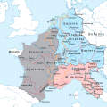
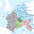
Category:Maps of the Carolingian Empire
Jump to navigation
Jump to search
Use the appropriate category for maps showing all or a large part of France. See subcategories for smaller areas:
| If the map shows | Category to use |
|---|---|
| France on a recently created map | Category:Maps of France or its subcategories |
| France on a map created more than 70 years ago | Category:Old maps of France or its subcategories |
| the history of France on a recently created map | Category:Maps of the history of France or its subcategories |
| the history of France on a map created more than 70 years ago | Category:Old maps of the history of France or its subcategories |
| NO WIKIDATA ID FOUND! Search for Maps of the Carolingian Empire on Wikidata | |
| Upload media |
Subcategories
This category has the following 7 subcategories, out of 7 total.
Media in category "Maps of the Carolingian Empire"
The following 79 files are in this category, out of 79 total.
-
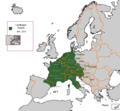
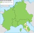
Carolingian Empire 481 - 814.GIF 579 × 535; 16 KB
-
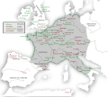
Frankish empire.jpg 1,755 × 1,241; 788 KB
-
Empire carolingien 806.png 800 × 706; 284 KB
-
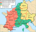
Verdun Treaty 843-es.svg 985 × 869; 637 KB
-
Verdun Treaty 843-pt.svg 985 × 869; 280 KB
-
727px-NE 800ad.jpg 727 × 599; 173 KB
-
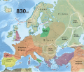
830 CE, Europe.svg 512 × 438; 1.6 MB
-
876 fr.png 6,824 × 6,584; 2.63 MB
-
888 CE, Europe.svg 512 × 438; 1.74 MB
-
An Impalaeriezhioù kristen hag ar bed arab ha muzulman e 800.svg 2,619 × 1,554; 1.88 MB
-
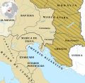
Awarenmark-frankenreich-es.svg 1,348 × 1,320; 1.33 MB
-
Awarenmark-frankenreich.png 450 × 450; 67 KB
-
Carolingian and Byzantine Empires 814.png 3,840 × 2,258; 700 KB
-
Carolingian and Eastern Roman empires 814.png 3,840 × 2,258; 460 KB
-
Carolingian empire 814-hu.svg 1,091 × 1,053; 185 KB
-
Carolingian empire 814-pt.svg 1,091 × 1,053; 185 KB
-
Carolingian empire 814-ru.svg 1,164 × 1,123; 187 KB
-
Carolingian empire 814.png 1,024 × 988; 169 KB
-
Carolingian empire 814.svg 1,092 × 1,057; 237 KB
-
Carolingian empire 828-ar.svg 1,164 × 1,123; 149 KB
-
Carolingian empire 828-hu.svg 1,091 × 1,053; 250 KB
-
Carolingian empire 828-pt.svg 1,091 × 1,053; 251 KB
-
Carolingian empire 828-ru.svg 1,169 × 1,129; 255 KB
-
Carolingian empire 828.svg 1,091 × 1,053; 348 KB
-
Carolingian empire 887-hu.svg 1,164 × 1,123; 341 KB
-
Carolingian empire 887-pt.svg 1,091 × 1,053; 338 KB
-
Carolingian empire 887-ru.svg 1,169 × 1,129; 338 KB
-
Carolingian empire 887.svg 1,164 × 1,123; 392 KB
-
Carolingian Empire and Holy Roman Empire at their greatest expansion.png 2,002 × 760; 512 KB
-
Carolingian Empire and Holy Roman Empire at their greatest extent.svg 1,877 × 712; 511 KB
-
Das Frankenreich von 771–843Simplificado-es.svg 3,265 × 2,679; 1.26 MB
-
Ecoles empire carolingien es.svg 1,204 × 1,074; 766 KB
-
Ecoles empire carolingien ru.svg 1,204 × 1,074; 946 KB
-
Ecoles empire carolingien.gif 1,206 × 1,138; 168 KB
-
Empire carolingien 768-811.jpg 1,400 × 1,180; 713 KB
-
Empire carolingien 814-fr.svg 1,091 × 1,053; 579 KB
-
Empire carolingien.png 371 × 428; 44 KB
-
Europa 814.png 1,350 × 1,022; 167 KB
-
Europe 814-es.svg 2,263 × 1,490; 2.1 MB
-
Europe 814-es2.svg 2,263 × 1,490; 8.59 MB
-
Europe 814-eu.svg 2,263 × 1,490; 4.01 MB
-
Europe 814-hu.svg 2,263 × 1,490; 7.86 MB
-
Europe 814-it.svg 512 × 336; 910 KB
-
Europe 814.svg 1,399 × 919; 3.4 MB
-
Europe in 814, Charlemagne, Krum, Nicephorus I-ar.png 1,218 × 888; 165 KB
-
Europe in 814, Charlemagne, Krum, Nicephorus I.png 1,218 × 888; 103 KB
-
Extension de l'Empèri Franc durant lo rèine de Carlesmanhe.png 689 × 595; 77 KB
-
Francia - Frank Krallığı.png 1,080 × 1,080; 1.15 MB
-
Francia 814.svg 500 × 380; 771 KB
-
Frankenreich 768-811.jpg 1,400 × 1,180; 261 KB
-
Frankenrijk.jpg 1,400 × 1,180; 179 KB
-
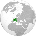
Frankish Empire (orthographic projection).svg 551 × 550; 735 KB
-
Frankish Empire 481 to 814-en.svg 1,591 × 1,205; 834 KB
-
Frankish Empire 481 to 814-id.svg 1,735 × 1,227; 332 KB
-
Frankish Empire 481 to 814-pl.svg 1,735 × 1,227; 314 KB
-
Frankish Empire 481 to 814-tr.svg 1,735 × 1,227; 329 KB
-
Frankish empire 768 - 814 and bavaria.png 1,735 × 1,343; 580 KB
-
Frankų imperija (Žemėlapis).png 1,591 × 1,205; 273 KB
-
Islam e imperio islámico.jpg 1,554 × 1,171; 644 KB
-
Kaarle Suuren valtakunta.png 917 × 861; 55 KB
-
Karte Alpenüberquerung Langobardenfeldzug.png 2,121 × 1,193; 1.64 MB
-
Map Iberian Peninsula 750-en a.svg 827 × 574; 181 KB
-
Map Iberian Peninsula 750-en.svg 827 × 574; 91 KB
-
Map Iberian Peninsula 750-hu.svg 827 × 574; 88 KB
-
Panonia.png 800 × 608; 160 KB
-
Péninsule ibérique en 814.png 2,000 × 1,500; 867 KB
-
Région de Maestricht.svg 1,238 × 750; 50 KB
-
Talbienrlpsaxo.jpg 804 × 566; 99 KB
-
Teilung Lotharingiens.png 499 × 505; 241 KB
-
Transalbien.gif 600 × 592; 23 KB
-
Transalbien.jpg 600 × 592; 46 KB
-
Transalbiensaxo.gif 600 × 592; 12 KB
-
Verdrag vo Verdun-als.png 660 × 500; 76 KB
-
Vertrag von Meerssen-es.svg 890 × 890; 1.15 MB
-
Vertrag von Meerssen.svg 890 × 890; 829 KB
-
Vertrag von Prüm-es.svg 890 × 890; 1.01 MB
-
Vertrag von Verdun und Ribemont.svg 890 × 890; 696 KB
-
World in 800.png 1,357 × 617; 37 KB
-
Historical atlas of modern Europe 1903 (135895425).jpg 9,053 × 6,961; 59.55 MB
