Category:Maps of the Göktürks
Jump to navigation
Jump to search
Media in category "Maps of the Göktürks"
The following 24 files are in this category, out of 24 total.
-
Asia 600ad.jpg 2,045 × 1,221; 811 KB
-
Asia 700ad (North central asia).jpg 715 × 398; 45 KB
-
Asia 700ad.jpg 1,953 × 1,166; 361 KB
-
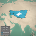
Batı Göktürk.png 1,080 × 1,080; 1.39 MB
-
Das zweite Reich der Göktürken (681-745).PNG 593 × 218; 10 KB
-
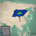
Doğu Göktürk.png 1,080 × 1,080; 1.33 MB
-
Empire of the Gökturks.png 752 × 591; 39 KB
-
Empire of the Kökturks.png 1,745 × 1,088; 2.56 MB
-
First Turk Khaganate(600).PNG 752 × 590; 31 KB
-
Gokturk empire at its greatest extent.png 731 × 433; 505 KB
-
Gokturk empire.png 4,500 × 2,234; 150 KB
-
Gokturk orthographic projection.png 2,048 × 2,048; 604 KB
-
Gokturk2 map.png 754 × 361; 515 KB
-
Gokturkut.jpg 752 × 590; 49 KB
-
Gokturkut.png 754 × 361; 558 KB
-
GökturksAD551-572.png 1,644 × 959; 28 KB
-
Göktürk - Turkıc Khaganate Map.png 1,080 × 1,080; 1.32 MB
-
GökTürk Empire.jpg 2,658 × 1,294; 1,009 KB
-
Göktürk Kağanlığı.png 1,080 × 1,080; 1.36 MB
-
GökTürk Khanate 600.png 830 × 830; 233 KB
-
Map of the First Turkic Kaghanate.png 3,197 × 1,842; 13.11 MB
-
Reich der Göktürken (552-581).png 751 × 591; 37 KB
-
Seyanto Hanlığı - Xueyantuo.png 1,080 × 1,080; 1.32 MB
-
Tujue Khanate.png 1,002 × 600; 425 KB


