Category:Gökturks
Jump to navigation
Jump to search
English: The Göktürks Khaganate, or Kök Türks (Celestial or Blue Turks) — a nomadic confederation of Turkic peoples in medieval Central Asia (552–747).
- The Göktürks succeeded the Rouran Khaganate as the main power in the region, and gained hold of the lucrative Silk Road trade.
中文(繁體):突厥。
Turkic people organized as a state in medieval Inner Asia   | |||||
| Upload media | |||||
| Instance of | |||||
|---|---|---|---|---|---|
| Inception |
| ||||
| Dissolved, abolished or demolished date |
| ||||
| Replaced by | |||||
| Different from | |||||
| |||||
 | |||||


Subcategories
This category has the following 9 subcategories, out of 9 total.
B
- Balbal (52 F)
- Bumin Qaghan (2 F)
E
- Eastern Turkic Khaganate (10 F)
G
- Göktürk flag (12 F)
M
- Maps of the Göktürks (24 F)
O
S
T
- Türgesh Khaganate (9 F)
W
Media in category "Gökturks"
The following 35 files are in this category, out of 35 total.
-
 5bdbb4c1ca0a504c07114f5feff8cbd9-1.jpg 640 × 960; 88 KB
-
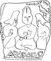 AltynTamganinscription.jpg 850 × 1,000; 213 KB
-
 Ashina tamga.png 64 × 53; 3 KB
-
 Ashina Tribe Tamga.svg 512 × 256; 1 KB
-
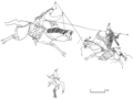
-
 Bf42006a4061db0f19a890a4e58d670b-1.jpg 1,045 × 1,299; 240 KB
-
 Bugut1.jpg 900 × 1,200; 538 KB
-
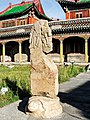 Bugut2.jpg 900 × 1,200; 368 KB
-
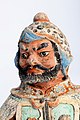
-
 Eastern Turkic Khaganate Flag of Map (Year-626).png 2,340 × 919; 244 KB
-
 Gokturk alfabesi1.png 495 × 359; 17 KB
-
 Gokturk cav.jpg 868 × 518; 152 KB
-
 Gokturk(Köktürk) Gray Wolf Symbol White.png 1,024 × 643; 32 KB
-
 Gokturk.jpg 1,329 × 996; 241 KB
-
 GokturkWarrior.jpg 1,079 × 720; 65 KB
-
 Gökturk Khaganate Modern Map.png 2,064 × 1,080; 243 KB
-
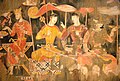 Göktürk Giysili Beyler, Pancikent (Panjakent)-Tacikistan.jpg 1,600 × 1,077; 323 KB
-
 Kultegin portrait.png 551 × 701; 521 KB
-
 Kultigin.png 893 × 570; 1,020 KB
-
 Map of the First Turkic Khaganate in Eurasia circa 576 CE.png 4,928 × 2,500; 26.86 MB
-
 Maya Cave 224, mourners of the Buddha.jpg 1,342 × 1,881; 1.5 MB
-
 Maya Cave 224, Turk man mourning the Budhha.jpg 1,316 × 788; 714 KB
-
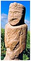 Niri Qaghan.jpg 514 × 1,000; 183 KB
-
 Ongi1.jpg 1,000 × 471; 162 KB
-
 Ongi2.jpg 486 × 1,000; 191 KB
-
 SealOfEmpressAshina.png 346 × 340; 56 KB
-
 Second Turkic Khaganate Flag of Map (Year-720).png 2,340 × 919; 187 KB
-
 Shoroon Bumbagar tomb mural, 7th century CE, Mongolia.jpg 1,108 × 734; 513 KB
-
 Tujue1.jpg 1,273 × 895; 239 KB
-
 Tujue2.jpg 1,000 × 1,138; 549 KB
-
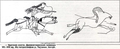 Turkic hunting scene, Gokturk period Altai.png 997 × 411; 539 KB
-
 Tyurki.jpg 700 × 524; 125 KB
-
 Warrior statue unearthed from a kurgan of the Göktürk period.jpg 640 × 960; 88 KB
-
 Western Turkic Khaganate Flag of Map (Year-630).png 2,340 × 919; 153 KB
-
 ZaamarTomb.jpg 1,801 × 1,351; 1.59 MB


.png)


.png)


_Gray_Wolf_Symbol_White.png)


-Tacikistan.jpg)


.png)


.png)
