Category:Maps of the North Palatine Uplands
Jump to navigation
Jump to search
Media in category "Maps of the North Palatine Uplands"
The following 10 files are in this category, out of 10 total.
-
 Einzugsgebietskarte Nahe.png 2,909 × 2,772; 12.73 MB
-
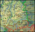
 Naturraumkarte Nordpfaelzer Bergland.png 2,272 × 1,810; 6.27 MB
-
 Naturraumkarte Donnersbergmassiv und Kaiserstrassensenke.png 1,035 × 946; 1.37 MB
-
 Naturraumkarte Glan-Alsenz-Hoehen.png 1,035 × 842; 1.3 MB
-
 Naturraumkarte Kirner Nahewinkel und Sobernheimer Talweitung.png 1,035 × 689; 1.01 MB
-

-
 Naturraumkarte Kuseler Bergland, Osterhoehen und Hoecherberg.png 1,035 × 1,018; 1.51 MB
-
 Naturraumkarte Lauterhoehen.png 1,035 × 770; 1.15 MB
-
 Naturraumkarte Porphyrbergland von Muenster am Stein und Wiesener Randhoehen.png 1,035 × 792; 1.14 MB
-
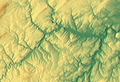 Sobernheimer Talweitung (Relief).png 1,132 × 776; 1.12 MB


.png)