Category:Maps of Saarland
Jump to navigation
Jump to search
Federal states of Germany:
Wikimedia category | |||||
| Upload media | |||||
| Instance of | |||||
|---|---|---|---|---|---|
| Category combines topics | |||||
| Saarland | |||||
state of the Federal Republic of Germany     | |||||
| Instance of | |||||
| Named after | |||||
| Location |
| ||||
| Capital | |||||
| Legislative body | |||||
| Highest judicial authority |
| ||||
| Head of government |
| ||||
| Legal form | |||||
| Inception |
| ||||
| Highest point | |||||
| Population |
| ||||
| Area |
| ||||
| Replaces | |||||
| Different from | |||||
| official website | |||||
 | |||||
Subcategories
This category has the following 27 subcategories, out of 27 total.
!
'
*
G
- Geological maps of Saarland (2 F)
L
- Location maps of Saarland (6 F)
M
- Maps of Göttelborn (5 F)
- Maps of Homburg (Saar) (9 F)
- Maps of Saarlouis (11 F)
- Maps of the history of Saarland (15 F)
N
O
S
T
- Topographic maps of Saarland (5 F)
Media in category "Maps of Saarland"
The following 34 files are in this category, out of 34 total.
-
 2018-06-08 Saarland karte (V1.9).png 1,089 × 835; 927 KB
-
 2018-06-28 Saarland karte (V1.10).png 1,634 × 1,253; 1.38 MB
-
 2018-06-28 Saarland karte (V1.11).png 1,634 × 1,253; 1.38 MB
-
 Fuerstentum Birkenfeld.jpg 942 × 802; 256 KB
-
 Goe rom karte 2.gif 986 × 709; 20 KB
-
 Hofgut Landschaftspark Imsbach Karte 2.jpg 960 × 720; 135 KB
-
 Karte des Saarlandes.png 1,089 × 835; 414 KB
-
 Lagekarte Neipel.jpg 753 × 591; 548 KB
-
 Lagekarte Tholey Geoportal.jpg 718 × 556; 451 KB
-
 Lv saarland.gif 261 × 208; 2 KB
-
 Map of Schwenken Prevalence in Germany.svg 1,073 × 1,272; 6.59 MB
-
 Naturraumkarte St Ingbert-Kaiserslauterer Senke (Mittelteil).png 1,035 × 751; 1.08 MB
-
 Naturraumkarte St Ingbert-Kaiserslauterer Senke (Ostteil).png 1,035 × 690; 995 KB
-
 Naturraumkarte St Ingbert-Kaiserslauterer Senke (Westteil).png 1,035 × 814; 1.12 MB
-
 Naturraumkarte St Ingbert-Kaiserslauterer Senke.png 2,141 × 1,481; 4.62 MB
-
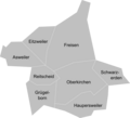 Ortsteile von Freisen.png 786 × 712; 61 KB
-
 S L.png 220 × 185; 6 KB
-
 Saar (PSF).png 1,692 × 1,322; 341 KB
-
 Stadtbezirke der Stadt Saarbrücken.png 1,167 × 1,168; 37 KB
-
 Saarland Anim.gif 300 × 200; 24 KB
-
 Saarland hom.png 221 × 175; 7 KB
-
 Saarland mzg.png 221 × 175; 7 KB
-
 Saarland nk.png 221 × 175; 18 KB
-
 Saarland sb.png 221 × 175; 7 KB
-
 Saarland sls.png 221 × 175; 7 KB
-
 Saarland wnd.png 221 × 175; 7 KB
-
 Saarland2020.png 269 × 213; 9 KB
-
 Schaumberg Relief mit Gemarkungen.pdf 1,752 × 1,239; 366 KB
-
 Sickinger Stufe - Karte des Naturraums.jpg 684 × 442; 180 KB
-
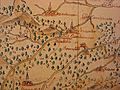
 The SAAR Extension under French Occupation - DPLA - c26cddddf2deccebe9f290110c06ff8b.jpg 5,231 × 3,950; 2.19 MB
-
 Verkehrsachsen der Stadt Wadern.JPG 2,238 × 3,091; 236 KB
-
 Wiki-Stammtisch Saarland.jpg 960 × 720; 45 KB
-
 Zuesch-Nonnweiler-manipulated.jpeg 900 × 675; 343 KB
-
 Zuesch-Nonnweiler.jpeg 900 × 675; 146 KB
.png)
.png)
.png)


.png)
.png)
.png)


.png)


