Category:Maps of South Africa
Jump to navigation
Jump to search
Countries of Africa: Algeria · Angola · Benin · Botswana · Burkina Faso · Burundi · Cameroon · Cape Verde · Central African Republic · Chad · Comoros · Democratic Republic of the Congo · Republic of the Congo · Djibouti · Egypt‡ · Equatorial Guinea · Eritrea · Eswatini · Ethiopia · Gabon · The Gambia · Ghana · Guinea · Guinea-Bissau · Ivory Coast · Kenya · Lesotho · Liberia · Libya · Madagascar · Malawi · Mali · Mauritania · Mauritius · Morocco · Mozambique · Namibia · Niger · Nigeria · Rwanda · São Tomé and Príncipe · Senegal · Seychelles · Sierra Leone · Somalia · South Africa · South Sudan · Sudan · Tanzania · Togo · Tunisia · Uganda · Zambia · Zimbabwe
Limited recognition: Ambazonia · Azawad · Puntland · Sahrawi Arab Democratic Republic · Somaliland – Other areas: Canary Islands · Ceuta · Madeira · Mayotte · Melilla · Réunion · Saint Helena, Ascension and Tristan da Cunha · Scattered Islands in the Indian Ocean · Western Sahara
‡: partly located in Africa
Español: Mapas de Sudáfrica
Wikimedia category | |||||
| Upload media | |||||
| Instance of | |||||
|---|---|---|---|---|---|
| Category combines topics | |||||
 | |||||
Use the appropriate category for maps showing all or a large part of South Africa. See subcategories for smaller areas:
| If the map shows | Category to use |
|---|---|
| South Africa on a recently created map | Category:Maps of South Africa or its subcategories |
| South Africa on a map created more than 70 years ago | Category:Old maps of South Africa or its subcategories |
| the history of South Africa on a recently created map | Category:Maps of the history of South Africa or its subcategories |
| the history of South Africa on a map created more than 70 years ago | Category:Old maps of the history of South Africa or its subcategories |
Subcategories
This category has the following 44 subcategories, out of 44 total.
+
A
B
- Blank maps of South Africa (29 F)
C
D
- Maps of dams in South Africa (10 F)
E
F
G
H
K
- Maps of the Kalahari (9 F)
L
M
- Maps of the Drakensberg (11 F)
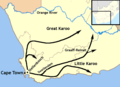
- Maps of the Karoo (28 F)
O
P
R
S
T
V
- Vegetation maps of South Africa (30 F)
W
- Maps of the Witwatersrand (18 F)
Pages in category "Maps of South Africa"
The following 2 pages are in this category, out of 2 total.
Media in category "Maps of South Africa"
The following 125 files are in this category, out of 125 total.
-
 20220121 DM Overview2021 repatriation v2.pdf 1,754 × 1,239; 757 KB
-

-
 Agulhas Bank NOAA ETOPO1.jpg 703 × 417; 91 KB
-
 Agulhas Bank NOAA.jpg 1,010 × 682; 88 KB
-
 Base Map of Southern Africa.png 1,344 × 871; 381 KB
-
 Battle of Salt River.svg 1,552 × 1,230; 978 KB
-
 Bushveld Igneous Complex.png 2,792 × 1,748; 373 KB
-
 Cape contours1.svg 1,051 × 411; 7.58 MB
-
 Cape Water map dams.png 1,300 × 1,299; 1.84 MB
-
 Chart of South Africa and Madagasca(GN01109).jpg 3,264 × 2,448; 1.43 MB
-
 COB data South Africa.PNG 1,357 × 628; 63 KB
-
 Cənubi afrika 1.jpg 780 × 676; 100 KB
-
 Dingana alaedeus, verspreiding.jpg 751 × 643; 56 KB
-
 Distribution of the Calotheca nigromaculata species group - Oo 639276.jpg 1,512 × 1,385; 511 KB
-
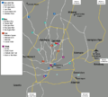
 Domestic Flights from johannesburg International Airport.svg 600 × 400; 146 KB
-
 ECDM 20160205 World SevereWeather.pdf 1,625 × 1,125; 560 KB
-
 ECDM 20181213 SW Indian Ocean TCs 2011-18.pdf 2,479 × 1,754; 1.24 MB
-
 Electrical Power Grid - South Africa.png 4,092 × 3,528; 1.63 MB
-
 Elgin valley location map - Western Cape South Africa.png 1,959 × 1,546; 4.61 MB
-
 Eskom NTCSA Transmission Line Infrastructure.svg 1,052 × 744; 1.78 MB
-
 Flag map of the Western Cape.svg 3,680 × 3,000; 46 KB
-
 FLII SouthAfrica.png 1,059 × 906; 281 KB
-
 German colonial claims in South Africa 1880s.jpg 2,000 × 1,000; 199 KB
-
 Heimkpalinurus.png 1,127 × 530; 317 KB
-
 HGG-reverses1-6.jpg 1,000 × 700; 140 KB
-
 Izifundazwe zna.jpg 974 × 758; 67 KB
-
 Jan Smuts early life map.png 386 × 274; 13 KB
-
 Kaart van konsentrasiekampe vir swart mense.jpg 946 × 1,282; 497 KB
-
 Kaart van konsentrasiekampe vir wit mense.jpg 915 × 1,251; 505 KB
-
 Kaart van Suid-Afrika met Afrikaanse byskrifte.svg 757 × 660; 352 KB
-
 Kakamas.jpg 7,819 × 6,299; 30.85 MB
-
 Kenilworth, Cape Town population map.png 2,387 × 1,144; 1.06 MB
-
 Kevin i.jpg 1,200 × 1,600; 796 KB
-

-
 Location of Rising Star Cave.png 2,106 × 1,013; 437 KB
-
 Locator map of Cape Colony 1885.svg 1,120 × 985; 231 KB
-
 Locator map of Griqualand East 1885.svg 1,120 × 985; 235 KB
-
 Locator map of Griqualand West 1885.svg 1,120 × 985; 237 KB
-
 Locator map of Pondoland 1885.svg 1,120 × 985; 236 KB
-
 Locator map of Thembuland 1885.svg 1,120 × 985; 229 KB
-
 Map of Cape Colony 1885.svg 1,120 × 985; 231 KB
-
-
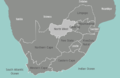
 Map of South Africa with English labels.svg 809 × 709; 540 KB
-
 Map of Southafrica.gif 266 × 268; 20 KB
-
 Map of Vredefort dome.jpg 10,000 × 8,319; 1.63 MB
-
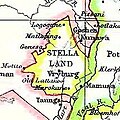 Map Stellaland cropped.jpg 218 × 218; 26 KB
-
 Map-South Africa-fifa-2010.png 800 × 444; 89 KB
-
 Map-South Africa-Johannesburg-fifa-2010.svg 744 × 1,052; 212 KB
-
 Map-South Africa-Johannesburg.svg 744 × 1,052; 187 KB
-
 Map-South Africa-Johannesburg01-Large.png 2,431 × 2,194; 639 KB
-
 Map-South Africa-Johannesburg01-Small.png 800 × 722; 211 KB
-
 Map-South Africa-North West01.png 927 × 600; 109 KB
-
 Map-South Africa-Northern Cape01.png 941 × 600; 109 KB
-
 Map-South Africa-Northern Cape02.png 1,024 × 786; 220 KB
-
 Map-South Africa-Pilgrims Rest.png 635 × 800; 135 KB
-
 Map-South Africa-Pilgrims Rest.svg 744 × 1,052; 119 KB
-
 Map-South Africa-Pretoria01.png 1,024 × 750; 417 KB
-
 Map-South Africa-Tshwane-Reitvlei01.png 1,029 × 863; 234 KB
-
 Map-South Africa-Tshwane-Reitvlei01.svg 744 × 1,052; 129 KB
-
 Map-South Africa-Ukhahlamba01.svg 744 × 1,052; 414 KB
-
 Map-South Africa.svg 744 × 1,052; 494 KB
-
 Map-South Africa01.png 800 × 573; 179 KB
-
 Map-Southern Africa.svg 744 × 1,052; 474 KB
-
 Map-Southern Africa01.png 800 × 605; 87 KB
-
 Map.South.Africa.Provincial.Teams.svg 1,000 × 786; 429 KB
-
 Mapa da África do Sul (OCHA).svg 254 × 254; 386 KB
-
 Mapa Mandela primeiros anos.png 1,200 × 840; 605 KB
-
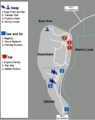
 MapGardenRoute.png 2,000 × 837; 362 KB
-
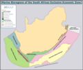 Marine Bioregions of the South African EEZ.png 7,879 × 6,693; 2.04 MB
-
 Marine species distribution reference map Southern Africa.png 3,600 × 2,507; 261 KB
-
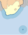 Maritime zones of South Africa.svg 681 × 843; 131 KB
-
 Maritime zones of the South African mainland.svg 1,053 × 746; 407 KB
-
 Milkwood City Location.jpg 904 × 844; 152 KB
-
 Motm 2010 07 Howiesons Poort.pdf 1,597 × 1,068; 6.6 MB
-
 National First Division.jpg 781 × 599; 39 KB
-
 Non-official language speakers density ZA.svg 995 × 768; 900 KB
-
 Non-official languages speakers proportion ZA.svg 995 × 768; 899 KB
-
 Nyanga SAPS precinct area 2022.png 1,789 × 896; 1.89 MB
-
 Political Map of South Africa drawn 1897 reprint 1899.jpg 650 × 565; 63 KB
-
 Proposed Map of Cape Republic.png 500 × 523; 104 KB
-
 Regions of South Africa 1.png 2,000 × 1,394; 771 KB
-
 SA super rugby franchises.svg 1,191 × 842; 44 KB
-
 SA WC 2010 Chi.PNG 436 × 313; 10 KB
-
 Salt River Battle Map.png 2,362 × 1,771; 1.36 MB
-
 SARepublicreferendum.svg 1,000 × 827; 61 KB
-
 SAstubmap.png 83 × 64; 801 bytes
-
 SEACOM South Africa Network Map.png 2,878 × 1,594; 1.39 MB
-
 Seismicity map South Africa.jpg 623 × 742; 105 KB
-
 Sekukuniland-South Africa.png 1,148 × 771; 622 KB
-
 ShakeMap Orkney 5 August 2014.jpg 587 × 729; 157 KB
-
 Shosholoza Meyl routes.svg 857 × 744; 38 KB
-

-
 Soewereine Staat van Goeie Hoop.jpg 2,000 × 1,753; 156 KB
-
 South Africa (1915-1990) (orthographic projection).svg 550 × 550; 678 KB
-
 South Africa - DPLA - 30cbf1d30df2fd7ef83dee793cdafa65.jpg 1,000 × 790; 360 KB
-
 South Africa - population migrations He.png 2,217 × 1,945; 281 KB
-
 South Africa - population migrations.svg 460 × 440; 73 KB
-
 South Africa 2001 non-official language speakers density map.svg 1,072 × 933; 478 KB
-
 South Africa 2001 non-official language speakers proportion map.svg 1,072 × 933; 139 KB
-
 South Africa Districts showing DMAs.png 1,145 × 828; 35 KB
-
 South Africa Districts showing GP.png 1,141 × 828; 31 KB
-
 South Africa Districts Template.png 1,141 × 828; 31 KB
-
 South Africa municipalities Cape Republic.png 671 × 622; 195 KB
-
 South africa sea.jpg 927 × 843; 455 KB
-
 South Africa South Coast Bathymetry.jpg 1,024 × 734; 69 KB
-
 South africa-2.jpg 1,000 × 748; 194 KB
-
 South Africa.webp 588 × 600; 44 KB
-
 SouthAfricaV11OMC.png 1,367 × 1,511; 129 KB
-
 Southern African Central Plateau.jpg 9,960 × 6,756; 2.92 MB
-
 Sovereign State of Good Hope.png 800 × 888; 136 KB
-
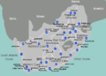
 Status of Wikidata hospitals in South Africa 16 April 2020.png 1,027 × 671; 1.98 MB
-
 Territorial waters - South Africa.svg 800 × 400; 694 KB
-
 The Groot Trek blank map.png 1,414 × 1,748; 292 KB
-
 Theewaterskloof dam and area it services.png 637 × 469; 143 KB
-
 Trekboer migration map.png 700 × 506; 85 KB
-
 Un-south-africa.png 3,037 × 2,257; 1.87 MB
-
 Cape Floral Region Protected Areas map.jpg 2,730 × 1,116; 561 KB
-
 Vals River watershed.jpg 1,482 × 984; 271 KB
-
 Verspreidingsgebied.jpg 1,024 × 724; 43 KB
-

-
 Volkstaat Map.jpg 2,900 × 2,620; 2.11 MB
-
 Volkstaat–VF.svg 1,000 × 765; 202 KB
-
 Map of Aloe Succotrina - Fynbos Aloe SA.jpg 434 × 336; 24 KB
-
 Witwatersrand outcrops 2.jpg 10,000 × 9,902; 2.62 MB
-
 Xəritə1.jpg 785 × 679; 101 KB
%27_(11161322574).jpg)


.jpg)


.png)


.svg)


_(orthographic_projection).svg)


