Category:Maps of the Riau Islands
Jump to navigation
Jump to search
| NO WIKIDATA ID FOUND! Search for Maps of the Riau Islands on Wikidata | |
| Upload media |

Subcategories
This category has the following 5 subcategories, out of 5 total.
Media in category "Maps of the Riau Islands"
The following 13 files are in this category, out of 13 total.
-
 AMH-5148-NA Map of the roadstead of Riouw.jpg 2,400 × 1,583; 452 KB
-
 Ca. 1948 Japanese nautical chart - East Coast Riouw Archipelago Durian Strait and Approaches.jpg 16,898 × 23,924; 45.11 MB
-
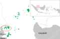
 ID - Lingga Islands.PNG 824 × 559; 28 KB
-
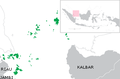
 ID - Riau.PNG 824 × 559; 27 KB
-
 IndonesiaRiauIslands.png 800 × 375; 97 KB
-
 Locator archriau.png 300 × 198; 24 KB
-
 Locator kepri final.png 300 × 198; 21 KB
-
 Locator Lingga Islands.png 300 × 198; 24 KB
-
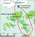 Map showing flight path of Qantas Flight 32 on 4 November 2010.png 252 × 271; 39 KB
-
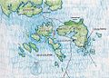 MapBintan-medium.jpg 1,000 × 720; 175 KB
-
 MapBintan-small.jpg 400 × 288; 54 KB
-
 Riau Islands Karimun.png 300 × 198; 19 KB
-
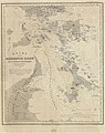 RiauIslands-versteeg-1860.jpg 600 × 755; 97 KB


