Category:Maps of the history of Jerusalem
Jump to navigation
Jump to search
| Category Maps of the history of Jerusalem on sister projects: | |||||||||
|---|---|---|---|---|---|---|---|---|---|
[[w:en:Category:Maps of the history of Jerusalem |
en:]] See more at interwikilinks (?) | ||||||||
Maps of the history of Jerusalem.
Subcategories
This category has the following 3 subcategories, out of 3 total.
J
M
O
Media in category "Maps of the history of Jerusalem"
The following 80 files are in this category, out of 80 total.
-
Jerusalem with its environs - draw and engraved by Thomas Starling - btv1b53119281d.jpg 7,064 × 9,429; 8.66 MB
-
1850s reconstruction of ancient Jerusalem.jpg 624 × 643; 446 KB
-
Jerusalem in the time of Christ (FL36567431 3909081).jpg 2,157 × 3,289; 3.26 MB
-
MACCOUN(1899) p093 JEBUS.jpg 1,979 × 3,480; 2.83 MB
-
MACCOUN(1899) p097 JERUSALEM - TIME OF DAVID AND SOLOMON.jpg 1,991 × 3,442; 2.93 MB
-
MACCOUN(1899) p125 JERUSALEM - TIME OF HEZEKIAH.jpg 1,986 × 3,554; 2.99 MB
-
MACCOUN(1899) p133 JERUSALEM - TIME OF NEHEMIAH.jpg 1,983 × 3,466; 3.01 MB
-
MACCOUN(1899) p179 JERUSALEM, TIME OF HEROD.jpg 1,978 × 3,550; 3.23 MB
-
MACCOUN(1899) p181 JERUSALEM, PLAN OF THE TEMPLE AREA.jpg 2,034 × 3,598; 2.28 MB
-
MACCOUN(1899) p191 JERUSALEM - TIME OF AGRIPPA.jpg 1,986 × 3,562; 3.25 MB
-
1961 Jordan Tourism Map of Jerusalem.jpg 692 × 890; 151 KB
-
AeliaCapitolina.png 700 × 634; 89 KB
-
AeliaCapitolina.svg 662 × 601; 46 KB
-
AeliaCapitolina22.jpg 697 × 900; 102 KB
-
AeliaCapitolina23.jpg 697 × 1,082; 123 KB
-
Ammunition Hill Museum Exhibits P1000934.JPG 4,000 × 2,387; 1.62 MB
-
Ammunition Hill Museum Exhibits P1000935.JPG 4,000 × 2,157; 1.71 MB
-
Ammunition Hill Museum Exhibits P1000936.JPG 4,000 × 1,754; 1.38 MB
-
Ammunition Hill Museum Exhibits P1000937.JPG 4,000 × 3,000; 4.63 MB
-
Ammunition Hill Museum Exhibits P1000938.JPG 4,000 × 3,000; 5.01 MB
-
Ammunition Hill Museum Exhibits P1010033.JPG 2,901 × 2,339; 1.33 MB
-
Ammunition Hill Museum Exhibits P1010034.JPG 4,000 × 3,000; 3.97 MB
-
Ammunition Hill Museum Exhibits P1010044.JPG 2,224 × 3,189; 1.04 MB
-
Assedio di Gerusalemme - fase 1.png 1,200 × 1,200; 241 KB
-
Assedio di Gerusalemme - fase 10.png 1,200 × 1,200; 298 KB
-
Assedio di Gerusalemme - fase 2.png 1,200 × 1,200; 252 KB
-
Assedio di Gerusalemme - fase 3.png 1,200 × 1,200; 259 KB
-
Assedio di Gerusalemme - fase 4.png 1,200 × 1,200; 257 KB
-
Assedio di Gerusalemme - fase 5.png 1,200 × 1,200; 263 KB
-
Assedio di Gerusalemme - fase 6.png 1,200 × 1,200; 283 KB
-
Assedio di Gerusalemme - fase 7.png 1,200 × 1,200; 287 KB
-
Assedio di Gerusalemme - fase 8.png 1,200 × 1,200; 313 KB
-
Assedio di Gerusalemme - fase 9.png 1,200 × 1,200; 301 KB
-
Atlas of ancient and classical geography (1909) (14595678750).jpg 3,488 × 2,023; 1.08 MB
-
C+B-Jerusalem-Map2-WallsAndContours.PNG 945 × 1,499; 194 KB
-
C+B-Jerusalem-Map2-WallsAndContours.svg 945 × 1,499; 395 KB
-
Charles Foster Kent, The Jerusalem of Nehemah (1899) (14596514630).jpg 2,008 × 2,620; 734 KB
-
EB1911 Jerusalem.jpg 1,734 × 2,440; 1.84 MB
-
Jerusalem at Jesus time EL.png 1,338 × 1,454; 238 KB
-
Jerusalem before Herod circa 37BC.svg 700 × 935; 32 KB
-
Jerusalem District Before 1948.png 322 × 598; 35 KB
-
Jerusalem Herod.jpg 262 × 247; 57 KB
-
Jerusalem in 70 - map.svg 740 × 1,020; 19 KB
-
Jerusalem Nehemiah.jpg 262 × 245; 54 KB
-
Jerusalem premier siècle.JPG 464 × 598; 86 KB
-
Jerusalem-1 Jht Lage Hiskija-Becken.jpg 535 × 686; 108 KB
-
Jerusalem-1 Jht.png 783 × 935; 111 KB
-
Jerusalem-1 Jht.svg 783 × 935; 297 KB
-
Jerusalem-ensimmäisellä-vuosisadalla.png 783 × 935; 127 KB
-
JerusalemAqueducte.png 996 × 1,033; 184 KB
-
JerusalemAqueducte.svg 933 × 968; 57 KB
-
Map of Jerusalem in 70 AD.jpg 1,506 × 2,133; 278 KB
-
Old Jerusalem Broad Wall map.jpg 4,000 × 3,000; 2.01 MB
-
Roman Jerusalem HEB.png 308 × 379; 9 KB
-
Roman Jerusalem.PNG 308 × 353; 3 KB
-
Roman Jerusalem.svg 308 × 353; 17 KB
-
Saint Clair 1887 Jerusalem in 1187.jpg 1,212 × 1,247; 255 KB
-
Third Wall P8170055.jpg 2,138 × 1,576; 852 KB
-
ירושלים 70 - הבקעת החומה השלישית.jpg 888 × 800; 127 KB
-
ירושלים 70 - הגיחה אל הלגיון ה-10.jpg 888 × 800; 130 KB
-
ירושלים 70 - הגיחה ממגדלי הנשים.jpg 888 × 800; 126 KB
-
ירושלים 70 - הדייק.jpg 1,126 × 868; 158 KB
-
ירושלים 70 - הסוללות במערב.jpg 888 × 800; 121 KB
-
ירושלים 70 - הריסת הסוללות השניות.jpg 888 × 800; 117 KB
-
ירושלים 70 - חמישיית הסוללות האחרונות.jpg 888 × 800; 120 KB
-
ירושלים 70 - מיטוט הסוללות באמצעות המנהרות.jpg 888 × 800; 118 KB
-
ירושלים 70 - פריצת החומה השנייה.jpg 888 × 800; 119 KB
-
ירושלים 70 - רביעיית הסוללות.jpg 888 × 800; 117 KB
-
ירושלים 70 - רביעיית סוללות נוספות באנטוניה.jpg 888 × 800; 118 KB
-
ירושלים 70 - שריפת בית המקדש.jpg 888 × 800; 120 KB
-
ירושלים 70 - תוכניתו של טיטוס.jpg 888 × 800; 154 KB
-
ירושלים 70, תרשים מפורט.jpg 2,231 × 2,027; 1.25 MB
-
ירושלים 70.svg 612 × 792; 1.67 MB
-
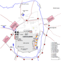
ירושלים בשנת 70.jpg 2,231 × 2,027; 473 KB
-
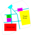
ירושלים שהוקמה בידי הקיסר הרומי אדריאנוס סביב שנת 117.jpg 492 × 540; 106 KB


