Category:Maps of the history of the Middle East
Bước tới điều hướng
Bước tới tìm kiếm
| Category Maps of the history of the Middle East on sister projects: | |||||||||
|---|---|---|---|---|---|---|---|---|---|
Maps of the history of the Middle East.
The overall wikimedia map index is Category:Maps

thể loại Wikimedia | |||||
| Tải lên phương tiện | |||||
| Là một | |||||
|---|---|---|---|---|---|
| |||||
Thể loại con
Thể loại này có 42 thể loại con sau, trên tổng số 42 thể loại con.
A
- Maps of the Ayyubid dynasty (24 F)
B
C
E
F
- Maps of the Fatimid Caliphate (36 F)
I
J
L
M
- Maps of the Eighth Crusade (3 F)
- Maps of the Fifth Crusade (4 F)
- Maps of the First Crusade (34 F)
- Maps of the Ninth Crusade (8 F)
- Maps of the Omani Empire (12 F)
- Maps of the Second Crusade (8 F)
- Maps of the Seventh Crusade (5 F)
- Maps of the Sixth Crusade (4 F)
- Maps of the Third Crusade (11 F)
O
- Ottoman Empire 1914 (2 F)
P
Q
R
- Maps of the Rashidun Caliphate (116 F)
S
T
- Maps of the Tulunid dynasty (14 F)
U
Tập tin trong thể loại “Maps of the history of the Middle East”
191 tập tin sau nằm trong thể loại này, trong tổng số 191 tập tin.
-
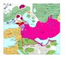
 Seljuk Empire locator map.svg 800×488; 161 kB
-
 Seljuq Empire1100-es.svg 2.758×1.689; 410 kB
-
 Seltsjoekentekst.png 1.236×689; 146 kB
-
 County of Edessa 1135 locator.svg 787×959; 135 kB
-
 Karta orienten 1190.jpg 1.642×942; 583 kB
-
 175bc.jpg 579×258; 139 kB
-

-

-
 2016-635963482038910180-891 main.jpg 498×319; 42 kB
-
 Achaemenid Empire 500 B.C.E.png 20.000×12.515; 11,74 MB
-
 Arab-Byzantine frontier zone-ar.svg 1.705×1.498; 3,5 MB
-
 Arab-Byzantine frontier zone-es.svg 1.483×1.435; 11,67 MB
-
 Arab-Byzantine frontier zone-pt.svg 1.705×1.498; 2,41 MB
-
 Arab-Byzantine frontier zone-zh.svg 512×450; 2,55 MB
-
 Arab-Byzantine frontier zone.svg 1.705×1.498; 3,23 MB
-
 Ararai 1.jpg 960×720; 44 kB
-
 Archeological sites - wine and oil (English).svg 2.466×1.208; 253 kB
-
 Asia 200bc.jpg 2.037×1.191; 763 kB
-
 Assur.png 875×800; 130 kB
-
 Ayyubid Sultanate 1193 AD.jpg 2.892×1.698; 925 kB
-
 Ayyubid.png 667×621; 37 kB
-
 Bahri Dynasty 1250 - 1382 (AD)-es.svg 838×519; 1,43 MB
-
 Bahri Dynasty 1250 - 1382 (AD).PNG 821×440; 36 kB
-
 Berekhat-Ram Map.png 212×308; 16 kB
-
 Bernat I de Vilamarí en Castellroig 01.jpg 1.181×1.118; 218 kB
-
 Bernat I de Vilamarí in Kastelorizo 01.jpg 1.062×1.006; 188 kB
-
 Bulgaria 800ad.jpg 972×541; 196 kB
-
 Califadofatimida-es.svg 1.405×621; 404 kB
-
 Califadofatimida-pt.svg 512×279; 10 kB
-
 Carte Qibya de.svg 330×715; 155 kB
-
 Carte Qibya-ar1.svg 330×715; 194 kB
-
 Carte Qibya-fa.svg 330×715; 61 kB
-
 Carte Qibya.svg 330×715; 61 kB
-
 CentalAsia 200bc.jpg 1.052×622; 208 kB
-
 CentralAsia 001ad.jpg 1.013×530; 180 kB
-
 CentralAsia 100bc.jpg 989×568; 178 kB
-
 CentralAsia 200ad.jpg 984×604; 213 kB
-
 CentralAsia 400ad.jpg 984×538; 176 kB
-
 Chobanids.svg 553×553; 270 kB
-
 CiliciaPrincipadoDeAntioquíaYCondadoDeTrípoli.svg 955×1.315; 180 kB
-
 Cimmerian Migrations.jpg 1.554×948; 2,08 MB
-
 Companyia catalan d'orient 1303-1304-pt.svg 3.001×2.062; 245 kB
-
 Companyia catalan d'orient 1303-1304.svg 3.001×2.062; 245 kB
-
 County of Edessa 1135 locator-es.svg 787×959; 130 kB
-
 County of Edessa 1135-es.svg 766×587; 187 kB
-
 County of Edessa 1135.jpg 817×626; 69 kB
-
 Crusade states in levant.PNG 291×504; 14 kB
-
 Das Reich Timur-i Lenks (1365-1405).GIF 752×593; 18 kB
-
 Dernteng, Hulwan or Bajalan territory centered by Derne or Darneg.jpg 7.374×5.629; 14,13 MB
-
 Contea di Edessa 1135.png 787×959; 200 kB
-
 ERE SPE in 570AD.jpg 1.763×943; 708 kB
-
 Etats latins d'Orient XIIe s.JPG 558×669; 310 kB
-
 FallsSkMap41toAleppo.jpeg 1.392×2.192; 702 kB
-
 Fatimid Islamic Caliphate He.png 1.000×550; 115 kB
-
 Fatimid Islamic Caliphate-ar.png 994×544; 141 kB
-
 Hittite Empire he.png 500×529; 79 kB
-
 Hittite Empire.png 500×529; 219 kB
-
 Intedab Map.jpg 2.016×1.480; 452 kB
-
 Jalairid Sultanate.svg 553×553; 270 kB
-
 Karte Mittani.png 896×595; 656 kB
-
 Kavad's campaigns-pt.svg 512×329; 58 kB
-
 Keresztény államok a Közel-Keleten.jpg 4.824×2.923; 1,25 MB
-
 Khosraw I's campaigns-es.svg 3.108×2.000; 828 kB
-
 Khosraw I's campaigns-pt.svg 512×329; 61 kB
-
 Khosraw II's and Heraclius' campaigns-es.svg 3.108×2.000; 814 kB
-
 Khosraw II's and Heraclius' campaigns-pt.svg 512×329; 64 kB
-
 Lawrence of Arabia Middle East proposal.svg 800×900; 109 kB
-
 Levantine Ajnad.png 1.389×2.340; 783 kB
-
 LocationFederationofArabEmirates.png 250×115; 6 kB
-
 Map Crusader states 1102-es.svg 591×690; 359 kB
-
 Map Crusader states 1102-fr.svg 591×690; 118 kB
-
 Map Crusader states 1102-hu.svg 591×690; 73 kB
-
 Map Crusader states 1102-it.svg 591×690; 716 kB
-
 Map Crusader states 1102-pt.svg 591×690; 42 kB
-
 Map Crusader states 1135-ar.png 649×882; 174 kB
-
 Map Crusader states 1135-de2.svg 690×738; 563 kB
-
 Map Crusader states 1135-el.svg 978×1.330; 490 kB
-
 Map Crusader states 1135-en.svg 955×1.315; 418 kB
-
 Map Crusader states 1135-eo.svg 978×1.330; 478 kB
-
 Map Crusader states 1135-es.svg 955×1.315; 428 kB
-
 Map Crusader states 1135-es2.svg 974×1.323; 293 kB
-
 Map Crusader states 1135-fr.svg 978×1.330; 582 kB
-
 Map Crusader states 1135-fr2.svg 744×921; 888 kB
-
 Map Crusader states 1135-hu.svg 955×1.315; 239 kB
-
 Map Crusader states 1135-it.png 978×1.330; 299 kB
-
 Map Crusader states 1135-jp.png 955×1.315; 301 kB
-
 Map Crusader states 1135-mk.svg 955×1.315; 394 kB
-
 Map Crusader states 1135-nl.svg 978×1.330; 654 kB
-
 Map Crusader states 1135-pl.png 1.631×2.217; 632 kB
-
 Map Crusader states 1135-pl.svg 978×1.330; 570 kB
-
 Map Crusader states 1135-pt.svg 974×1.323; 119 kB
-
 Map Crusader states 1148-fa.svg 978×1.330; 385 kB
-
 Map Crusader states 1165-en.svg 955×1.315; 362 kB
-
 Map Crusader states 1165-es.svg 955×1.315; 662 kB
-
 Map Crusader states 1165-fa.svg 955×1.315; 308 kB
-
 Map Crusader states 1165-it.svg 955×1.315; 129 kB
-
 Map Crusader states 1165-pt.svg 955×1.315; 117 kB
-
 Map Crusader states 1190-ar.svg 978×1.330; 444 kB
-
 Map Crusader states 1190-arz.png 441×600; 68 kB
-
 Map Crusader states 1190-en.svg 978×1.330; 470 kB
-
 Map Crusader states 1190-es.svg 978×1.330; 185 kB
-
 Map Crusader states 1190-fa.svg 978×1.330; 323 kB
-
 Map Crusader states 1190-he.svg 978×1.330; 356 kB
-
 Map Crusader states 1190-it.png 978×1.330; 298 kB
-
 Map Crusader states 1190-it.svg 978×1.330; 591 kB
-
 Map Crusader states 1190-ka.png 978×1.330; 315 kB
-
 Map Crusader states 1190-pt.svg 978×1.330; 91 kB
-
 Map Crusader states 1190-ua.jpg 351×477; 159 kB
-
 Map Crusader states 1197-en.svg 507×690; 76 kB
-
 Map Crusader states 1197-es.svg 507×690; 114 kB
-
 Map Crusader states 1197-fr.svg 507×690; 596 kB
-
 Map Crusader states 1197-it.svg 507×690; 77 kB
-
 Map Crusader states 1197-ka.png 502×683; 104 kB
-
 Map Crusader states 1240-de.svg 507×690; 162 kB
-
 Map Crusader states 1240-eng.png 600×823; 110 kB
-
 Map Crusader states 1240-es.svg 507×690; 385 kB
-
 Map Crusader states 1240-fa.png 600×823; 117 kB
-
 Map Crusader states 1240-fr.svg 507×690; 636 kB
-
 Map Crusader states 1240-it.svg 507×690; 699 kB
-
 Map Crusader states 1240-pt.svg 507×690; 38 kB
-
 Map of Persian Military-pt.svg 512×329; 290 kB
-
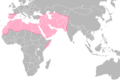
 Map of the MENA region in 1798.svg 1.543×1.006; 528 kB
-
 Mediterranean1400.png 1.215×549; 187 kB
-
 Middle East Cultural Historical Zones.svg 800×608; 299 kB
-
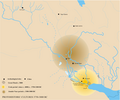
 Middle east map 1250.png 1.268×1.080; 364 kB
-
 Mohammad adil-Rashidun-empire-at-its-peak-close.PNG 1.196×580; 58 kB
-
 Mongol raids in Syria and Palestine 1260-ru.svg 657×901; 177 kB
-
 Moyen-Orient en 0.pdf 1.752×1.239; 511 kB
-
 Moyen-Orient en 100.pdf 1.752×1.239; 515 kB
-
 Moyen-Orient en 200.pdf 1.752×1.239; 518 kB
-
 Moyen-Orient en 300.pdf 1.752×1.239; 478 kB
-
 Moyen-Orient en 400.pdf 1.752×1.239; 477 kB
-
 Moyen-Orient en 500.pdf 1.752×1.239; 442 kB
-
 Moyen-Orient en 550.pdf 1.752×1.239; 454 kB
-
 Moyen-Orient en 600.pdf 1.752×1.239; 457 kB
-
 Moyen-Orient en 650.pdf 1.752×1.239; 470 kB
-
 Moyen-Orient en 700.pdf 1.752×1.239; 427 kB
-
 Moyen-Orient en 750.pdf 1.752×1.239; 430 kB
-
 Mtravel2.JPG 614×460; 46 kB
-
 Muslim Conquest-2.JPG 528×330; 22 kB
-
 Muslim Conquest-ar.png 1.006×893; 247 kB
-
 Muslim Conquest-es.svg 1.479×1.513; 1,85 MB
-
 Muslim Conquest.PNG 1.006×893; 227 kB
-
 Naher Osten historisch - Osmanisches Reich 1830-1923.gif 1.104×834; 128 kB
-
 Ninus.png 877×586; 22 kB
-
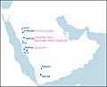
 Omaniempire1856.png 642×899; 222 kB
-
 Omaniempire1856cs.png 642×899; 150 kB
-
 Orient Mejan (vèrs 540 avC).png 1.014×558; 100 kB
-
 Orient Mejan (vèrs 600 avC).png 935×516; 95 kB
-
 Orient Pròche en 632 (a la mòrt de Maomet).png 748×446; 58 kB
-
 Oriente medio 1919-1925.jpg 596×759; 140 kB
-
 Piris Reis expedition map-fr.svg 533×356; 75 kB
-
 Praying Mantis operation map-fr.svg 755×598; 1,04 MB
-
 Principality of Antioch locator.svg 822×1.013; 140 kB
-
 Qara Qoyunlu (greatest extent).svg 553×553; 270 kB
-
 Qara Qoyunlu Turcomans 1407–1468.png 620×428; 20 kB
-
 Qarmatian Republic.png 876×765; 938 kB
-
 Rashidun Caliphate.svg 940×477; 377 kB
-
 Regions of the Lands of Islam by al-Muqaddasi.jpg 8.925×3.500; 9,44 MB
-
 Regions of the Lands of Islam by al-Muqaddasi.svg 8.925×3.500; 9,33 MB
-
 REmpire-29 Lycia.png 400×296; 28 kB
-
 Scythes et Parthes 100 av JC.png 1.494×856; 2,08 MB
-
 Scythia-Parthia 100 BC-es.svg 865×522; 2,16 MB
-
 Scythia-Parthia 100 BC-pt.svg 865×522; 2,11 MB
-
 Scythia-Parthia 100 BC.png 550×350; 303 kB
-
 Scythian Kingdom in West Asia.jpg 1.554×948; 2,02 MB
-
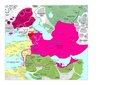
 Seljuk Empire locator map-es.svg 1.024×627; 725 kB
-
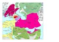
 Seljuk Empire locator map-pt.svg 1.024×627; 161 kB
-
 Seljuq Empire1100. he.svg 642×396; 254 kB
-
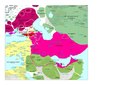
 Seljuq Empire1100.svg 642×396; 253 kB
-
 Syria in the 9th century-ar.svg 422×516; 1,5 MB
-
 Syria in the 9th century-ar2.png 449×548; 380 kB
-
 Syria in the 9th century-es.svg 806×964; 1,04 MB
-
 Syria in the 9th century-pt.svg 450×550; 613 kB
-
 Syria in the 9th century.svg 431×521; 1,81 MB
-
 The Crusader States in 1135-gl.svg 966×1.322; 220 kB
-
 TheSalarides.jpg 242×168; 7 kB
-
 Treaty of Sèvres Middle East fr.png 585×600; 457 kB
-
 TribusMusulmanesEtJuives Yathrib.jpg 741×606; 67 kB
-
 TurcomanosKaraKoyunlu1407-1468.svg 1.801×1.373; 2,1 MB
-
 Umayyad-Empire.png 680×451; 24 kB
-
 UNGA 181 Map.png 1.357×628; 20 kB
-
 Uruk-jemdetnasr.png 1.201×1.000; 238 kB
-
 Zengid Dynasty 1127 - 1250 (AD).PNG 821×440; 35 kB
-
 Zengid dynasty, 1127 - 1183-ar.png 821×439; 58 kB
-
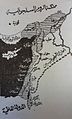 الإمارات الصليبية وما جاورها.jpg 827×1.371; 277 kB
-
 الدولة الزنكية.jpg 624×416; 98 kB
-
 السلطنة الأيوبية.jpg 589×427; 87 kB
-
 حدود تقریبی امارت درتنگ یا باجلان به مرکزیت درنه در اوج گسترش آن در قرن 16 میلادی.jpg 7.374×5.629; 14,33 MB
-
 حروب الردة.svg 970×676; 2,52 MB
-
 خريطة رومانية.jpg 473×373; 99 kB


.svg)


-es.svg)
.PNG)


.GIF)


.png)
.png)
.png)


.svg)


.PNG)


