Category:Maps of the world
Jump to navigation
Jump to search

Maps in this category and its subcategories should show the entire world. For maps showing only a part of the world, please use another subcategory of Category:Maps or Category:Maps by region. Note that Category:Maps by theme has many maps of the world in its subcategories that need to be moved to Category:Maps of the world by theme. Many maps below need to be subcategorized. Feel free to create more subcategories. See Commons:How to create new subcategories.
a single map of the entire surface of the Earth   | |||||
| Upload media | |||||
| Instance of | |||||
|---|---|---|---|---|---|
| Subclass of | |||||
| Depicts | Earth's surface | ||||
| Different from | |||||
| |||||
Subcategories
This category has the following 39 subcategories, out of 39 total.
*
+
A
B
C
- Choropleth maps of the world (72 F)
D
E
F
G
- GIF maps of the world (38 F)
M
O
- OpenStreetMap maps of the world (38 F)
P
R
S
- Satellite maps of the world (52 F)
T
W
- World Flag (7 F)
- World maps of visited countries (empty)
Pages in category "Maps of the world"
The following 3 pages are in this category, out of 3 total.
Media in category "Maps of the world"
The following 200 files are in this category, out of 1,655 total.
(previous page) (next page)-
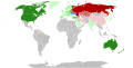
 1963 GANEFO countries.png 1,357 × 628; 59 KB
-
 1966 GANEFO countries.png 1,357 × 628; 57 KB
-
 20230519193449!A large blank world map with oceans marked in blue (1).png 4,150 × 2,134; 285 KB
-
 2036 Apophis Path of Risk.jpg 992 × 527; 248 KB
-
 21 Oct 2021 Malaysia B.png 4,058 × 2,018; 1.09 MB
-

-
 31 pays RS.png 962 × 522; 213 KB
-
 3GPP Long Term Evolution Country Map v2.svg 512 × 260; 1.04 MB
-
 4DXLocationMap.png 749 × 434; 52 KB
-
 A Culture of Copyright - A. Wallace (page 36 crop - fig 5).jpg 3,008 × 1,596; 494 KB
-
 A summary of international service from ZHHH.png 1,280 × 650; 116 KB
-
 A-World-of-Paintings.png 2,635 × 1,139; 894 KB
-
 Abshir Omar Huruse international discussion map.png 7,192 × 3,318; 1.94 MB
-
 Academy Award for Best Foreign Language Film.svg 2,560 × 1,314; 1.59 MB
-
 Acesso à água no mundo.svg 1,405 × 601; 359 KB
-
 Adventure Galley journey map.png 972 × 456; 25 KB
-
 Africa-EurasiaLocation.svg 463 × 236; 248 KB
-
 Alone charts map.png 4,500 × 2,234; 273 KB
-
 AMBA-accredited business schools worldwide.png 1,277 × 902; 361 KB
-
 Amsa chapters map.png 750 × 580; 138 KB
-
 Amsalem world map2.jpg 517 × 240; 40 KB
-
 Animal rights at the UN.png 1,400 × 625; 33 KB
-
-
 Association of the temperature niche minimum with drier climates.webp 2,168 × 1,829; 187 KB
-
 AsteelflashGlobalLocations.png 1,574 × 782; 213 KB
-
 Astronaut Nationalities.png 863 × 443; 103 KB
-
 AtlasIntl-Banner.jpg 676 × 367; 139 KB
-
 AtlasIntl-Feature.jpg 502 × 300; 105 KB
-
 Australia's GNI per capita in 2015.png 6,300 × 3,095; 752 KB
-
 Axis of resistance map.png 2,000 × 856; 201 KB
-
 AZTARNATEGI GUZTIAK.jpg 1,446 × 1,083; 356 KB
-
 Años de gobierno.png 6,300 × 3,545; 1.88 MB
-
 Bans on Nazi and Communist symbols.svg 2,560 × 1,314; 1.8 MB
-
 Bass és Messner féle 7 summits.jpg 800 × 400; 86 KB
-
 Basshunter live performances and countries visited without performing in 2023.png 4,500 × 2,592; 285 KB
-
 Basshunter live performances and countries visited without performing in 2024.png 4,500 × 2,592; 281 KB
-
 Basshunter live performances in 2023.png 4,500 × 2,592; 284 KB
-
 Basshunter live performances in 2024.png 4,500 × 2,592; 281 KB
-
 Basshunter live performances.png 4,500 × 2,592; 288 KB
-
 Bear Grylls Survivor world map ver2.png 800 × 351; 73 KB
-
 Belt and Road Initiative participant states.svg 512 × 260; 787 KB
-
 Bergen-flesland.png 1,357 × 628; 53 KB
-
 Best-Threat-Maps.png 2,160 × 1,080; 597 KB
-
 Bharti-Airtel-Country-Map.PNG 1,425 × 625; 51 KB
-
 Bhubaneswar Heritage Challenge Participation Infographic.jpg 2,244 × 1,358; 210 KB
-
 Big brother map3.png 1,182 × 712; 62 KB
-
 Biophysical Effects on Global Temperature From Deforestation by 10° Latitude Band.jpg 4,223 × 3,795; 640 KB
-
 Blank world map with independent Maarra (southern California).png 800 × 406; 66 KB
-

-
 Bocchi the Rock - Simulcast.png 6,460 × 3,403; 1.89 MB
-
 Bodleian Libraries WIR map.png 3,996 × 2,274; 852 KB
-
 Bolide events 1994-2013.jpg 1,486 × 853; 206 KB
-
 Brihatta Art Foundation 21.jpg 6,000 × 4,000; 5.89 MB
-
 BrowserAddonHyperTranslateOfficialLanguagesWorldSupportMap.png 2,753 × 1,400; 116 KB
-
 Brugiroux Parcours.png 3,937 × 2,154; 15.19 MB
-
 BTI CountrySelection 2014.jpg 1,655 × 849; 218 KB
-
 Bản đồ các quốc gia có đầu tư của Viettel.jpg 1,835 × 927; 288 KB
-
 C hemistiktos map.png 3,200 × 1,800; 366 KB
-
 Calendars world map.svg 2,754 × 1,398; 1.17 MB
-
 Cannabis medicinal (2).png 2,752 × 1,396; 549 KB
-
 Capital not largest city2.png 1,279 × 592; 187 KB
-
 Car toll map of the world.png 1,425 × 625; 43 KB
-
 Carrerae terrae.png 2,387 × 1,313; 294 KB
-
 Carta isu 2012.png 1,366 × 631; 67 KB
-
 Carte de l'Église.png 830 × 501; 129 KB
-
 Carte de la Terre et des blocs économiques.jpg 1,000 × 563; 68 KB
-
-
 Carte des zones ECA dans le monde.gif 705 × 330; 31 KB
-
 Carte du monde crete.png 600 × 305; 35 KB
-
 Carte du monde Initiative Développement.gif 600 × 300; 36 KB
-
 Carte implantations Statkraft 2019.jpg 960 × 600; 116 KB
-
 Carte implantations Statkraft 2020.jpg 960 × 600; 116 KB
-
 Carte jeunes diplimés de l'ISTOM.jpg 1,959 × 978; 212 KB
-
 Carte monde attentats islamiste.jpg 5,569 × 2,725; 1.03 MB
-
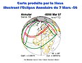 Carte Nasa .jpg 1,000 × 773; 165 KB
-
 Carte Pékin Express.jpg 1,356 × 811; 246 KB
-
 Carte réseau Geoscope 2019.png 2,164 × 1,302; 3.48 MB
-
 Carte siège sociaux CA.png 1,071 × 749; 207 KB
-
 Carte-monde-correspondants-fsf.png 4,335 × 2,145; 786 KB
-
 CartoMap.PNG 921 × 463; 411 KB
-
 CBTC Map July2012.PNG 1,144 × 547; 170 KB
-
 CC sisters.PNG 1,357 × 628; 53 KB
-
 CEN Community.svg 2,754 × 1,398; 1.05 MB
-
-

-
 Chemical Element Place Names World & Solar System Map.png 3,800 × 2,000; 1.11 MB
-
 CIA map of world by subregions of UN geoscheme zh-cn.png 25,000 × 12,662; 10.27 MB
-
 CIA map of world by subregions of UN geoscheme zh-hkmo.png 25,000 × 12,662; 10.17 MB
-
 CIA map of world by subregions of UN geoscheme zh-sgmy.png 25,000 × 12,662; 10.28 MB
-
 CIA map of world by subregions of UN geoscheme zh-tw.png 25,000 × 12,662; 10.15 MB
-
 CIA map of world by subregions of United Nations geoscheme zh-cn.svg 863 × 443; 1.66 MB
-
 City GDP.svg 2,560 × 1,314; 1.68 MB
-

-
 Coastal phytoplankton bloom change 2003–2020.jpg 3,087 × 1,833; 1.03 MB
-
 CoffeeProducersWiki.pdf 1,650 × 1,275; 640 KB
-
 Colour of passports.png 1,425 × 625; 40 KB
-
 Concept Board-World Tour of Hubs.png 1,429 × 811; 312 KB
-
 CONEFO (member states and observers).png 1,357 × 628; 57 KB
-

-
 Conversion therapy ban nations.svg 2,560 × 1,314; 6.39 MB
-
 ConvertAbbrev Progress.svg 1,410 × 715; 1,007 KB
-
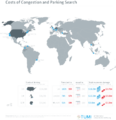 Costs of Congestion and Parking Search.png 4,028 × 4,159; 1.08 MB
-
 Countres.JPG 572 × 258; 111 KB
-
 Countries By Land Border.png 2,560 × 1,312; 265 KB
-
 Countries by most used web browser3.png 1,452 × 743; 63 KB
-
 Countries of 7Wonders of Nature.png 2,000 × 1,027; 250 KB
-
 Countries OPIC supports with U.S. private investment.gif 1,626 × 871; 158 KB
-
 Countries visited on Jet Lag The Game.png 11,475 × 5,825; 2.19 MB
-
 Distribution map of M. Phragmitis.png 1,211 × 333; 60 KB
-
 Divisao-dos-Continentes-America-Europa-Asia-Oceania-Africa-Antardida-Mapa-IBGE-Brasil.pdf 1,268 × 1,770; 2.08 MB
-

-
 Donations by Continent From FY1819 Wikimedia Fundraising Report.png 2,361 × 1,207; 892 KB
-
 Dragora contributors.svg 1,405 × 601; 305 KB
-
 Driving standards historic.png 1,357 × 628; 36 KB
-
 Dst map with permanent.png 4,972 × 2,492; 342 KB
-
 Dual Citizenship2020.svg 853 × 433; 1.26 MB
-
 DV applicants.png 1,480 × 625; 41 KB
-

-
 Délocalisations du CUEJ.png 1,425 × 625; 37 KB
-
 E-waste dump site GDP per capita.png 738 × 338; 146 KB
-
 Earth - Following a Polar Ice Melt (Version 2).jpg 2,500 × 1,250; 3.23 MB
-
 Earth lights vs population density.png 4,320 × 2,160; 6.02 MB
-
 EarthBump1000x500.png 1,000 × 500; 1.11 MB
-
 Earthmap1k2.png 1,000 × 500; 130 KB
-
 Effective Martin curve slope for POC.png 1,221 × 642; 181 KB
-
 Eight Tetraspheres of Earth.jpg 320 × 160; 25 KB
-
 ELEKS Worldwide Locations.png 1,132 × 647; 261 KB
-
 Elektrownie atomowe na świecie.png 788 × 453; 146 KB
-
 Elife-76988-fig1-figsupp1.jpg 739 × 370; 88 KB
-
 Elnino crops 2023 food insecurity.jpg 720 × 420; 138 KB
-
 Endonyms of the World.svg 1,368 × 936; 17.67 MB
-
 English Wikipedia usage of place infoboxes.svg 2,754 × 1,398; 1.06 MB
-
 Environmental and geochemical changes of the CPE.jpg 1,050 × 1,240; 274 KB
-
 Escherichia coli O104H4 bacterial outbreak Mk2.png 2,964 × 1,236; 133 KB
-
 ESON.png 1,500 × 740; 55 KB
-
 España Antiguo.png 1,280 × 657; 575 KB
-
 Estaciones principales MSFN.jpg 450 × 238; 43 KB
-
 Estados Pluripartidários e Unipartidários no mapa..png 6,460 × 3,600; 2.82 MB
-
 Eudaimonic well-being Joshanloo.jpg 3,725 × 2,362; 316 KB
-
 Euler-hermes-regional-map.jpg 512 × 370; 35 KB
-
 Eunoe plus E leiotentaculata.tif 556 × 244; 483 KB
-
 EUREKA participants.png 1,357 × 628; 47 KB
-
 European Conservatives and Reformists Party members map.svg 512 × 263; 1.53 MB
-

-
 Exclusive Economic Zones World.png 2,410 × 1,178; 153 KB
-
 Experamental.jpg 938 × 492; 190 KB
-
 ExpoParticipants11022017.svg 1,410 × 715; 1.13 MB
-
 Export Countries Map.jpg 923 × 448; 99 KB
-
 ExtremeUS4.jpg 546 × 304; 59 KB
-
 Faded charts map.png 4,500 × 2,234; 275 KB
-
 February 2019 Warsaw Conference map.svg 2,754 × 1,398; 1.13 MB
-
 FIFA Qualifiers 2022.png 5,606 × 2,866; 164 KB
-
 Fifth Dimension Presence.png 6,460 × 3,480; 1.68 MB
-

-
 Film-translation standards around the world.PNG 4,500 × 2,234; 383 KB
-
 Final-titan-map.jpg 888 × 575; 52 KB
-
 Finalchaptersmap5.jpg 1,728 × 1,015; 277 KB
-
 FlagDesecrationwithkey.png 3,508 × 2,480; 949 KB
-
 Formation-countries.png 1,425 × 744; 34 KB
-
 Fossil-fuel subsidies as a share of GDP, OWID.svg 850 × 600; 139 KB
-
 Fossil-fuel subsidies per capita, OWID.svg 850 × 600; 139 KB
-
 Fossil-fuel-subsidies-gdp.svg 850 × 600; 168 KB
-
 Fossil-fuel-subsidies-per-capita.svg 850 × 600; 168 KB
-
 Foyers de l'agriculture.png 775 × 394; 43 KB
-
 FR1415WorldMapCover-v1.jpg 4,524 × 2,856; 2.12 MB
-
 France philatelique 1986-1996.png 1,880 × 954; 276 KB
-
 France philatelique 1997-2006.png 1,880 × 954; 274 KB
-
 Freedom of Panorama world map.png 1,427 × 628; 56 KB
-
 Freedom-of-religions-map-2014.png 1,415 × 815; 72 KB
-
 French Wikipedia Page Views Per Country 2013 Q4.svg 2,754 × 1,397; 1.69 MB
-
 French20.svg 1,425 × 625; 192 KB
-
 Freshwater-withdrawals-as-a-share-of-internal-resources.svg 850 × 600; 167 KB
-
 Friendsfoes.svg 512 × 260; 798 KB
-
 Friendsfoes2.svg 512 × 260; 798 KB
-
 Friendship associations based in Finland.svg 1,104 × 566; 1.4 MB
-
 FY1819-Donations-By-Continent-nl.png 2,361 × 1,207; 862 KB
-
 Gaciación Andina.jpg 1,200 × 667; 142 KB
-
 GaWC World Cities.png 1,500 × 775; 56 KB
-
 GB,Überseegebiete,Ex-Kolonien.png 1,480 × 625; 55 KB
-
 GCF Signed Pledges 2018.svg 852 × 449; 1.79 MB
-
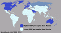 GDP per capita than Russia 2014.png 1,350 × 739; 47 KB
-
 GDP per capita, PPP (current international $) World bank, 2016.png 6,300 × 3,095; 1.62 MB
-
 GE FEB 2022.png 1,287 × 911; 198 KB
-
 Geisterbeschwörer-Anfang-des-21.-Jahrhunderts.png 2,000 × 1,174; 1.99 MB
-
 Gekijōban Karakai jōzu no Takagi-san - Release.png 4,584 × 2,745; 2.01 MB
-
 Gelatinous zooplankton biomass.png 800 × 500; 258 KB
-
 GENSO network map coverage July 2012.png 1,140 × 729; 169 KB
-
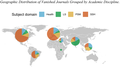 Geographic Distribution of Vanished Journals Grouped by Academic Discipline.png 1,391 × 779; 181 KB
-

-
 Geolocated images in Wikimedia Commons 2012-01-21 remake.png 720 × 360; 17 KB
-
 Geolocated images in Wikimedia Commons 2012-01-21.png 720 × 360; 19 KB
-
 Geolocated images in Wikimedia Commons 2014-02-21.png 720 × 360; 24 KB
-
 Geolocated images in Wikimedia Commons 2015-01-07.png 720 × 360; 25 KB
-
 Geolocated images in Wikimedia Commons 2016-04-16.png 720 × 360; 28 KB
-
 Geolocated images in Wikimedia Commons 2017-09-20.png 720 × 360; 38 KB
-
 Geonames world map (6281371842).png 7,200 × 3,600; 1.8 MB
-
 Geonames4.png 1,440 × 720; 169 KB
-
 GLC worldmap.png 664 × 337; 23 KB
-
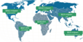
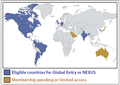
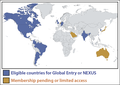 Global Entry Countries.png 1,268 × 899; 198 KB
-
 Global Examples of Emerging and Re-Emerging Infectious Diseases.jpg 1,687 × 1,125; 477 KB


.jpg)


.png)


.png)


.jpg)


.png)


_World_bank,_2016.png)


.png)


.png)
.png)
.png)