Category:Maps of weather and climate of Asia
Jump to navigation
Jump to search
Temperate regions: North America · South America · Africa · Europe · Asia · Oceania – Polar regions: Antarctica · Arctic – Other regions:
Subcategories
This category has the following 55 subcategories, out of 55 total.
*
- North Polar meteorological maps (16 F)
- Rainfall amount maps of Asia (37 F)
- Temperature anomaly maps of Asia (42 F)
A
B
C
I
J
K
M
N
O
P
Q
R
S
T
U
V
Y
Media in category "Maps of weather and climate of Asia"
The following 41 files are in this category, out of 41 total.
-
 1815 tambora explosion ru.png 1,200 × 537; 697 KB
-
 1815 tambora explosion.png 1,200 × 537; 720 KB
-

-
 Annales de géographie (1891) (14595330298).jpg 2,960 × 1,882; 1.03 MB
-
 1cavg2 2022-08 East Asia.png 2,000 × 1,700; 518 KB
-
 1cavg2 202304 East Asia.png 3,000 × 2,550; 868 KB
-
 2019 Indo-Pakistan heat wave by NASA Earth Observatory.png 720 × 800; 455 KB
-

-
 454 of 'The International Geography. ... Edited by H. R. Mill' (11162379264).jpg 1,003 × 755; 211 KB
-
 454 of 'The International Geography. ... Edited by H. R. Mill' (11166760114).jpg 1,010 × 755; 225 KB
-
 ECDM 20221019 TC NESAT.pdf 1,625 × 1,125; 583 KB
-
 IEA'The Oil and Gas Industry in Net Zero Transitions'-Figure 4.3.png 821 × 577; 174 KB
-
 Iraq-gwi-map.jpg 242 × 229; 37 KB
-
 Iraqndvia spt 200804 lrg.jpg 700 × 525; 258 KB
-
 Koppen-Geiger Map Asia future.svg 1,800 × 850; 9.76 MB
-
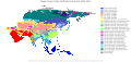 Koppen-Geiger Map Asia present.svg 1,800 × 850; 9.62 MB
-
 Koppen-Geiger Map Central Asia present.svg 1,786 × 850; 1.75 MB
-
 Koppen-Geiger Map Eastern Asia future.svg 1,816 × 850; 4.53 MB
-
 Koppen-Geiger Map Eastern Asia present.svg 1,816 × 850; 4.58 MB
-
 Koppen-Geiger Map Southeastern Asia future.svg 1,438 × 850; 4.17 MB
-
 Koppen-Geiger Map Southeastern Asia present.svg 1,438 × 850; 4.26 MB
-
 Koppen-Geiger Map Southern Asia future.svg 1,400 × 850; 2.96 MB
-
 Koppen-Geiger Map Southern Asia present.svg 1,400 × 850; 3.1 MB
-
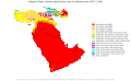 Koppen-Geiger Map Western Asia future.svg 1,385 × 850; 1.53 MB
-
 Koppen-Geiger Map Western Asia present.svg 1,385 × 850; 1.65 MB
-
 Mediterranean Drought Hoerlingetalfig1b.jpg 1,679 × 1,212; 965 KB
-
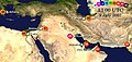 Middle East C Current.jpg 1,074 × 512; 204 KB
-
 Omegalage Russland Pakistan 2010.svg 941 × 415; 1.2 MB
-
 Shamal1 en.jpg 819 × 730; 218 KB
-
 Shamal1 pl.jpg 819 × 730; 219 KB
-
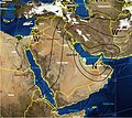 Shamal2 pl.jpg 819 × 730; 214 KB
-
 Snow cover across Europe and Asia 2019-02-03.gif 512 × 512; 22 KB
-
 Tephra fall from 1991 eruption of Mt Pinatubo fr.gif 600 × 425; 27 KB
-
 Tephra fall from 1991 eruption of Mt Pinatubo.gif 600 × 425; 25 KB
-
 TOMS AI Jun16 91.gif 800 × 590; 129 KB
-
 TOMS SO2 Jun17 91.gif 800 × 590; 64 KB
-
 Tropical Asia Koppen.png 2,048 × 1,084; 622 KB
-
 Wcmax5 20230409 20230415 Southeast Asia Extreme Maximum Temperature.png 1,800 × 1,800; 408 KB
-
 Weathermap eastasia 0.png 1,200 × 800; 43 KB
-
 Weathermap eastasia 1.png 1,200 × 800; 83 KB
-
 Winds of the globe vis.png 424 × 684; 178 KB


.jpg)
_(14595330298).jpg)


.jpg)
.jpg)
.jpg)


