Category:Marylebone
Jump to navigation
Jump to search
inner-city area of central London | |||||
| Upload media | |||||
| Instance of | |||||
|---|---|---|---|---|---|
| Location | City of Westminster, Greater London, London, England | ||||
| Different from | |||||
 | |||||
Subcategories
This category has the following 160 subcategories, out of 160 total.
A
- Adam and Eve Court (3 F)
- Ashland Place, London (6 F)
B
- Bakers Mews (3 F)
- Balcombe Street, London (21 F)
- Beaumont Mews (2 F)
- Beaumont Street, London (16 F)
- Berners Place, London W1 (7 F)
- Bolsover Street (33 F)
- Boston Place, London (20 F)
- Brendon Street (7 F)
- Broadstone Place (3 F)
- Bryanston Mews East (3 F)
- Bryanston Mews West (6 F)
- Bryanston Place, London (8 F)
- Bulstrode Place (2 F)
C
- Carburton Street (1 F)
- Chagford Street (7 F)
- Clarke's Mews (1 F)
- Cross Keys Close (4 F)
D
- Devonshire Close, London (5 F)
- Devonshire Mews South (12 F)
- Devonshire Mews West (3 F)
- Devonshire Place Mews (3 F)
- Duchess Mews (10 F)
- Dunstable Mews (4 F)
- Durweston Street (8 F)
F
G
- Garbutt Place (6 F)
- Gloucester Place Mews (9 F)
- Grotto Passage (5 F)
H
- Hallam Mews (5 F)
- Hampden Gurney Street (8 F)
- Harrowby Street (9 F)
I
J
- James Street, Marylebone (13 F)
L
M
- Manchester Mews (17 F)
- Mansfield Mews (9 F)
- Margaret Court, London (3 F)
- Marylebone Mews (6 F)
- Montagu Mansions (2 F)
- Montagu Mews North (3 F)
- Montagu Street, London (5 F)
- Moxon Street, London W1 (6 F)
N
- New Quebec Street (18 F)
O
- Old Quebec Street, London (12 F)
- Oldbury Place (8 F)
- Ossington Buildings (17 F)
P
- Picton Place (3 F)
- Portman Street (20 F)
Q
R
- Robert Adam Street (2 F)
- Rodmarton Street (2 F)
S
- St Christophers Place (26 F)
- Salisbury Place, London (2 F)
- Seymour Mews, London (8 F)
- Shouldham Street, London (5 F)
- Siddons Lane (6 F)
- St Paul's Church, Marylebone (12 F)
T
- Taunton Place, London (1 F)
- Transept Street (5 F)
U
- Upper Montagu Street (15 F)
V
W
- Walmer Street, London (3 F)
- Welbeck Way (6 F)
- Wells Mews, London (3 F)
- Wesley Street (2 F)
- Wimpole Mews (8 F)
- Wythburn Place (4 F)
Y
- York Street, London (21 F)
Media in category "Marylebone"
The following 47 files are in this category, out of 47 total.
-
LONDON, MARYLEBONE by BARTLETT, F.A. and B.J. DAVIES.jpg 1,684 × 2,000; 1.39 MB
-
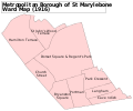
St Marylebone Met. B Ward Map 1916.svg 1,056 × 879; 30 KB
-
Air Raid Damage Map - East Marylebone.jpg 1,783 × 2,229; 2.08 MB
-
148 - The Phoenix Pub.jpg 3,672 × 4,896; 6.7 MB
-
Marylebone Gardens.gif 600 × 376; 100 KB
-
Fields north of great portland street.jpg 2,816 × 2,112; 1.89 MB
-
Robert Owen election poster, July 1847, Marylebone, London (1294285).jpg 1,000 × 1,327; 201 KB
-
Princes Street on an 1870s Ordnance Survey map.png 4,738 × 3,812; 13.46 MB
-
37 Chapel Street - geograph.org.uk - 2681856.jpg 492 × 640; 183 KB
-
5-11 Ranston Street, Marylebone, June 2020.jpg 4,032 × 3,024; 3.26 MB
-
9-11 Nutford Place, Marylebone, June 2021 (1).jpg 3,024 × 4,032; 6.34 MB
-
9-11 Nutford Place, Marylebone, June 2021 (2).jpg 3,024 × 4,032; 5.26 MB
-
Booth Povery Map - Weymouth New Cavendish Streets Extract 1888-9.jpg 556 × 432; 152 KB
-
Brendon Street, Marylebone - geograph.org.uk - 4930964.jpg 3,264 × 2,448; 2.06 MB
-
Cavendish Square and Old Cavendish Street 1870s Ordnance Survey map.png 4,338 × 4,512; 13.09 MB
-
Central London from the air - geograph.org.uk - 4604487.jpg 640 × 480; 187 KB
-
Central London from the air - geograph.org.uk - 4604496.jpg 640 × 480; 202 KB
-
Enford St - geograph.org.uk - 2601438.jpg 640 × 430; 84 KB
-
Enford St - geograph.org.uk - 5034222.jpg 640 × 426; 77 KB
-
Etalage van boekhandel Francis Edwards te Londen, RP-P-2015-26-1786.jpg 2,912 × 4,346; 3.36 MB
-
Georgian doorway - geograph.org.uk - 5301061.jpg 2,912 × 4,378; 3.51 MB
-
Great Cumberland St - geograph.org.uk - 2583425.jpg 640 × 480; 90 KB
-
Hayward Brothers, Union Street, manhole cover Marylebone.jpg 2,660 × 2,893; 2.91 MB
-
Henrietta Street on an 1870s Ordnance Survey map (now Henrietta Place).png 4,685 × 2,672; 7.02 MB
-
St. Marylebone General Dispensary. Wellcome L0005922.jpg 1,142 × 1,614; 1.04 MB
-
La Fromagerie, Cheese Shop in Marylebone area of London at Christmas (16602614695).jpg 3,456 × 5,184; 10.16 MB
-
London-slum-1880s.jpg 624 × 459; 36 KB
-
Lucille Marylebone Theatre 1848.jpg 1,000 × 544; 152 KB
-
Map of East Marylebone Conservation Area.png 1,406 × 979; 559 KB
-
Mary Lowndes Album - 23734804391.jpg 3,570 × 4,601; 5.95 MB
-
Marylebone, London, United Kingdom (Unsplash rjd4Whp341I).jpg 3,500 × 2,333; 3.82 MB
-
Members of the United Cooks' Society preparing plum pudding. Wellcome L0004802.jpg 1,530 × 1,308; 1.14 MB
-
North of Oxford Street 1870s Ordnance Survey.png 14,040 × 9,930; 62.75 MB
-
North of Oxford Street 1910s.png 13,457 × 8,557; 76.04 MB
-
North of Oxford Street Ordnance Survey map 1920s.png 12,471 × 7,972; 67.39 MB
-
North west London from the air - geograph.org.uk - 4600985.jpg 640 × 480; 193 KB
-
Oliver Twist Pavilion Theatre 1838.jpg 1,139 × 1,854; 898 KB
-
Street Art for Ohisama Sushi by Studio Belnyte, Kenrick Place.jpg 3,888 × 2,592; 5.3 MB
-
The Brown Collection Front of Building.jpg 10,028 × 9,365; 36.15 MB


