Category:Mathon, Herefordshire
Jump to navigation
Jump to search
village in United Kingdom  | |||||
| Upload media | |||||
| Instance of | |||||
|---|---|---|---|---|---|
| Location | Herefordshire, West Midlands, England | ||||
 | |||||

Subcategories
This category has the following 3 subcategories, out of 3 total.
M
- Moorend Cross (15 F)
O
- Oasts in Mathon, Herefordshire (11 F)
Media in category "Mathon, Herefordshire"
The following 200 files are in this category, out of 258 total.
(previous page) (next page)-
 A field of maize near Mathon - geograph.org.uk - 1552867.jpg 640 × 426; 116 KB
-
 Approaching Moorend cross - geograph.org.uk - 4248297.jpg 800 × 534; 324 KB
-
 Approaching Stonehouse - geograph.org.uk - 972087.jpg 467 × 640; 70 KB
-

-
 Avenue of trees, Mathon Court - geograph.org.uk - 775449.jpg 426 × 640; 101 KB
-
 Bank farm submarine - geograph.org.uk - 6105147.jpg 1,024 × 768; 301 KB
-
 Bank Farm viewed from Cother Bank - geograph.org.uk - 5582384.jpg 1,600 × 900; 444 KB
-
 Bridge over the Cradley Brook - geograph.org.uk - 2028303.jpg 4,272 × 2,848; 5.32 MB
-
 Broadleaf woodland - geograph.org.uk - 2028567.jpg 4,272 × 2,848; 7.56 MB
-
 Brook House, Mathon (geograph 6600736).jpg 1,024 × 768; 232 KB
-
 Bungalow near Old Country Farm - geograph.org.uk - 845532.jpg 640 × 480; 142 KB
-
 Cattle below Cockshot Hill - geograph.org.uk - 3190280.jpg 640 × 480; 216 KB
-
 Cattle feeder - geograph.org.uk - 4248321.jpg 800 × 534; 277 KB
-
 Cattle watering hole - geograph.org.uk - 2029979.jpg 4,272 × 2,848; 5.09 MB
-
 Cereal field by South Hyde Lane - geograph.org.uk - 4063691.jpg 800 × 451; 201 KB
-
 Church Farm, Mathon - geograph.org.uk - 974911.jpg 640 × 480; 96 KB
-
 Church Farm, Mathon, Herefordshire - geograph.org.uk - 6314154.jpg 1,600 × 1,200; 360 KB
-
 Come in number 37 your time is up - geograph.org.uk - 466644.jpg 640 × 480; 152 KB
-
 Concrete road to Hollings Hill - geograph.org.uk - 4248306.jpg 800 × 534; 235 KB
-

-
 Cottages near Mathon Lodge - geograph.org.uk - 2576906.jpg 640 × 480; 81 KB
-
 Cradley Brook at Mathon - geograph.org.uk - 4063791.jpg 600 × 800; 284 KB
-
 Cradley Brook at Mathon - geograph.org.uk - 775594.jpg 426 × 640; 119 KB
-
 Cradley Brook, 1 - geograph.org.uk - 4248344.jpg 800 × 534; 254 KB
-
 Cradley Brook, 2 - geograph.org.uk - 4248349.jpg 800 × 534; 254 KB
-
 Cradley Brook, Mathon, Herefordshire - geograph.org.uk - 6314145.jpg 1,600 × 1,200; 813 KB
-
 Dappled morning sunlight - geograph.org.uk - 5582415.jpg 1,600 × 900; 622 KB
-
 Do not disturb^ - geograph.org.uk - 4061733.jpg 800 × 449; 201 KB
-
 Drive at Bank Farm, West Malvern - geograph.org.uk - 2576884.jpg 640 × 480; 107 KB
-
 East Herefordshire countryside in October - geograph.org.uk - 5582375.jpg 1,600 × 900; 496 KB
-
 Entrance to Bank Farm, West Malvern - geograph.org.uk - 776441.jpg 640 × 426; 113 KB
-
 Entrance to Mathon Court - geograph.org.uk - 4063757.jpg 800 × 451; 212 KB
-
 Entrance to Treehouse Farm - geograph.org.uk - 4639188.jpg 4,000 × 3,000; 3.51 MB
-
 Farm Buildings at Rook Row - geograph.org.uk - 4248302.jpg 800 × 534; 253 KB
-
 Farm buildings, Croft Farm - geograph.org.uk - 5628311.jpg 1,024 × 768; 261 KB
-
 Farm road from Bank Farm - geograph.org.uk - 5582411.jpg 1,600 × 900; 636 KB
-
 Farm track and public path - geograph.org.uk - 5582407.jpg 1,600 × 901; 720 KB
-
 Farm track near Homehouse Farm - geograph.org.uk - 760050.jpg 640 × 480; 97 KB
-
 Farmland at Holling's Hill - geograph.org.uk - 760484.jpg 640 × 480; 101 KB
-
 Farmland at Home End - geograph.org.uk - 545517.jpg 640 × 480; 118 KB
-
 Farmland at Merryfields - geograph.org.uk - 760471.jpg 640 × 480; 54 KB
-
 Farmland at West Malvern - geograph.org.uk - 6170872.jpg 1,024 × 768; 270 KB
-
 Farmland near Mathon - geograph.org.uk - 1110576.jpg 640 × 426; 112 KB
-
 Farmland to the south-east of Mathon - geograph.org.uk - 1555950.jpg 640 × 426; 105 KB
-
 Ferne Cottage - geograph.org.uk - 2028479.jpg 4,272 × 2,848; 5.21 MB
-
 Field by South End Road - geograph.org.uk - 4639180.jpg 4,000 × 3,000; 4.21 MB
-
 Fields and woods near Stockton Farm - geograph.org.uk - 5582366.jpg 1,600 × 900; 454 KB
-
 Flooded field near The Brays - geograph.org.uk - 968895.jpg 640 × 480; 115 KB
-
 Footbridge north of Mathon - geograph.org.uk - 565603.jpg 640 × 480; 142 KB
-
 Footbridge over the Cradley Brook - geograph.org.uk - 2027972.jpg 4,272 × 2,848; 6.53 MB
-
 Footbridge over the Cradley Brook - geograph.org.uk - 2027996.jpg 3,994 × 2,512; 7.69 MB
-
 Footpath and sheep pasture - geograph.org.uk - 4248310.jpg 800 × 534; 260 KB
-
 Footpath approaching Croft Farm - geograph.org.uk - 6170869.jpg 1,024 × 768; 296 KB
-
 Footpath north from Ham Green - geograph.org.uk - 4061726.jpg 800 × 600; 279 KB
-
 Footpath to Mathon - geograph.org.uk - 2028287.jpg 4,272 × 2,848; 5.28 MB
-
 Former gravel workings - geograph.org.uk - 1552828.jpg 640 × 426; 80 KB
-
-
 Gate and stream, Old Country Farm - geograph.org.uk - 966848.jpg 480 × 640; 131 KB
-
 Gateway on path above Bank Farm - geograph.org.uk - 2576886.jpg 640 × 480; 114 KB
-
 Golden oaks,1 - geograph.org.uk - 4248287.jpg 800 × 450; 194 KB
-
 Golden oaks,2 - geograph.org.uk - 4248289.jpg 800 × 600; 303 KB
-
 Grassy field by South Hyde Lane - geograph.org.uk - 4063703.jpg 800 × 451; 195 KB
-
 Grazing land west of Bank Farm - geograph.org.uk - 5582403.jpg 1,600 × 901; 708 KB
-
 Ham Field, Ham Green - geograph.org.uk - 871368.jpg 640 × 427; 297 KB
-
 Ham Green - lane to South Hyde farm - geograph.org.uk - 845425.jpg 640 × 480; 87 KB
-
 Ham Green - South Hyde lane junction - geograph.org.uk - 845429.jpg 640 × 480; 83 KB
-
 Heath Mill - geograph.org.uk - 34606.jpg 640 × 479; 118 KB
-
 Heathers - in the polytunnels. - geograph.org.uk - 71773.jpg 640 × 407; 152 KB
-
 Holling's Farm, near Cradley - geograph.org.uk - 1110437.jpg 640 × 426; 113 KB
-
 Holling's Hill - geograph.org.uk - 2037341.jpg 4,272 × 2,848; 5.38 MB
-
 Holling's Hill Farm - geograph.org.uk - 2037374.jpg 4,272 × 2,848; 6.72 MB
-
 Holling's Hill farmhouse - geograph.org.uk - 2037777.jpg 4,272 × 2,848; 5.52 MB
-
 Holling's Hill Lodge - geograph.org.uk - 2037794.jpg 4,272 × 2,848; 4.71 MB
-
 House at the junction - geograph.org.uk - 845431.jpg 640 × 480; 113 KB
-
 House by the Village Green, Mathon - geograph.org.uk - 3190272.jpg 640 × 480; 249 KB
-
 House with dovecote opposite Mathon Church - geograph.org.uk - 6314151.jpg 1,600 × 1,200; 615 KB
-
 Houses in Harcourt Road, Mathon - geograph.org.uk - 4279264.jpg 1,600 × 1,045; 1.58 MB
-
 Houses on Park Lane - geograph.org.uk - 2164214.jpg 4,272 × 2,848; 6.01 MB
-
 Lake in sandpit near Mathon - geograph.org.uk - 972104.jpg 640 × 348; 35 KB
-
 Lane at Hackney Cross - geograph.org.uk - 3190248.jpg 640 × 480; 206 KB
-
 Lane past Treehouse Farm - geograph.org.uk - 4639191.jpg 4,000 × 3,000; 4.96 MB
-
 Lane to Bank Farm running through woodland - geograph.org.uk - 6310451.jpg 1,600 × 1,200; 754 KB
-
 Late afternoon sun near Mathon - geograph.org.uk - 1552839.jpg 640 × 256; 47 KB
-
 Late afternoon sun, near Mathon - geograph.org.uk - 1552859.jpg 426 × 640; 104 KB
-
 Looking towards Bank Farm, Herefordshire - geograph.org.uk - 6310447.jpg 1,600 × 1,200; 421 KB
-

-
 Lych gate to Mathon Church (St John the Baptist's) - geograph.org.uk - 6314156.jpg 1,600 × 1,200; 730 KB
-
 Main Street, Mathon - geograph.org.uk - 4063818.jpg 800 × 451; 196 KB
-
 Maize planted over footpath - geograph.org.uk - 2037236.jpg 4,272 × 2,848; 6.99 MB
-
 Maize planted over footpath - geograph.org.uk - 2037254.jpg 4,272 × 2,848; 6.9 MB
-
 Mathon - cottages at the corner - geograph.org.uk - 845414.jpg 640 × 480; 90 KB
-

-
 Mathon - South End Farm - geograph.org.uk - 845423.jpg 640 × 480; 91 KB
-
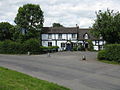 Mathon - The Cliffe Arms - geograph.org.uk - 845405.jpg 640 × 480; 83 KB
-
 Mathon church from the north - geograph.org.uk - 2028041.jpg 4,272 × 2,848; 5.15 MB
-
 Mathon from the north - geograph.org.uk - 2027983.jpg 4,052 × 2,577; 3.07 MB
-
 Mathon Lane - geograph.org.uk - 845417.jpg 640 × 480; 105 KB
-
 Mathon Road - geograph.org.uk - 4639122.jpg 3,000 × 4,000; 4.9 MB
-
 Mathon Show 1997 - geograph.org.uk - 1079996.jpg 640 × 461; 110 KB
-
 Mathon village centre - geograph.org.uk - 565589.jpg 640 × 480; 100 KB
-
 Mathon Village Hall, Lane End - geograph.org.uk - 33454.jpg 640 × 479; 92 KB
-
 Mist above St. John the Baptist Church (Mathon) - geograph.org.uk - 6383658.jpg 2,258 × 1,006; 688 KB
-
 Moat Farm, Ham Green - geograph.org.uk - 869867.jpg 640 × 427; 303 KB
-
 Netherley Hall - geograph.org.uk - 566011.jpg 640 × 480; 102 KB
-
 Nurseries at Mathon - geograph.org.uk - 5890419.jpg 1,600 × 1,200; 740 KB
-
 Nursery land by Mathon Road - geograph.org.uk - 4368845.jpg 800 × 450; 204 KB
-
 Oak and Worcestershire Beacon - geograph.org.uk - 4248317.jpg 800 × 450; 270 KB
-
 Oak seen from Mathon Road - geograph.org.uk - 4368830.jpg 798 × 800; 397 KB
-
 Oak Tree - with a sad plaque - geograph.org.uk - 34116.jpg 479 × 640; 143 KB
-
 Old cottage next to footpath, near Mathon - geograph.org.uk - 6314134.jpg 1,600 × 1,200; 548 KB
-
 Old Man's Beard, Clematis vitalba - geograph.org.uk - 5582388.jpg 1,600 × 900; 546 KB
-
 Orchard at Old Country Farm - 2 - geograph.org.uk - 757963.jpg 640 × 480; 113 KB
-
 Orchard at Old Country Farm - geograph.org.uk - 757051.jpg 640 × 480; 124 KB
-
 Orchard, Old Country Farm - geograph.org.uk - 965997.jpg 640 × 480; 111 KB
-
 Orchard, Old Country Farm - geograph.org.uk - 968872.jpg 640 × 480; 142 KB
-
 Overgrown footpath - geograph.org.uk - 2031677.jpg 4,272 × 2,848; 5.77 MB
-
 Path near Stonehouse - geograph.org.uk - 972095.jpg 640 × 480; 125 KB
-
 Path to Netherley Hall - geograph.org.uk - 2576894.jpg 640 × 480; 121 KB
-
 Pond at the eastern end of Mathon Court (geograph 4116536).jpg 1,024 × 683; 251 KB
-
 Pool at Mathon - geograph.org.uk - 774501.jpg 640 × 426; 83 KB
-
 Pool in former sandpit near Mathon - geograph.org.uk - 972125.jpg 480 × 640; 121 KB
-
 Pool near Mathon - geograph.org.uk - 1552824.jpg 640 × 426; 79 KB
-
 Ripening wheat - geograph.org.uk - 2029961.jpg 4,272 × 2,848; 5.54 MB
-
 Road junction in Mathon - geograph.org.uk - 775451.jpg 640 × 426; 92 KB
-
 Road north of Mathon - geograph.org.uk - 975116.jpg 640 × 480; 87 KB
-
 Road to Bank Farm - geograph.org.uk - 6170412.jpg 1,024 × 768; 274 KB
-
 Rook Row Field - geograph.org.uk - 2037818.jpg 4,158 × 2,494; 7.16 MB
-
 Rose Farm - geograph.org.uk - 566033.jpg 640 × 480; 98 KB
-
 Rose Farm, near Mathon, Herefordshire - geograph.org.uk - 6314124.jpg 1,600 × 1,200; 572 KB
-
 Rowburrow Wood - geograph.org.uk - 34571.jpg 640 × 479; 78 KB
-

-
 School House - geograph.org.uk - 775584.jpg 640 × 426; 82 KB
-
 Sheep balancing on the quarry face - geograph.org.uk - 565639.jpg 640 × 480; 101 KB
-
 Sheep grazing at Bank Farm - geograph.org.uk - 466645.jpg 640 × 480; 137 KB
-
 Sheep pasture - geograph.org.uk - 2028423.jpg 4,272 × 2,848; 4 MB
-
 Sheep pasture above Rowburrow Wood - geograph.org.uk - 466646.jpg 640 × 480; 145 KB
-
 Showery sky and Herefordshire Beacon - geograph.org.uk - 4063710.jpg 800 × 451; 173 KB
-
 Silage clamp, Holling's Hill Farm - geograph.org.uk - 2037405.jpg 4,272 × 2,848; 6.4 MB
-
 South End Road - geograph.org.uk - 4639181.jpg 4,000 × 3,000; 3.67 MB
-
 South Hyde Lane - geograph.org.uk - 4061746.jpg 800 × 451; 198 KB
-
 Stile on Cockshot Hill - geograph.org.uk - 34576.jpg 640 × 479; 119 KB
-
 Stonehouse, Mathon - geograph.org.uk - 968980.jpg 480 × 640; 106 KB
-
 Stream by the orchard - geograph.org.uk - 966931.jpg 480 × 640; 145 KB
-
 Super wide field margins - geograph.org.uk - 2031699.jpg 4,272 × 2,848; 6.83 MB
-
 Tanhouse Lane - geograph.org.uk - 4248324.jpg 800 × 451; 291 KB
-
 Tanhouse Lane - geograph.org.uk - 760100.jpg 640 × 480; 81 KB
-
 The Cliffe Arms, Mathon - geograph.org.uk - 775456.jpg 640 × 426; 72 KB
-
 The Cliffe Arms, Mathon, 2014 - geograph.org.uk - 4063809.jpg 800 × 451; 181 KB
-
 The Cradley Brook - geograph.org.uk - 2028029.jpg 3,258 × 2,188; 5.97 MB
-
 The Cradley Brook - geograph.org.uk - 2028332.jpg 4,161 × 2,684; 7.7 MB
-
 The Cradley Brook - geograph.org.uk - 2028343.jpg 4,272 × 2,848; 6.3 MB
-
 The former Cliffe Arms, Mathon - geograph.org.uk - 6314148.jpg 1,600 × 1,200; 403 KB
-
 The Mathon Lake - geograph.org.uk - 591985.jpg 640 × 427; 169 KB
-
 The track to Ferney Cottage - geograph.org.uk - 2028461.jpg 4,272 × 2,848; 7.48 MB
-
 Three trees, Mathon - geograph.org.uk - 974677.jpg 640 × 353; 67 KB
-
 Timber framed house, Mathon, Herefordshire - geograph.org.uk - 6314140.jpg 1,600 × 1,200; 417 KB
-
 Towards Netherley Hall (geograph 6902543).jpg 3,064 × 1,841; 1.04 MB
-
 Town House, Mathon - geograph.org.uk - 775589 (cropped).jpg 261 × 261; 21 KB
-
 Town House, Mathon - geograph.org.uk - 775589.jpg 640 × 426; 86 KB
-
 Track and footpath - geograph.org.uk - 6170425.jpg 1,024 × 768; 266 KB
-
 Track to Cockshot Hill - geograph.org.uk - 776438.jpg 640 × 426; 80 KB
-
 Track to Home House - geograph.org.uk - 2031667.jpg 4,272 × 2,848; 6.25 MB
-
 Track to the Cradley road - geograph.org.uk - 2028077.jpg 4,090 × 2,523; 6.75 MB
-
 Trees below Cockshot Hill - geograph.org.uk - 6170791.jpg 1,024 × 768; 313 KB
-
 Victorian Postbox, Ham Green - geograph.org.uk - 869845.jpg 640 × 427; 295 KB
-
 Victorian Postbox, Ham Green - geograph.org.uk - 869850.jpg 427 × 640; 307 KB
-
 View from Cockshot Hill - geograph.org.uk - 566017.jpg 640 × 480; 89 KB
-
 View over Mathon - geograph.org.uk - 5669685.jpg 1,024 × 683; 244 KB
-
 View over Netherley - geograph.org.uk - 6170787.jpg 1,024 × 768; 259 KB
-
 View over the Cradley Brook valley - geograph.org.uk - 4248332.jpg 800 × 450; 233 KB
-
 View to the Malvern Hills - geograph.org.uk - 6170420.jpg 1,024 × 768; 297 KB
-
 View to Treehouse Farm - geograph.org.uk - 4639185.jpg 4,000 × 3,000; 3.41 MB
-

-
 Warner's Farm - geograph.org.uk - 566037 (cropped).jpg 552 × 207; 45 KB
-
 Warner's Farm - geograph.org.uk - 566037.jpg 640 × 480; 97 KB
-
 Weather vane and doves - geograph.org.uk - 972092.jpg 640 × 446; 58 KB
-
 West Malvern - geograph.org.uk - 5582392.jpg 1,600 × 900; 460 KB
-
 West Malvern and North Hill - geograph.org.uk - 6248675.jpg 1,600 × 1,200; 389 KB
-
 West Malvern Cricket Club's ground - geograph.org.uk - 4063721.jpg 800 × 451; 189 KB
-
 West Malvern Cricket Club's ground - geograph.org.uk - 4116542.jpg 1,024 × 390; 118 KB
-
 Western Gates to Mathon Court - geograph.org.uk - 33450.jpg 640 × 479; 162 KB
-
 Wet field at Old Country Farm - geograph.org.uk - 757953.jpg 640 × 480; 87 KB
-

-
 Woods for auction - geograph.org.uk - 2028539.jpg 4,272 × 2,848; 7.75 MB
-
 Apples in Six Acre Wood - geograph.org.uk - 324953.jpg 427 × 640; 344 KB
-
 B4220 at Holling's Hill - geograph.org.uk - 760521.jpg 640 × 480; 65 KB
-
 Bagburrow Wood - geograph.org.uk - 324922.jpg 640 × 427; 217 KB
-
 Barn conversion at South Hyde Farm - geograph.org.uk - 635975.jpg 640 × 480; 67 KB
-
 Bend in Tanhouse Lane - geograph.org.uk - 760096.jpg 640 × 480; 103 KB
-
 Bridge over the stream at Mathon - geograph.org.uk - 565598.jpg 640 × 480; 102 KB
-

-
 Cottage at Smith's Green - geograph.org.uk - 635934.jpg 640 × 480; 75 KB
-
 Cottage at Smith's Green - geograph.org.uk - 635951.jpg 640 × 480; 69 KB
-
 Cottage at Smith's Green - geograph.org.uk - 775441.jpg 426 × 640; 84 KB
-
 Cottage on the Mathon road - geograph.org.uk - 566023.jpg 640 × 480; 99 KB
-
 Cottage on the Mathon road. - geograph.org.uk - 566026.jpg 640 × 480; 130 KB
-
 Cottage on the outskirts of Mathon - geograph.org.uk - 566031.jpg 640 × 480; 75 KB
-
 Cottages in Mathon - geograph.org.uk - 775585.jpg 640 × 426; 73 KB
-
 Crop Damage near the Cradley Brook - geograph.org.uk - 513937.jpg 640 × 427; 261 KB
-
 Entrance road at Winsordine - geograph.org.uk - 758412.jpg 640 × 481; 54 KB


.jpg)


_-_geograph.org.uk_-_6314156.jpg)


_-_geograph.org.uk_-_6383658.jpg)


.jpg)


.jpg)
.jpg)


.jpg)