Category:May 2018 in Kent
Jump to navigation
Jump to search
Ceremonial counties of England: Bedfordshire · Berkshire · Buckinghamshire · Cambridgeshire · Cheshire · Cornwall · Cumbria · Derbyshire · Devon · Dorset · Durham · East Riding of Yorkshire · East Sussex · Essex · Gloucestershire · Greater London · Greater Manchester · Hampshire · Herefordshire · Hertfordshire · Isle of Wight · Kent · Lancashire · Leicestershire · Lincolnshire · Merseyside · Norfolk · North Yorkshire · Northamptonshire · Northumberland · Nottinghamshire · Oxfordshire · Shropshire · Somerset · South Yorkshire · Staffordshire · Suffolk · Surrey · Tyne and Wear · Warwickshire · West Midlands · West Sussex · West Yorkshire · Wiltshire · Worcestershire
City-counties: Bristol ·
Former historic counties:
Other former counties:
City-counties: Bristol ·
Former historic counties:
Other former counties:
Deutsch: Bilder, die im Mai 2018 in Kent aufgenommen worden sind. Bitte beachten Sie, dass dies weder das Datum des Uploads noch das Datum des Scannens eines Fotos ist.
English: Images/pictures taken in Kent during May 2018. Note this is not the date of the upload, nor the date a photo was scanned.
Español: Fotografías o imágenes tomadas en Kent durante mayo 2018. No es la fecha de subida ni escaneo, sino la fecha en que las fotografías o imágenes se crearon.
Esperanto: Bildoj faritaj en Kent en majo 2018. Tio ne estas la dato, kiam la bildoj estis alŝutitaj aŭ skanitaj.
Français : Photographies ou images prises en Kent durant mai 2018. Ce n'est pas la date du téléchargement ou du scan.
Galego: Fotografías ou imaxes tomadas en Kent durante maio 2018. Non é a data de subida nin escaneamento, senón a data na que se crearon as fotografías ou imaxes.
Italiano: Fotografie o immagini scattate a Kent nel maggio 2018. Nota bene: la data non si riferisce né a quella di upload né a quella in cui la foto è stata digitalizzata.
Norsk bokmål: Bilder tatt i Kent i løpet av mai 2018. Merk at dette ikke er datoen for opplasting, eller når et bilde har blitt skannet.
Norsk nynorsk: Bilete teke i Kent i løpet av mai 2018. Merk at dette ikkje er datoen for opplasting, eller når eit bilete har vorte skanna.
Русский: Изображения, сделанные в Kent в течение май 2018 (не дата загрузки изображения).
Українська: Зображення, зроблені в Kent протягом травень 2018. Зауважте, що це не дата завантаження чи дата сканування фотографії.
| May 2017 | ← | May 2018 | → | May 2019 | |||||||
| Jan | Feb | Mar | Apr | May | Jun | Jul | Aug | Sep | Oct | Nov | Dec |
| 525 | 108 | 89 | 49 | 219 | 15 | 42 | 345 | 12 | 306 | 9 | 7 |
|---|---|---|---|---|---|---|---|---|---|---|---|
Media in category "May 2018 in Kent"
The following 200 files are in this category, out of 219 total.
(previous page) (next page)-
 SOO First days of Luton service 8913.jpg 4,608 × 3,456; 3.3 MB
-
 SOO First days of Luton service 8914c.jpg 2,797 × 2,101; 1.21 MB
-
 SOO First days of Thameslink Luton Rainham arriving 8911c.jpg 3,918 × 2,935; 1.51 MB
-
 SOO First days of Thameslink Luton Rainham livery 8912.jpg 4,608 × 3,456; 3.11 MB
-
 SOO First days of Thameslink Luton Rainham service arriving 8910c.jpg 3,257 × 2,090; 924 KB
-
 43, The Pantiles - geograph.org.uk - 5845202.jpg 1,024 × 681; 214 KB
-
 43, The Pantiles - geograph.org.uk - 5889515.jpg 1,024 × 681; 215 KB
-
 49 - 50, Mount Ephraim - geograph.org.uk - 5850988.jpg 1,024 × 681; 178 KB
-
 52 - 53, Mount Ephraim - geograph.org.uk - 5850981.jpg 1,024 × 681; 261 KB
-
 63 - 65, Mount Ephraim - geograph.org.uk - 5850872.jpg 1,024 × 681; 169 KB
-
 70 - 73, Mount Ephraim - geograph.org.uk - 5850867.jpg 1,024 × 681; 189 KB
-
 75, Mount Ephraim - geograph.org.uk - 5850860.jpg 1,024 × 681; 158 KB
-
 77, Mount Ephraim - geograph.org.uk - 5850853.jpg 1,024 × 681; 304 KB
-
 79, Mount Ephraim - geograph.org.uk - 5850848.jpg 1,024 × 681; 268 KB
-
 88, Grosvenor Rd - geograph.org.uk - 5850991.jpg 1,024 × 681; 179 KB
-
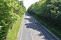
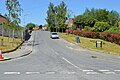
 A21, Pembury bypass - geograph.org.uk - 5925988.jpg 1,024 × 681; 207 KB
-
 A21, Pembury bypass - geograph.org.uk - 5925992.jpg 1,024 × 681; 192 KB
-
 A21, Pembury bypass - geograph.org.uk - 5933806.jpg 1,024 × 681; 130 KB
-
 A21, Pembury bypass - geograph.org.uk - 5933858.jpg 1,024 × 733; 163 KB
-
 A21, Pembury bypass - geograph.org.uk - 5940858.jpg 1,024 × 681; 146 KB
-
 A228 - geograph.org.uk - 5920461.jpg 1,024 × 681; 252 KB
-
 A228 - geograph.org.uk - 5925954.jpg 1,024 × 681; 182 KB
-
 A228 - geograph.org.uk - 5940835.jpg 1,024 × 681; 149 KB
-
 A228 looking west - geograph.org.uk - 5920463.jpg 1,024 × 871; 278 KB
-
 A228, Pembury - geograph.org.uk - 5933839.jpg 1,024 × 526; 135 KB
-
 A26 - geograph.org.uk - 5944831.jpg 1,024 × 916; 149 KB
-
 A264 - A26 junction - geograph.org.uk - 5850984.jpg 1,024 × 681; 149 KB
-
 A264, Pembury Rd - geograph.org.uk - 5926141.jpg 1,024 × 681; 209 KB
-
 All Saints Church, West Stourmouth 01.jpg 3,864 × 5,152; 4.36 MB
-
 All Saints Church, West Stourmouth 02.jpg 3,864 × 5,152; 4.39 MB
-
 All Saints Church, West Stourmouth 03.jpg 3,864 × 5,152; 4.36 MB
-
 All Saints Church, West Stourmouth 04.jpg 3,154 × 4,945; 6.81 MB
-
 All Saints Church, West Stourmouth 05.jpg 3,864 × 5,152; 4.29 MB
-
 All Saints Church, West Stourmouth 06.jpg 3,864 × 5,152; 4.36 MB
-
 All Saints Church, West Stourmouth 07.jpg 3,864 × 5,152; 4.25 MB
-
 All Saints Church, West Stourmouth 08.jpg 3,864 × 5,152; 4.33 MB
-
 All Saints Church, West Stourmouth 09.jpg 5,152 × 3,864; 4.21 MB
-
 All Saints Church, West Stourmouth 10.jpg 5,152 × 3,864; 4.41 MB
-
 All Saints Church, West Stourmouth 11.jpg 3,864 × 5,152; 4.33 MB
-
 All Saints Church, West Stourmouth 12.jpg 3,864 × 5,152; 4.36 MB
-
 All Saints Church, West Stourmouth 13.jpg 5,152 × 3,864; 4.45 MB
-
 All Saints Church, West Stourmouth 14.jpg 5,152 × 3,864; 4.36 MB
-
 All Saints Church, West Stourmouth 15.jpg 3,864 × 5,152; 4.38 MB
-
 All Saints Church, West Stourmouth 16.jpg 5,152 × 3,864; 4.4 MB
-
 All Saints Church, West Stourmouth 17.jpg 3,864 × 5,152; 4.4 MB
-
 All Saints Church, West Stourmouth 18.jpg 5,152 × 3,864; 4.38 MB
-
 All Saints Church, West Stourmouth 19.jpg 5,152 × 3,864; 4.36 MB
-
 All Saints' Rise - geograph.org.uk - 5867703.jpg 1,024 × 681; 189 KB
-
 Archway to The Priory - geograph.org.uk - 5893406.jpg 1,024 × 681; 205 KB
-
 ASK Italian - geograph.org.uk - 5867544.jpg 1,024 × 681; 148 KB
-
 ASK, Monson Rd - geograph.org.uk - 5929617.jpg 1,024 × 681; 131 KB
-
 Aspen Dental Clinic - geograph.org.uk - 5905034.jpg 1,024 × 681; 132 KB
-
 Beaumont House - geograph.org.uk - 5850911.jpg 1,024 × 681; 198 KB
-
 Bedford Terrace - geograph.org.uk - 5889520.jpg 1,024 × 681; 252 KB
-
 Belleville - geograph.org.uk - 5867556.jpg 1,024 × 681; 228 KB
-
 Blacks, Monson Rd - geograph.org.uk - 5929614.jpg 1,024 × 681; 191 KB
-
 Brewhouse Hotel - geograph.org.uk - 5889518.jpg 1,024 × 681; 185 KB
-
 Brighton Lake - geograph.org.uk - 5845270.jpg 1,024 × 681; 305 KB
-
 Brook Rd - geograph.org.uk - 5928678.jpg 1,024 × 681; 186 KB
-
 Brook Rd - geograph.org.uk - 5928679.jpg 1,024 × 681; 207 KB
-
 Broomhill Rd - geograph.org.uk - 5869063.jpg 1,024 × 681; 262 KB
-
 Bryans Barber Shop (closed) - geograph.org.uk - 5845111.jpg 1,024 × 681; 148 KB
-
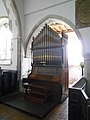
 Buffet carriage, Spa Valley Railway - geograph.org.uk - 5845238.jpg 1,024 × 681; 197 KB
-
 Cabbage Stalk Lane - geograph.org.uk - 5850736.jpg 1,024 × 681; 318 KB
-
 Caffe Nero, High St - geograph.org.uk - 5929607.jpg 1,024 × 681; 147 KB
-
 Caley Rd - geograph.org.uk - 5928663.jpg 1,024 × 681; 180 KB
-
 Caley Rd - geograph.org.uk - 5928667.jpg 1,024 × 681; 204 KB
-
 Calverley House - geograph.org.uk - 5867542.jpg 1,024 × 681; 155 KB
-
 Calverley Park - geograph.org.uk - 5940035.jpg 1,024 × 681; 193 KB
-
 Calverley Park Gardens - geograph.org.uk - 5929637.jpg 1,024 × 681; 214 KB
-
 Calverley Park Gardens - geograph.org.uk - 5929638.jpg 1,024 × 681; 239 KB
-
 Camden Food Bazaar - geograph.org.uk - 5845159.jpg 1,024 × 681; 148 KB
-
 Camden Road Retro Centre - geograph.org.uk - 5845163.jpg 1,024 × 681; 160 KB
-
 Cannon Hoare Memorial - geograph.org.uk - 5940072.jpg 681 × 1,024; 136 KB
-
 Cannon Hoare Memorial - geograph.org.uk - 5944826.jpg 681 × 1,024; 124 KB
-
 Carluccio's - geograph.org.uk - 5904892.jpg 1,024 × 681; 217 KB
-
 Church of St John - geograph.org.uk - 5867692.jpg 681 × 1,024; 201 KB
-
 Church of St John - geograph.org.uk - 5867696.jpg 1,024 × 681; 167 KB
-
 Church of St John - geograph.org.uk - 5893417.jpg 681 × 1,024; 104 KB
-
 Church of St John - geograph.org.uk - 5893420.jpg 681 × 1,024; 141 KB
-
 Church of St John - geograph.org.uk - 5905040.jpg 1,024 × 681; 196 KB
-
 Church of St John - geograph.org.uk - 5940073.jpg 1,024 × 681; 131 KB
-
 Church of St John - geograph.org.uk - 5944835.jpg 681 × 1,024; 106 KB
-
 Church of St John - geograph.org.uk - 5944854.jpg 1,024 × 681; 148 KB
-
 Church Rd, A264 - geograph.org.uk - 5850851.jpg 1,024 × 681; 198 KB
-
 Cliff, All Saints' Rd - geograph.org.uk - 5867704.jpg 1,024 × 681; 329 KB
-
 Clifton Rd - geograph.org.uk - 5928682.jpg 1,024 × 681; 168 KB
-
 Clifton Rd - geograph.org.uk - 5928685.jpg 1,024 × 681; 169 KB
-
 Conduit House of St. Augustine's Abbey, Canterbury 01.jpg 5,152 × 3,864; 4.47 MB
-
 Conduit House of St. Augustine's Abbey, Canterbury 02.jpg 5,152 × 3,864; 4.39 MB
-
 Coneyburrow Rd, Sherwood Rd junction - geograph.org.uk - 5926107.jpg 1,024 × 681; 239 KB
-
 Cunningham Close - geograph.org.uk - 5908482.jpg 1,024 × 681; 173 KB
-
 Dale St - geograph.org.uk - 5940005.jpg 1,024 × 681; 194 KB
-
 Derelict barn, Smockham Farm - geograph.org.uk - 5869048.jpg 1,024 × 681; 189 KB
-

-
 Domino's - geograph.org.uk - 5944808.jpg 1,024 × 681; 138 KB
-
 Domino's Pizza - geograph.org.uk - 5893409.jpg 1,024 × 681; 193 KB
-
 Drinking Fountain outside The Spa Hotel - geograph.org.uk - 5850778.jpg 680 × 1,024; 173 KB
-
 Dunorlan Park - geograph.org.uk - 5944734.jpg 1,024 × 681; 165 KB
-
 Entrance Lodge, Nevill Park - geograph.org.uk - 5850752.jpg 1,024 × 681; 196 KB
-
 Farmers' Market - geograph.org.uk - 5929551.jpg 1,024 × 681; 161 KB
-
 Fir Tree Rd - geograph.org.uk - 5889317.jpg 1,024 × 681; 276 KB
-
 First Church of Christ the Scientist - geograph.org.uk - 5845216.jpg 1,024 × 681; 181 KB
-
 Footbridge crosses A228 - geograph.org.uk - 5920460.jpg 1,024 × 681; 284 KB
-
 Former Arriva bus depot - geograph.org.uk - 5893415.jpg 1,024 × 681; 95 KB
-
 Former BT Building - geograph.org.uk - 5867566.jpg 1,024 × 681; 119 KB
-
 Former Velo Cafe - geograph.org.uk - 5944822.jpg 1,024 × 681; 160 KB
-
 Friars Way - geograph.org.uk - 5928632.jpg 1,024 × 681; 214 KB
-
 Garden St - geograph.org.uk - 5940009.jpg 1,024 × 681; 177 KB
-
 George Whitfield Memorial - geograph.org.uk - 5867564.jpg 1,024 × 681; 159 KB
-
 Gibraltar Cottage - geograph.org.uk - 5850883.jpg 1,024 × 681; 232 KB
-
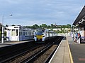
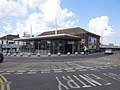 Gillingham railway station, Kent (geograph 5783846).jpg 1,600 × 1,200; 335 KB
-
 Gorse Rd - geograph.org.uk - 5926075.jpg 1,024 × 681; 206 KB
-
 Grosvenor Lodge - geograph.org.uk - 5867534.jpg 1,024 × 681; 154 KB
-
 Grove Ferry Inn, Kent.jpg 5,152 × 3,864; 4.34 MB
-
 Hall's Bookshop - geograph.org.uk - 5039731.jpg 640 × 426; 77 KB
-
 Hoopers - geograph.org.uk - 5904889.jpg 1,024 × 681; 165 KB
-
 Hoopers Department Store - geograph.org.uk - 5893402.jpg 1,024 × 681; 161 KB
-
 Hoopers Department Store - geograph.org.uk - 5929608.jpg 1,024 × 681; 155 KB
-
 Hungershall Park - geograph.org.uk - 5850743.jpg 1,024 × 681; 241 KB
-
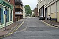
 John St - geograph.org.uk - 5893427.jpg 1,024 × 681; 142 KB
-
 John St - geograph.org.uk - 5905041.jpg 1,024 × 681; 169 KB
-
 John St - geograph.org.uk - 5944858.jpg 1,024 × 681; 137 KB
-
 King Charles Square - geograph.org.uk - 5867563.jpg 1,024 × 681; 153 KB
-
 King Charles Square - geograph.org.uk - 5905032.jpg 1,024 × 681; 153 KB
-
 Lamp standards, Lonsdale Gardens - geograph.org.uk - 5904896.jpg 681 × 1,024; 144 KB
-
 Lloyds Bank - geograph.org.uk - 5944783.jpg 1,024 × 681; 147 KB
-
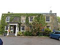
 Major York's Cottage - geograph.org.uk - 5889509.jpg 1,024 × 681; 267 KB
-
 Major Yorks Rd - geograph.org.uk - 5889305.jpg 1,024 × 681; 236 KB
-
 Major Yorks Rd - geograph.org.uk - 5889306.jpg 1,024 × 681; 274 KB
-
 Major Yorks Rd - geograph.org.uk - 5889319.jpg 1,024 × 681; 237 KB
-
 Maplin - geograph.org.uk - 5929644.jpg 1,024 × 681; 140 KB
-
 Marks ^ Spencer - geograph.org.uk - 5867541.jpg 1,024 × 681; 207 KB
-
 Mereworth Rd - geograph.org.uk - 5893429.jpg 1,024 × 681; 108 KB
-
 Millennium Clock - geograph.org.uk - 5845167.jpg 681 × 1,024; 153 KB
-
 Molyneux Place - geograph.org.uk - 5850856.jpg 1,024 × 681; 207 KB
-
 Montgomery Rd - geograph.org.uk - 5908480.jpg 1,024 × 681; 196 KB
-
 Moss Bros - geograph.org.uk - 5893404.jpg 1,024 × 681; 165 KB
-
 M^S Simply Food - geograph.org.uk - 5944846.jpg 1,024 × 681; 106 KB
-
 Nevill Park - geograph.org.uk - 5850753.jpg 1,024 × 681; 184 KB
-
 Nevill Terrace - geograph.org.uk - 5845221.jpg 1,024 × 681; 160 KB
-
 Newcomen Rd - geograph.org.uk - 5893428.jpg 1,024 × 681; 132 KB
-
 Newcomen Rd - geograph.org.uk - 5905042.jpg 1,024 × 681; 127 KB
-
 Newcomen Rd - geograph.org.uk - 5944862.jpg 1,024 × 681; 133 KB
-
 Out building, Smockham Farm - geograph.org.uk - 5869045.jpg 681 × 1,024; 218 KB
-
 Paydens Pharmacy - geograph.org.uk - 5944824.jpg 1,024 × 681; 151 KB
-
 Pedestrian crossing, A228 - geograph.org.uk - 5920548.jpg 1,024 × 681; 216 KB
-
 Pizza Hut - geograph.org.uk - 5940074.jpg 1,024 × 681; 148 KB
-
 Queens Rd - geograph.org.uk - 5893422.jpg 1,024 × 681; 143 KB
-
 Queens Rd - geograph.org.uk - 5929539.jpg 1,024 × 681; 152 KB
-
 Railway Bridge, Broadwater Lane - geograph.org.uk - 5845277.jpg 1,024 × 681; 183 KB
-
 Robingate Wood - geograph.org.uk - 5925998.jpg 1,024 × 681; 312 KB
-
 Rose ^ Crown - geograph.org.uk - 5867539.jpg 1,024 × 681; 131 KB
-
 Royal Wells Hotel - geograph.org.uk - 5850909.jpg 1,024 × 681; 130 KB
-
 Sherwood Rd - geograph.org.uk - 5926110.jpg 1,024 × 681; 182 KB
-
 Sherwood Rd - geograph.org.uk - 5926113.jpg 1,024 × 681; 209 KB
-
 Sign, The Major Yorke - geograph.org.uk - 5850763.jpg 681 × 1,024; 273 KB
-
 Site of former gasworks - geograph.org.uk - 4158036.jpg 640 × 430; 72 KB
-
 Small unnamed woodland stream, Smockham Farm - geograph.org.uk - 5869055.jpg 1,024 × 681; 327 KB
-
 Smockham Farm - geograph.org.uk - 5869051.jpg 1,024 × 681; 211 KB
-
 Smockham Farmhouse - geograph.org.uk - 5869053.jpg 1,024 × 681; 205 KB
-
 Southwood Avenue - geograph.org.uk - 5893433.jpg 1,024 × 681; 109 KB
-
 St Augustine's Catholic Church - geograph.org.uk - 5940030.jpg 1,024 × 681; 172 KB
-
 St Barnabas Primary School - geograph.org.uk - 5845156.jpg 1,024 × 681; 184 KB
-
 St James Rd - geograph.org.uk - 5845107.jpg 1,024 × 681; 158 KB
-
 St John Ambulance, Silverdale Rd - geograph.org.uk - 5949502.jpg 1,024 × 681; 166 KB
-
 St John's Primary School - geograph.org.uk - 5908478.jpg 1,024 × 681; 251 KB
-
 St John's Rd - geograph.org.uk - 5867688.jpg 1,024 × 681; 181 KB
-
 St John's Rd - geograph.org.uk - 5893425.jpg 1,024 × 681; 134 KB
-
 St John's Recreation Ground - geograph.org.uk - 5869027.jpg 1,024 × 681; 299 KB
-
 St John's Recreation Ground - geograph.org.uk - 5869029.jpg 1,024 × 681; 268 KB
-
 St John's Recreation Ground - geograph.org.uk - 5869030.jpg 1,024 × 681; 324 KB
-
 Stodmarsh Church 01.jpg 3,864 × 5,152; 9.35 MB
-
 Stodmarsh Church 02.jpg 1,920 × 2,560; 1.19 MB
-
 Stodmarsh Church 03.jpg 2,560 × 1,920; 1.85 MB
-
 Stodmarsh Church 04.jpg 2,560 × 1,920; 2.33 MB
-
 Stodmarsh Church 05.jpg 1,920 × 2,560; 2 MB
-
 Stodmarsh Church 06.jpg 2,560 × 1,920; 1.22 MB
-
 Stodmarsh, Kent.jpg 5,152 × 3,864; 9.36 MB
-
 Stone St - geograph.org.uk - 5940002.jpg 1,024 × 681; 174 KB
-
 Temple Grove Academy - geograph.org.uk - 5928629.jpg 1,024 × 681; 243 KB
-
 Temple Grove Academy - geograph.org.uk - 5928659.jpg 1,024 × 681; 245 KB
-
 Temple House - geograph.org.uk - 5850976.jpg 1,024 × 681; 149 KB
-
 Temple Way - geograph.org.uk - 5928688.jpg 1,024 × 681; 179 KB
-
 Tesco Express - geograph.org.uk - 5867702.jpg 1,024 × 681; 196 KB
-
 Thackeray's Place - geograph.org.uk - 5867558.jpg 1,024 × 681; 159 KB
-
 Thanet School of Art 1928 0199.jpg 2,905 × 2,129; 1.36 MB
-
 Thanet School of Art 1928 0200.jpg 3,566 × 2,675; 2.09 MB
-
 Thanet School of Art 1928 0201.jpg 2,543 × 3,389; 1.6 MB
-
 Thanet School of Art 1928 0202.jpg 2,517 × 3,355; 1.54 MB
-
 The Chalet - geograph.org.uk - 5850838.jpg 1,024 × 681; 189 KB
-
 The Dairy - geograph.org.uk - 5867701.jpg 1,024 × 681; 175 KB
-
 The Forum - geograph.org.uk - 5929594.jpg 1,024 × 681; 231 KB
-
 The George - geograph.org.uk - 5850990.jpg 1,024 × 681; 133 KB
-
 The George Hotel - geograph.org.uk - 5944814.jpg 1,024 × 681; 132 KB
-
 The Great Hall Arcade - geograph.org.uk - 5845179.jpg 1,024 × 681; 152 KB
-
 The Great Hall Arcade - geograph.org.uk - 5904891.jpg 1,024 × 681; 167 KB
-
 The Great Hall Arcade - geograph.org.uk - 5904895.jpg 1,024 × 681; 157 KB
-
 The Great Hall Arcade - geograph.org.uk - 5929610.jpg 1,024 × 681; 151 KB
-
 The Local - geograph.org.uk - 5928692.jpg 1,024 × 681; 143 KB


_-_geograph.org.uk_-_5845111.jpg)


.jpg)


