Category:March 2018 in Kent
Jump to navigation
Jump to search
Ceremonial counties of England: Bedfordshire · Berkshire · Cheshire · Cornwall · Cumbria · Derbyshire · Devon · Dorset · Durham · East Riding of Yorkshire · Essex · Gloucestershire · Greater London · Greater Manchester · Hampshire · Herefordshire · Kent · Lancashire · Leicestershire · Lincolnshire · Merseyside · Norfolk · North Yorkshire · Northamptonshire · Northumberland · Nottinghamshire · Oxfordshire · Shropshire · Somerset · South Yorkshire · Staffordshire · Suffolk · Surrey · Warwickshire · West Yorkshire · Wiltshire · Worcestershire
City-counties: Bristol ·
Former historic counties:
Other former counties:
City-counties: Bristol ·
Former historic counties:
Other former counties:
Deutsch: Bilder, die im März 2018 in Kent aufgenommen worden sind. Bitte beachten Sie, dass dies weder das Datum des Uploads noch das Datum des Scannens eines Fotos ist.
English: Images/pictures taken in Kent during March 2018. Note this is not the date of the upload, nor the date a photo was scanned.
Español: Fotografías o imágenes tomadas en Kent durante marzo 2018. No es la fecha de subida ni escaneo, sino la fecha en que las fotografías o imágenes se crearon.
Esperanto: Bildoj faritaj en Kent en marto 2018. Tio ne estas la dato, kiam la bildoj estis alŝutitaj aŭ skanitaj.
Français : Photographies ou images prises en Kent durant mars 2018. Ce n'est pas la date du téléchargement ou du scan.
Galego: Fotografías ou imaxes tomadas en Kent durante marzo 2018. Non é a data de subida nin escaneamento, senón a data na que se crearon as fotografías ou imaxes.
Italiano: Fotografie o immagini scattate a Kent nel marzo 2018. Nota bene: la data non si riferisce né a quella di upload né a quella in cui la foto è stata digitalizzata.
Norsk bokmål: Bilder tatt i Kent i løpet av mars 2018. Merk at dette ikke er datoen for opplasting, eller når et bilde har blitt skannet.
Norsk nynorsk: Bilete teke i Kent i løpet av mars 2018. Merk at dette ikkje er datoen for opplasting, eller når eit bilete har vorte skanna.
Русский: Изображения, сделанные в Kent в течение март 2018 (не дата загрузки изображения).
Українська: Зображення, зроблені в Kent протягом березень 2018. Зауважте, що це не дата завантаження чи дата сканування фотографії.
| March 2017 | ← | March 2018 | → | March 2019 | |||||||
| Jan | Feb | Mar | Apr | May | Jun | Jul | Aug | Sep | Oct | Nov | Dec |
| 530 | 127 | 102 | 56 | 267 | 20 | 53 | 350 | 20 | 344 | 42 | 8 |
|---|---|---|---|---|---|---|---|---|---|---|---|
Media in category "March 2018 in Kent"
The following 102 files are in this category, out of 102 total.
-
 The flooded ford at Eynsford (geograph 5736359).jpg 4,000 × 3,000; 4.88 MB
-
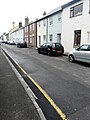
 22, King Charles Square - geograph.org.uk - 5775725.jpg 640 × 426; 59 KB
-
 67c ^ d, York Road - geograph.org.uk - 5709778.jpg 2,448 × 3,264; 2.19 MB
-
 88, Grosvenor Rd - geograph.org.uk - 5775732.jpg 640 × 426; 73 KB
-
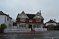
 A former estate house - geograph.org.uk - 5775492.jpg 640 × 425; 56 KB
-
 B2169, Bayham Rd - geograph.org.uk - 5775488.jpg 640 × 426; 60 KB
-
 Bath House, The Pantiles - geograph.org.uk - 5768585.jpg 640 × 426; 75 KB
-
 Bayham Rd, B2169 - geograph.org.uk - 5775485.jpg 640 × 426; 92 KB
-
 Bedford Terrace - geograph.org.uk - 5775528.jpg 640 × 426; 100 KB
-
 Bollards, Calverley Park Crescent - geograph.org.uk - 5770105.jpg 640 × 425; 86 KB
-
 BP filling Station - geograph.org.uk - 5775748.jpg 640 × 426; 57 KB
-
 Broadwater Down - geograph.org.uk - 5775517.jpg 640 × 426; 79 KB
-
 BT Building - geograph.org.uk - 5775734.jpg 640 × 426; 46 KB
-
 Byng Hall - geograph.org.uk - 5797504.jpg 425 × 640; 87 KB
-
 Camden Park - geograph.org.uk - 5770137.jpg 640 × 426; 87 KB
-
 Christian Centre - geograph.org.uk - 5775554.jpg 640 × 426; 46 KB
-
 Church of Christ - geograph.org.uk - 5778125.jpg 640 × 426; 53 KB
-
 Church of St John - geograph.org.uk - 5775742.jpg 425 × 640; 57 KB
-
 Church of St John - geograph.org.uk - 5775750.jpg 640 × 426; 49 KB
-
 Church of St John - geograph.org.uk - 5797496.jpg 426 × 640; 55 KB
-
 Church of St John - geograph.org.uk - 5797501.jpg 640 × 425; 49 KB
-
 Church of St Peter - geograph.org.uk - 5770126.jpg 640 × 550; 66 KB
-

-
 Costa, St John's Rd - geograph.org.uk - 5797510.jpg 640 × 426; 52 KB
-
 Dartford-PID-NoToilet-P1440787 (26080254857).jpg 3,240 × 4,320; 5.39 MB
-
 Dartford-PID-SchoolCarriage-P1440788 (27081832568).jpg 3,240 × 4,320; 5.68 MB
-
 Domino's Pizza - geograph.org.uk - 5797485.jpg 640 × 426; 85 KB
-
 Dover-docks-IMG 5675a.jpg 5,472 × 3,648; 5.02 MB
-

-
 Entrance to Kent ^ Sussex Cemetery - geograph.org.uk - 5775494.jpg 640 × 426; 100 KB
-
 Estate Cottages, Benhall Mill Rd - geograph.org.uk - 5770158.jpg 640 × 426; 74 KB
-
 Estate Cottages, Benhall Mill Rd - geograph.org.uk - 5770160.jpg 640 × 426; 65 KB
-
 Folkestone Harbour Station (geograph 5720442).jpg 640 × 481; 74 KB
-
 Folkestone Harbour Station (geograph 5720479).jpg 480 × 640; 88 KB
-
 Folkestone Harbour Station (geograph 5720488).jpg 640 × 472; 81 KB
-
 Folkestone Harbour Station (geograph 5720500).jpg 640 × 413; 46 KB
-
 Folkestone Harbour Station (geograph 5720571).jpg 640 × 478; 64 KB
-
 Former Congregational Church - geograph.org.uk - 5770078.jpg 640 × 426; 62 KB
-

-
 Fountain and water trough, Calverley Rd - geograph.org.uk - 5770110.jpg 640 × 426; 124 KB
-
 Hanover Baptist Church - geograph.org.uk - 5775551.jpg 640 × 425; 58 KB
-
 Hawkenbury United Reformed Church - geograph.org.uk - 5770150.jpg 640 × 426; 44 KB
-
 Headmaster's House, Skinners' School - geograph.org.uk - 5797507.jpg 640 × 426; 85 KB
-
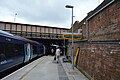
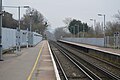 High Brooms Station - geograph.org.uk - 5778128.jpg 640 × 426; 61 KB
-
 High Brooms Station - geograph.org.uk - 5798826.jpg 640 × 426; 68 KB
-
 High Brooms Station - geograph.org.uk - 5798828.jpg 640 × 425; 66 KB
-
 Highbury - geograph.org.uk - 5775529.jpg 640 × 426; 82 KB
-
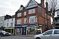
 Hoopers Department Store - geograph.org.uk - 5775535.jpg 640 × 426; 66 KB
-
 Job Centre - geograph.org.uk - 5797489.jpg 640 × 426; 68 KB
-
 Kent ^ Sussex Cemetery - geograph.org.uk - 5770168.jpg 640 × 425; 57 KB
-
 Kent ^ Sussex Cemetery - geograph.org.uk - 5770202.jpg 640 × 426; 74 KB
-
 Kent ^ Sussex Cemetery - geograph.org.uk - 5775479.jpg 640 × 426; 62 KB
-
 King Charles Square - geograph.org.uk - 5797486.jpg 640 × 425; 55 KB
-
 Lamp standards, Lonsdale Gardens - geograph.org.uk - 5775538.jpg 426 × 640; 72 KB
-
 Lodge, Camden Park - geograph.org.uk - 5770138.jpg 640 × 426; 82 KB
-
 Lodge, Camden Park - geograph.org.uk - 5770153.jpg 640 × 426; 82 KB
-
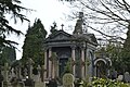 Mauseleum, Kent ^ Sussex Cemetery - geograph.org.uk - 5770208.jpg 640 × 426; 90 KB
-
 One stop, Hawkenbury - geograph.org.uk - 5770142.jpg 640 × 426; 61 KB
-
 OvergroundNetwork-Dartford-P1440707 (40289213605).jpg 3,240 × 4,320; 5.64 MB
-
 Pizza Hut - geograph.org.uk - 5797502.jpg 640 × 426; 52 KB
-
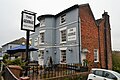
 Prince of Wales - geograph.org.uk - 5770072.jpg 640 × 426; 53 KB
-
 Railway tracks near Eynsford (geograph 5716683).jpg 640 × 480; 78 KB
-
 Royal Victoria Place - geograph.org.uk - 5775545.jpg 640 × 426; 82 KB
-
 Royal Victoria Place - geograph.org.uk - 5797479.jpg 640 × 425; 77 KB
-
 Salvation Army - geograph.org.uk - 5770119.jpg 640 × 425; 67 KB
-
 Sandstone cliff, All Saints' Rise - geograph.org.uk - 5797515.jpg 640 × 426; 123 KB
-

-
 Signal box, Folkestone Harbour Station (geograph 5720453).jpg 640 × 483; 70 KB
-
 Snow, Forge Farm - geograph.org.uk - 5752492.jpg 640 × 359; 36 KB
-
 Snow, High Brooms Station - geograph.org.uk - 5752485.jpg 640 × 425; 79 KB
-
 Southwood Avenue - geograph.org.uk - 5797512.jpg 640 × 426; 70 KB
-
 Spread Eagle - geograph.org.uk - 5770154.jpg 640 × 426; 89 KB
-
 Springhead - geograph.org.uk - 5427574.jpg 640 × 426; 86 KB
-
 St Augustine's Church - geograph.org.uk - 5770104.jpg 640 × 426; 74 KB
-
 St Barnabas Primary School - geograph.org.uk - 5770048.jpg 640 × 426; 61 KB
-
 St John's Close - geograph.org.uk - 5797497.jpg 640 × 426; 70 KB
-
 Station House, High Brooms Station - geograph.org.uk - 5778127.jpg 640 × 426; 57 KB
-
 The Bedford - geograph.org.uk - 5775533.jpg 640 × 426; 68 KB
-
 The Black Horse - geograph.org.uk - 5770061.jpg 640 × 425; 59 KB
-
 The Bull - geograph.org.uk - 5775502.jpg 640 × 426; 51 KB
-
 The Crystal Palace (Closed) - geograph.org.uk - 5770068.jpg 640 × 426; 57 KB
-
 The Dairy - geograph.org.uk - 5775754.jpg 640 × 425; 72 KB
-
 The Dairy - geograph.org.uk - 5797505.jpg 640 × 426; 61 KB
-
 The George - geograph.org.uk - 5775555.jpg 640 × 426; 72 KB
-
 The Great Hall Arcade - geograph.org.uk - 5775722.jpg 640 × 426; 65 KB
-
 The Range - geograph.org.uk - 5775532.jpg 640 × 426; 69 KB
-
 The Royal Oak - geograph.org.uk - 5770115.jpg 640 × 426; 61 KB
-
 The Sussex Arms - geograph.org.uk - 5775521.jpg 640 × 426; 78 KB
-
 The Velo House - geograph.org.uk - 5775729.jpg 640 × 426; 66 KB
-
 TN2, Food ^ Wine - geograph.org.uk - 5775504.jpg 640 × 425; 58 KB
-
 Tunbridge Wells Post Office - geograph.org.uk - 5775546.jpg 640 × 425; 73 KB
-
 Tunbridge Wells Station - geograph.org.uk - 5768579.jpg 640 × 426; 58 KB
-
 Tunbridge Wells Station - geograph.org.uk - 5775531.jpg 640 × 426; 61 KB
-
 Tunbridge Wells Station - geograph.org.uk - 5775536.jpg 407 × 640; 43 KB
-
 Tunbridge Wells Station - geograph.org.uk - 5787367.jpg 640 × 426; 71 KB
-
 Tunbridge Wells War Memorial - geograph.org.uk - 5775543.jpg 426 × 640; 83 KB
-
 Tunbridge Wells War Memorial - geograph.org.uk - 5797477.jpg 640 × 425; 76 KB
-
 Wagamama - geograph.org.uk - 5775539.jpg 640 × 426; 91 KB
-
 Wagamama - geograph.org.uk - 5787370.jpg 640 × 426; 94 KB
-
 War memorial, Kent ^ Sussex Cemetery - geograph.org.uk - 5770231.jpg 640 × 426; 96 KB
-
 War memorial, Kent ^ Sussex Cemetery - geograph.org.uk - 5770234.jpg 426 × 640; 54 KB
-
 Whitstable railway station northside 8202.jpg 4,608 × 3,456; 3.49 MB
.jpg)


.jpg)
.jpg)


.jpg)
.jpg)
.jpg)
.jpg)
.jpg)


.jpg)


.jpg)


.jpg)
.jpg)


_-_geograph.org.uk_-_5770068.jpg)


