Category:Meinier
Jump to navigation
Jump to search
Municipalities of Geneva canton: Aire-la-Ville · Anières · Avully · Avusy · Bardonnex · Bellevue · Bernex · Carouge · Céligny · Chancy · Chêne-Bougeries · Chêne-Bourg · Choulex · Collex-Bossy · Collonge-Bellerive · Cologny · Confignon · Corsier · Dardagny · Ville de Genève · Genthod · Hermance · Jussy · Laconnex · Lancy · Le Grand-Saconnex · Meinier · Meyrin · Onex · Perly-Certoux · Plan-les-Ouates · Pregny-Chambésy · Presinge · Puplinge · Russin · Satigny · Thônex · Troinex · Vandœuvres · Vernier · Versoix · Veyrier
Former municipalities of Geneva canton: Compesières · Les Eaux-Vives · Les Trois-Chêne · Petit-Saconnex · Plainpalais
Former municipalities of Geneva canton: Compesières · Les Eaux-Vives · Les Trois-Chêne · Petit-Saconnex · Plainpalais
municipality in Switzerland | |||||
| Upload media | |||||
| Instance of | |||||
|---|---|---|---|---|---|
| Location | Canton of Geneva, Switzerland | ||||
| Official language | |||||
| Head of government |
| ||||
| Population |
| ||||
| Area |
| ||||
| Elevation above sea level |
| ||||
| official website | |||||
 | |||||
Subcategories
This category has the following 4 subcategories, out of 4 total.
Media in category "Meinier"
The following 44 files are in this category, out of 44 total.
-
Carre d'Aval panneau 1.12 zoom.jpg 4,000 × 3,000; 4.66 MB
-
Carre d'Aval panneau 1.12.jpg 4,000 × 3,000; 4.79 MB
-
Carre d'Aval panneaux 1.01 5.01 zoom.jpg 4,000 × 3,000; 4.76 MB
-
Carre d'Aval panneaux 1.01 5.01.jpg 4,000 × 3,000; 4.75 MB
-
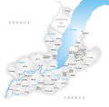
Carte commune Meinier 2007.png 1,476 × 1,446; 579 KB
-
CHE Meinier Flag.svg 750 × 750; 11 KB
-
CHE Meinier Logo.png 740 × 160; 36 KB
-
CheminDeLaDameBlanche Rouelbeau-Meinier-Geneva RomanDeclert20210206.jpg 4,128 × 2,322; 4.25 MB
-
Château de Rouelbeau @ Meinier (50829350263).jpg 6,240 × 4,160; 10.51 MB
-
ETH-BIB-Choulex, Presinge v. O. aus 2500 m-Inlandflüge-LBS MH01-005930.tif 5,777 × 4,016; 66.53 MB
-
Flag of Meinier.gif 216 × 216; 3 KB
-
Karte Gemeinde Meinier 2007.png 1,476 × 1,446; 692 KB
-
Karte Gemeinde Meinier-fr 2007.png 944 × 926; 243 KB
-
Karte Gemeinde Meinier.png 944 × 926; 263 KB
-
CHE Meinier COA.svg 720 × 820; 5 KB
-
Meinier panneau 1.03 zoom.jpg 3,000 × 4,000; 5.02 MB
-
Meinier panneau 1.03.jpg 4,000 × 3,000; 4.61 MB
-
Meinier panneau 1.04 zoom.jpg 4,000 × 3,000; 4.84 MB
-
Meinier panneau 1.04.jpg 4,000 × 3,000; 4.9 MB
-
Meinier-coat of arms.svg 603 × 763; 19 KB
-
Meinier. Dettaglio di un muro delle rovine del castello di Rouelbeau (DOI 23747).jpg 3,000 × 2,052; 892 KB
-
Meinier. Dettaglio di un muro delle rovine del castello di Rouelbeau.jpg 3,000 × 2,051; 1.01 MB
-
Meinier. Rovine del castello di Rouelbeau (DOI 23749).jpg 3,000 × 2,069; 831 KB
-
Meinier. Rovine del castello di Rouelbeau (DOI 23750).jpg 3,000 × 2,017; 895 KB
-
Meinier. Rovine del castello di Rouelbeau.jpg 3,000 × 2,037; 738 KB
-
Meinier. Sentiero di ingresso alle rovine del castello di Rouelbeau.jpg 3,000 × 2,079; 1.05 MB
-
Noms locaux Meinier.png 1,925 × 2,420; 2.13 MB
-
Panneau 1.03 Meinier.jpg 4,000 × 3,000; 4.85 MB
-
Panneau 2.13 zoom.jpg 4,000 × 3,000; 4.75 MB
-
Panneau 2.13.jpg 4,000 × 3,000; 4.57 MB
-
Panneau 4.51.1.jpg 3,000 × 4,000; 4.64 MB
-
Panneau suisse 1.07 à Meinier.jpg 4,000 × 3,000; 4.59 MB
-
Panneau suisse 3.04 route de Jussy.jpg 3,928 × 2,905; 3.43 MB
-
Panneau suisse 4.91 à Meinier.jpg 4,000 × 3,000; 4.81 MB
-
Panneaux 2.30.1, 4.29, 1.25, 6.30, entrée de Compois.jpg 3,000 × 4,000; 4.76 MB
-
Route de Jussy limitation à 60.jpg 4,000 × 3,000; 4.55 MB
-
Signal routier suisse 2.30 vitesse maximale 50.jpg 5,472 × 3,648; 9.17 MB
-
Signal routier suisse 2.30 vitesse maximale 70.jpg 5,472 × 3,648; 7.65 MB
-
Signal routier suisse de giratoire sur route secondaire.jpg 5,472 × 3,648; 9.09 MB
-
Signaux routiers suisses 1.32 et 6.30 01.jpg 5,472 × 3,648; 9.03 MB
-
Signaux routiers suisses 1.32 et 6.30 02.jpg 5,472 × 3,648; 8.76 MB
-
Signaux routiers suisses 1.32 et 6.30 et bande cyclable.jpg 5,472 × 3,648; 8.71 MB
-
Summer wheat under Mt. Blanc.jpg 3,024 × 4,032; 1.71 MB


