Category:Melbecks
Jump to navigation
Jump to search
civil parish in Richmondshire, North Yorkshire, England  | |||||
| Upload media | |||||
| Instance of |
| ||||
|---|---|---|---|---|---|
| Location | Richmondshire, North Yorkshire, Yorkshire and the Humber, England | ||||
| Population |
| ||||
 | |||||
Subcategories
This category has the following 5 subcategories, out of 5 total.
Media in category "Melbecks"
The following 200 files are in this category, out of 659 total.
(previous page) (next page)-
 "I" Shaped Grouse Butt on Long Brae - geograph.org.uk - 3521888.jpg 3,809 × 2,438; 3.31 MB
-
 'Glory Be', Blades (geograph 5815845).jpg 1,024 × 768; 227 KB
-
 'Holme View' beside B6270 - geograph.org.uk - 5129852.jpg 1,024 × 683; 157 KB
-
-
 'Norman' arches - geograph.org.uk - 5121043.jpg 5,184 × 3,888; 5.76 MB
-
 'Robingate' set back on the north side of B6270 - geograph.org.uk - 5130459.jpg 1,024 × 672; 206 KB
-
 'Spring Cottage' beside B6270 - geograph.org.uk - 5129413.jpg 1,024 × 658; 150 KB
-
 'The Old School' - geograph.org.uk - 5129495.jpg 1,024 × 683; 250 KB
-
 'Toledo', beside B6270 - geograph.org.uk - 5129449.jpg 1,024 × 683; 172 KB
-
 2013 Surrender Bridge Healaugh North Yorkshire.jpg 3,136 × 2,091; 4.32 MB
-
 A pressing thought - geograph.org.uk - 2920661.jpg 1,600 × 1,200; 484 KB
-
 A row of Bouse Teams at Victoria Level - geograph.org.uk - 5139875.jpg 3,000 × 4,000; 3.67 MB
-
 Abandoned stone breaker - geograph.org.uk - 2765460.jpg 640 × 425; 359 KB
-
 Above Gunnerside - geograph.org.uk - 6627832.jpg 1,600 × 1,200; 505 KB
-
 Above Gunnerside - geograph.org.uk - 6657037.jpg 1,600 × 1,200; 301 KB
-
 Above the spoil - geograph.org.uk - 5121041.jpg 5,184 × 3,888; 5.48 MB
-
 Adit, Bunton (or Bunting) Level - geograph.org.uk - 2702021.jpg 425 × 640; 217 KB
-
 Air Receiver - geograph.org.uk - 1752504.jpg 1,600 × 1,200; 626 KB
-
 Another barn to check - geograph.org.uk - 4335842.jpg 3,944 × 2,924; 2.84 MB
-
 Approaching Gunnerside - geograph.org.uk - 5721748.jpg 1,600 × 1,059; 375 KB
-
 Approaching Gunnerside - geograph.org.uk - 6000963.jpg 1,600 × 1,067; 302 KB
-
 Approaching storm, Swaledale - geograph.org.uk - 2285001.jpg 2,816 × 2,112; 1.31 MB
-
 Approaching Surrender Bridge from the North - geograph.org.uk - 5611966.jpg 5,184 × 3,456; 6.9 MB
-
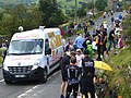 Arrival of la Caravanne Publicitaire - geograph.org.uk - 4060313.jpg 640 × 480; 511 KB
-
 Ash Pot Gutter - geograph.org.uk - 2006358.jpg 640 × 480; 95 KB
-
 Ash Pot Gutter draining east from the Melbecks Moor track - geograph.org.uk - 6516241.jpg 3,648 × 5,472; 5.69 MB
-
 Ash tree and wall junction - geograph.org.uk - 4702520.jpg 3,648 × 5,472; 3.17 MB
-
 Ashpots Level - geograph.org.uk - 5139867.jpg 3,618 × 2,002; 1.88 MB
-
 B6270 below Friar Intake - geograph.org.uk - 5096007.jpg 1,024 × 683; 218 KB
-
 B6270 heading east at Rowleth Wath - geograph.org.uk - 5095934.jpg 1,024 × 683; 271 KB
-
 B6270 heading for Gunnerside - geograph.org.uk - 5129351.jpg 1,024 × 683; 181 KB
-
 B6270 Heading West towards Low Row - geograph.org.uk - 5611710.jpg 5,184 × 3,456; 4.57 MB
-
 B6270 south of Gunnerside - geograph.org.uk - 3145607.jpg 1,500 × 1,125; 2.02 MB
-
 B6270, Low Row - geograph.org.uk - 2584544.jpg 640 × 480; 134 KB
-
 B6270, Strands - geograph.org.uk - 2195948.jpg 640 × 480; 73 KB
-
 Barf End Farmhouse, Dated 1731 - geograph.org.uk - 3521941.jpg 4,000 × 3,000; 3.53 MB
-
 Barn at Gunnerside - geograph.org.uk - 4335876.jpg 4,000 × 3,000; 2.45 MB
-
 Barn at Ivelet - geograph.org.uk - 2571579.jpg 2,448 × 2,176; 879 KB
-
 Barn at Ivelet - geograph.org.uk - 4335863.jpg 3,882 × 2,318; 2.84 MB
-
 Barn beside B6270 at Mouse Hall - geograph.org.uk - 5095968.jpg 1,024 × 683; 219 KB
-
 Barn beside B6270 near Wood End - geograph.org.uk - 5130428.jpg 1,024 × 683; 229 KB
-
 Barn built against hillside at Gunnerside - geograph.org.uk - 4335885.jpg 4,000 × 3,000; 3.15 MB
-
 Barn close to valley floor of Swaledale - geograph.org.uk - 5885137.jpg 1,500 × 1,125; 1.94 MB
-
 Barn in field near to Blades - geograph.org.uk - 5496525.jpg 1,500 × 1,125; 1.88 MB
-
 Barn near Birbeck Wood - geograph.org.uk - 2927667.jpg 640 × 427; 212 KB
-
 Barn near Rutter Wood - geograph.org.uk - 2927647.jpg 640 × 427; 246 KB
-
 Barn near Rutter Wood - geograph.org.uk - 2927650.jpg 640 × 427; 229 KB
-
 Barn, The Park, Swaledale - geograph.org.uk - 5379780.jpg 600 × 800; 115 KB
-
 Barney Beck - geograph.org.uk - 4921526.jpg 3,240 × 4,320; 5.55 MB
-

-
 Barney Beck footbridge - geograph.org.uk - 4136530.jpg 4,320 × 3,240; 5.16 MB
-
 Barney Beck from High Bridge - geograph.org.uk - 4921515.jpg 3,240 × 4,320; 5.03 MB
-
 Barns, Swaledale - geograph.org.uk - 6382198.jpg 2,000 × 969; 2.26 MB
-
 Beck in Flincher Gill - geograph.org.uk - 2824743.jpg 2,448 × 3,264; 2.24 MB
-
 Bench Mark, Strands Farmhouse - geograph.org.uk - 2195941.jpg 480 × 640; 101 KB
-
 Benchmark on 'foxgloves', Gunnerside - geograph.org.uk - 5095555.jpg 683 × 1,024; 228 KB
-
 Benchmark on 'Holme View' - geograph.org.uk - 5129850.jpg 683 × 1,024; 277 KB
-
 Benchmark on 'Robingate' - geograph.org.uk - 5130450.jpg 683 × 1,024; 220 KB
-
 Benchmark on 'Spring Cottage' - geograph.org.uk - 5129399.jpg 683 × 1,024; 298 KB
-
 Benchmark on 'The Old School' - geograph.org.uk - 5129480.jpg 1,024 × 655; 265 KB
-
 Benchmark on 'Toledo' - geograph.org.uk - 5129427.jpg 683 × 1,024; 268 KB
-
 Benchmark on barn at Mouse Hall - geograph.org.uk - 5095949.jpg 672 × 1,024; 255 KB
-
 Benchmark on barn near Wood End - geograph.org.uk - 5130414.jpg 1,024 × 683; 348 KB
-
 Benchmark on door jamb of Wardell Hall - geograph.org.uk - 5129509.jpg 637 × 1,024; 280 KB
-
-
 Benchmark on parapet of Isles Bridge - geograph.org.uk - 5096172.jpg 683 × 1,024; 248 KB
-
 Benchmark on roadside wall near Isles - geograph.org.uk - 5096136.jpg 683 × 1,024; 300 KB
-
-

-
 Benchmark on stone outbuilding - geograph.org.uk - 5129842.jpg 1,024 × 683; 260 KB
-
 Benchmark on Strands House - geograph.org.uk - 5069642.jpg 683 × 1,024; 272 KB
-
 Benchmark on the Methodist Chapel - geograph.org.uk - 5069490.jpg 1,024 × 683; 316 KB
-
 Benchmark on Trough House - geograph.org.uk - 5130048.jpg 1,024 × 683; 227 KB
-
 Benchmark on United Reformed Church - geograph.org.uk - 5129362.jpg 1,024 × 683; 254 KB
-
 Benchmark on wall beside B6270 at Rowleth Wath - geograph.org.uk - 5095878.jpg 1,024 × 683; 297 KB
-
 Benchmark on wall on north side of B6270 - geograph.org.uk - 5146476.jpg 683 × 1,024; 201 KB
-

-
 Birk Park from near Nova Scotia - geograph.org.uk - 4089469.jpg 4,320 × 3,240; 2.48 MB
-
 Blades from the north-east - geograph.org.uk - 5815527.jpg 1,024 × 768; 198 KB
-
 Blakethwaite Gill - geograph.org.uk - 2189061.jpg 2,000 × 1,271; 1.99 MB
-
 Blakethwaite Gill - geograph.org.uk - 2765449.jpg 640 × 425; 463 KB
-
 Blakethwaite Mine ruins - geograph.org.uk - 2614367.jpg 480 × 640; 125 KB
-
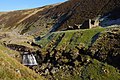
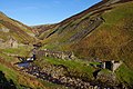
 Blakethwaite Smelt Mill - geograph.org.uk - 2703350.jpg 640 × 425; 194 KB
-
 Blakethwaite Smelt Mill - geograph.org.uk - 2703355.jpg 640 × 425; 233 KB
-
 Blakethwaite Smelt Mill - geograph.org.uk - 2703359.jpg 640 × 425; 221 KB
-
 Blakethwaite Smelt Mill - geograph.org.uk - 2765443.jpg 640 × 425; 436 KB
-
 Blakethwaite Smelt Mill - geograph.org.uk - 2765448.jpg 640 × 425; 407 KB
-
 Blakethwaite Smelt Mill Chimney - geograph.org.uk - 3522006.jpg 4,000 × 3,000; 3.53 MB
-
 Blakethwaite Smelt Mill Peat Store - geograph.org.uk - 1094894.jpg 640 × 480; 135 KB
-
 Blakethwaite Smelt Mine - geograph.org.uk - 5209711.jpg 640 × 480; 125 KB
-
 Blind Gill Level - geograph.org.uk - 3521991.jpg 3,000 × 4,000; 3.14 MB
-
 Blooming heather on Brownsey Moor - geograph.org.uk - 5498712.jpg 1,500 × 902; 1.17 MB
-
 Boardwalk Bridge over minor stream - geograph.org.uk - 5173535.jpg 4,000 × 3,000; 3.51 MB
-
 Botcher Gill - geograph.org.uk - 3429664.jpg 427 × 640; 255 KB
-
 Botcher Gill - geograph.org.uk - 3429666.jpg 427 × 640; 253 KB
-
 Botcher Gill - geograph.org.uk - 6627830.jpg 1,600 × 1,200; 710 KB
-
 Bouse Teams - geograph.org.uk - 2927663.jpg 640 × 427; 293 KB
-
 Bouse teams, Bunton (or Bunting) Level - geograph.org.uk - 2702018.jpg 640 × 425; 249 KB
-
 Bouse teams, Bunton (or Bunting) Level - geograph.org.uk - 2702022.jpg 640 × 425; 203 KB
-
 Bouseteams, Bunting Level - geograph.org.uk - 890986.jpg 640 × 480; 319 KB
-
 Bridge over Ashpots Gutter - geograph.org.uk - 5139877.jpg 4,000 × 3,000; 3.47 MB
-
 Bridge over Hard Level Gill - geograph.org.uk - 2088819.jpg 2,048 × 1,536; 1.33 MB
-
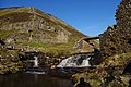
 Bridge over Mill Gill - geograph.org.uk - 2765467.jpg 640 × 425; 413 KB
-
 Bridge over River Swale - geograph.org.uk - 3508005.jpg 720 × 960; 225 KB
-
 Bridleway above Hard Level Gill - geograph.org.uk - 2006365.jpg 640 × 480; 87 KB
-
 Bridleway Above the River Swale - geograph.org.uk - 1358930.jpg 640 × 427; 141 KB
-
 Bridleway alongside Hard Level Gill - geograph.org.uk - 2866850.jpg 1,024 × 768; 169 KB
-
 Bridleway ford, Flincher Gill - geograph.org.uk - 2866869.jpg 1,024 × 768; 166 KB
-
 Bridleway ford, Flincher Gill - geograph.org.uk - 2866895.jpg 1,024 × 768; 182 KB
-
 Bridleway into Gunnerside Gill - geograph.org.uk - 2921507.jpg 3,000 × 2,667; 1.66 MB
-
 Bridleway near Level House - geograph.org.uk - 2088836.jpg 2,048 × 1,536; 1.26 MB
-
 Bridleway on Low Row Pasture - geograph.org.uk - 2006290.jpg 640 × 480; 73 KB
-
 Bridleway over Stoops Rigg - geograph.org.uk - 3480464.jpg 3,000 × 4,000; 2.61 MB
-
 Bridleway, Low Row - geograph.org.uk - 2195925.jpg 640 × 480; 84 KB
-
 Brockma Gill - geograph.org.uk - 1358799.jpg 600 × 398; 100 KB
-
 Brownberry - geograph.org.uk - 2006310.jpg 640 × 480; 88 KB
-
 Brownberry - geograph.org.uk - 5497102.jpg 1,500 × 1,125; 1.96 MB
-
 Brownberry above Swaledale - geograph.org.uk - 4702572.jpg 5,472 × 3,000; 2.51 MB
-
 Brownsey - geograph.org.uk - 2775667.jpg 640 × 480; 62 KB
-
 Brownsey End - geograph.org.uk - 2775674.jpg 640 × 480; 91 KB
-
 Brownsey End and old lead workings - geograph.org.uk - 5140251.jpg 3,970 × 1,757; 1.27 MB
-
 Brownsey House - geograph.org.uk - 4335818.jpg 4,000 × 3,000; 2.71 MB
-
 Brownsey Level - geograph.org.uk - 3479288.jpg 2,987 × 3,248; 2.5 MB
-
 Bunton (or Bunting) Level - geograph.org.uk - 2702016.jpg 640 × 425; 189 KB
-
 Bunton (or Bunting) Level - geograph.org.uk - 2702017.jpg 640 × 425; 170 KB
-
 Bunton (or Bunting) Level - geograph.org.uk - 2702020.jpg 640 × 425; 172 KB
-
 Bunton (or Bunting) Level - geograph.org.uk - 2765440.jpg 640 × 425; 429 KB
-
 Bunton Crushing Mill - geograph.org.uk - 2905197.jpg 640 × 427; 247 KB
-
 Bunton Hush - geograph.org.uk - 3429675.jpg 427 × 640; 246 KB
-
 Bunton Hush above the entrance to Bunton Level - geograph.org.uk - 4702388.jpg 3,648 × 5,472; 4.65 MB
-
 Bunton Level lead mine, Gunnerside Gill - geograph.org.uk - 2006753.jpg 640 × 480; 121 KB
-
 Cantrells Barn north of Blades (geograph 5815666).jpg 1,024 × 768; 222 KB
-
 Caravan at Home Farm - geograph.org.uk - 6541303.jpg 2,000 × 1,237; 2.62 MB
-

-

-
 Church ruin, Isles - geograph.org.uk - 1258285.jpg 640 × 480; 99 KB
-
 Clean water, Dirty Spot - geograph.org.uk - 2921625.jpg 2,782 × 2,569; 1.33 MB
-
 Clinging to the cliff - geograph.org.uk - 2073007.jpg 2,448 × 3,264; 2.02 MB
-
 Close up of Stone Breaker - geograph.org.uk - 890851.jpg 640 × 427; 245 KB
-

-
 Collapsed mineshaft below Friarfold Rake - geograph.org.uk - 4702188.jpg 3,648 × 5,472; 3.52 MB
-
 Come to Gunnerside for a fowl holiday - geograph.org.uk - 2945755.jpg 4,000 × 2,406; 2.53 MB
-
 Concrete ford through Ash Pot Gutter - geograph.org.uk - 3521866.jpg 4,000 × 3,000; 3.03 MB
-
 Concrete River Defence - geograph.org.uk - 5173565.jpg 3,000 × 4,000; 4.45 MB
-
 Confluence of Gunnerside Beck and River Swale - geograph.org.uk - 6000954.jpg 1,600 × 1,067; 423 KB
-
 Coppiced ash trees at Marble Scar - geograph.org.uk - 2860723.jpg 1,024 × 768; 234 KB
-
 Cottages and fields, Blades - geograph.org.uk - 5378651.jpg 640 × 480; 100 KB
-
 Country lane in winter - geograph.org.uk - 1728818.jpg 518 × 389; 140 KB
-

-
 Crossroads north of Feetham - geograph.org.uk - 2578186.jpg 640 × 480; 98 KB
-
 Crushing mill, Bunton (or Bunting) Level - geograph.org.uk - 2702023.jpg 640 × 425; 213 KB
-
 Crushing mill, Bunton (or Bunting) Level - geograph.org.uk - 2702024.jpg 640 × 425; 201 KB
-
 Crushing mill, Dolly Lead Level - geograph.org.uk - 2703365.jpg 640 × 425; 160 KB
-

-
 Cyclist on the bridleway to Botcher Gill Gate - geograph.org.uk - 2867669.jpg 1,024 × 768; 137 KB
-
 Daleside barn at Heights - geograph.org.uk - 2956373.jpg 3,966 × 2,000; 1.41 MB
-
 Decaying buildings at Brownsey - geograph.org.uk - 3479467.jpg 4,000 × 3,000; 2.54 MB
-
 Derelict cottage (2) at Kearton - geograph.org.uk - 4315085.jpg 4,000 × 3,000; 2.74 MB
-
 Derelict cottage at Kearton - geograph.org.uk - 4315078.jpg 4,000 × 3,000; 2.68 MB
-
 Derelict Enclosure at Disused Mine Workings - geograph.org.uk - 4109661.jpg 4,000 × 3,000; 2.94 MB
-
 Derelict Mine Buildings at Lownathwaite Mea - geograph.org.uk - 4109663.jpg 4,000 × 3,000; 4.48 MB
-
 Descending into the dale - geograph.org.uk - 2921619.jpg 3,886 × 2,445; 1.36 MB
-
 Descent to Heights - geograph.org.uk - 1358944.jpg 640 × 427; 130 KB
-
 Disused Barn above Swaledale - geograph.org.uk - 1358814.jpg 640 × 427; 148 KB
-
 Disused bridge across Gunnerside Gill - geograph.org.uk - 1728858.jpg 518 × 389; 171 KB
-
 Disused mine buildings, Gunnerside Gill - geograph.org.uk - 2383174.jpg 640 × 480; 123 KB
-
 Doctor Gill - geograph.org.uk - 2088807.jpg 2,048 × 1,536; 1.61 MB
-
 Doctor Gill - geograph.org.uk - 838591.jpg 427 × 640; 326 KB
-
 Dolly Lead Level - geograph.org.uk - 890873.jpg 427 × 640; 388 KB
-
 Drifting smoke over the moor - geograph.org.uk - 6020640.jpg 4,319 × 2,470; 2.06 MB
-
 Dropping down into Dyke Heads - geograph.org.uk - 5802795.jpg 4,608 × 3,456; 6.87 MB
-

-
 Dry stone wall beside B6270 east of Robingate - geograph.org.uk - 5146483.jpg 1,024 × 683; 304 KB
-

-
 Dry Stone Wall Corner - geograph.org.uk - 2905188.jpg 640 × 427; 275 KB
-
 Dry stone wall on Middle Bank - geograph.org.uk - 3145932.jpg 1,500 × 1,125; 1.3 MB
-
 Drystone zigzag - geograph.org.uk - 2860807.jpg 1,024 × 768; 198 KB
-
 Dwellings and barns at Winterings - geograph.org.uk - 2921524.jpg 3,985 × 2,000; 1.39 MB
-
 Dyke Heads Farm - geograph.org.uk - 3430005.jpg 640 × 427; 207 KB
-
 East Brocca - geograph.org.uk - 6630190.jpg 1,486 × 1,192; 599 KB
-
 Elias's Stot Wood - geograph.org.uk - 2291223.jpg 1,024 × 768; 123 KB
-
 Erosion on the bank of the Swale - geograph.org.uk - 2860754.jpg 1,024 × 768; 216 KB
-
 Estate road with grouse butts near Cross Gill - geograph.org.uk - 3354839.jpg 1,500 × 1,125; 1.48 MB
-
 Evidence of use - geograph.org.uk - 1727913.jpg 518 × 389; 148 KB
-
 Eweleap Scar - geograph.org.uk - 4702262.jpg 5,472 × 3,648; 4.7 MB
-
 Eweleap Scar - geograph.org.uk - 5209716.jpg 640 × 480; 124 KB
-
 Eweleap Scar - geograph.org.uk - 890946.jpg 640 × 427; 247 KB
-
 Eweleap Scar, Blakethwaite Gill - geograph.org.uk - 2614354.jpg 640 × 480; 139 KB
-
 Excavation on north side of hill road - geograph.org.uk - 5938405.jpg 2,000 × 1,297; 2.29 MB
-
 Exhaustion sets in at Feetham - geograph.org.uk - 4315117.jpg 4,000 × 3,000; 3.22 MB
-
 Farm building at Winterings - geograph.org.uk - 5427217.jpg 640 × 480; 87 KB
-
 Farmhouse and barns at Dyke Heads - geograph.org.uk - 2945790.jpg 3,980 × 2,000; 1.28 MB
-
 Farmhouse at Bents - geograph.org.uk - 4306641.jpg 3,995 × 2,000; 1.45 MB
-
 Feetham - geograph.org.uk - 5611719.jpg 5,184 × 3,456; 7.11 MB
-
 Feetham above the River Swale - geograph.org.uk - 6121730.jpg 1,600 × 1,067; 240 KB
-
 Feetham from High Lane - geograph.org.uk - 6052315.jpg 4,320 × 3,239; 2.87 MB
-

-
 Fence Post, Flincher Gill - geograph.org.uk - 838643.jpg 640 × 427; 365 KB
-
 Fenced Off Mine Shaft, Melbrecks Moor - geograph.org.uk - 890865.jpg 640 × 427; 239 KB
-
 Field barn in winter - geograph.org.uk - 1728849.jpg 518 × 389; 164 KB

.jpg)


_Level_-_geograph.org.uk_-_2702021.jpg)


_Level_-_geograph.org.uk_-_2702018.jpg)
_Level_-_geograph.org.uk_-_2702022.jpg)


_Level_-_geograph.org.uk_-_2702016.jpg)
_Level_-_geograph.org.uk_-_2702017.jpg)
_Level_-_geograph.org.uk_-_2702020.jpg)
_Level_-_geograph.org.uk_-_2765440.jpg)


.jpg)


_Level_-_geograph.org.uk_-_2702023.jpg)
_Level_-_geograph.org.uk_-_2702024.jpg)


_at_Kearton_-_geograph.org.uk_-_4315085.jpg)


