Category:Metropolitan Borough of Calderdale
Jump to navigation
Jump to search

metropolitan borough in West Yorkshire, United Kingdom   | |||||
| Upload media | |||||
| Instance of | |||||
|---|---|---|---|---|---|
| Location | West Yorkshire, Yorkshire and the Humber, England | ||||
| Capital | |||||
| Legislative body |
| ||||
| Inception |
| ||||
| Population |
| ||||
| Area |
| ||||
| official website | |||||
 | |||||
Subcategories
This category has the following 31 subcategories, out of 31 total.
*
H
R
S
T
W
Media in category "Metropolitan Borough of Calderdale"
The following 152 files are in this category, out of 152 total.
-

-
 A plethora of signs on the A58 - geograph.org.uk - 6419392.jpg 2,000 × 1,365; 3.51 MB
-
 A58 on the edge of Lightcliffe - geograph.org.uk - 6419312.jpg 2,000 × 1,023; 2.89 MB
-

-

-
 Bottom Hall Beck, Bailiff Bridge - geograph.org.uk - 6411327.jpg 2,000 × 1,500; 2.25 MB
-
 Bottom Viaduct - geograph.org.uk - 6419387.jpg 2,000 × 900; 2.18 MB
-
 Brighouse Footpath 64 (east branch) - geograph.org.uk - 6348371.jpg 2,000 × 1,500; 1.7 MB
-
 Brighouse Footpath 64 (east branch) - geograph.org.uk - 6348376.jpg 2,000 × 1,501; 1.47 MB
-
 Brighouse Footpath 64 (east branch) from Footpath 64 - geograph.org.uk - 6348131.jpg 2,000 × 1,500; 1.83 MB
-
 Brighouse Footpath 64-1 - geograph.org.uk - 6348384.jpg 2,000 × 1,500; 1.55 MB
-
 Brighouse Methodist Church and Sunday School - geograph.org.uk - 6349797.jpg 2,000 × 2,000; 1.26 MB
-
 Brighouse Wood Row approaching Brighouse Wood Lane - geograph.org.uk - 6348796.jpg 2,000 × 1,330; 1.18 MB
-
 Building work on Station Road, Norwood Green - geograph.org.uk - 6417432.jpg 2,000 × 1,047; 2.47 MB
-
 Bungalows on Close Lea, Rastrick - geograph.org.uk - 6407953.jpg 800 × 600; 119 KB
-

-

-
 Calder ^ Hebble Navigation, Elland - geograph.org.uk - 6407744.jpg 800 × 569; 100 KB
-
 Chapel Lane, Norwood Green - geograph.org.uk - 6419008.jpg 2,000 × 1,009; 2.62 MB
-
 Christmas flowers, Church Lane, Brighouse - geograph.org.uk - 6354458.jpg 2,000 × 2,000; 1.8 MB
-
 Climbing wall on a former grain silo, Brighouse - geograph.org.uk - 6394135.jpg 1,500 × 2,000; 945 KB
-
 Coley Beck - geograph.org.uk - 6419224.jpg 1,331 × 2,000; 4.24 MB
-
 Cottages and The Tower, Brighouse - geograph.org.uk - 6348813.jpg 2,000 × 2,000; 1.75 MB
-
 Crumbling outbuilding, Rookes Hall, Norwood Green - geograph.org.uk - 6419409.jpg 2,000 × 1,154; 1.5 MB
-

-

-
 Derelict seat near Ganny Lock, Brighouse - geograph.org.uk - 6348880.jpg 2,000 × 1,500; 1.75 MB
-
 Dewsbury Road (B6114), Elland - geograph.org.uk - 6407836.jpg 800 × 600; 109 KB
-
 Disused viaduct crossing Whitehall Road (A58) - geograph.org.uk - 6416941.jpg 2,000 × 1,331; 2.86 MB
-

-
 Drain and Hebble Brook, Halifax - geograph.org.uk - 6407479.jpg 800 × 600; 230 KB
-
 Dumb Steeple - geograph.org.uk - 6347895.jpg 2,000 × 1,095; 2.78 MB
-
 Dumb Steeple - geograph.org.uk - 6347896.jpg 1,340 × 2,000; 4.14 MB
-
 Elland Viaduct Bridge - geograph.org.uk - 6407671.jpg 800 × 600; 138 KB
-
 Elland Viaduct Bridge - geograph.org.uk - 6407699.jpg 800 × 574; 130 KB
-
 Entrance to a subway under Ludenscheid Link, Brighouse - geograph.org.uk - 6349853.jpg 2,000 × 1,500; 1.88 MB
-
 Entrance to Park Wood Crematorium - geograph.org.uk - 6407690.jpg 800 × 499; 118 KB
-
 Exley Lane - geograph.org.uk - 6407627.jpg 800 × 600; 211 KB
-
 Exley Lane, Elland - geograph.org.uk - 6407929.jpg 640 × 521; 124 KB
-
 Fairway House, 18-20 Bethel Street, Brighouse - geograph.org.uk - 6400213.jpg 2,000 × 1,732; 1,024 KB
-
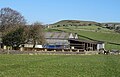 Farm buildings, Upper Exley - geograph.org.uk - 6407489.jpg 800 × 513; 132 KB
-
 Farmland, Toothill Bank - geograph.org.uk - 6408183.jpg 800 × 600; 123 KB
-
 Field by Syke Lane, Priestley Green - geograph.org.uk - 6419303.jpg 2,000 × 884; 1.84 MB
-
 Fields alongside Rookes Lane, Norwood Green - geograph.org.uk - 6419404.jpg 2,000 × 1,163; 3.05 MB
-
 Flood mark on a garden wall, Brighouse - geograph.org.uk - 6360178.jpg 2,000 × 1,497; 1.2 MB
-
 Footpath between the church and Waterloo Road, Brighouse - geograph.org.uk - 6346943.jpg 2,000 × 1,500; 1.66 MB
-
 Footpath from Halifax Road to Bank Street, Brighouse - geograph.org.uk - 6349661.jpg 2,000 × 1,500; 1.9 MB
-
 Footpath from Rydings Avenue to Halifax Road - geograph.org.uk - 6356710.jpg 2,000 × 1,500; 1.29 MB
-

-
 Footpath leaving Norwood Green Hill, Norwood Green - geograph.org.uk - 6419081.jpg 1,650 × 2,000; 4.55 MB
-

-
 Former lane to Slead Sike Mill (Woollen), Brighouse - geograph.org.uk - 6347787.jpg 2,000 × 1,500; 1.38 MB
-

-

-
 Grazing off Exley Lane - geograph.org.uk - 6407626.jpg 640 × 480; 71 KB
-
 Grazing, Elland Upper Edge - geograph.org.uk - 6407860.jpg 640 × 480; 85 KB
-
 Green Royd Farm House, Norwood Green - geograph.org.uk - 6416967.jpg 2,000 × 1,427; 3.39 MB
-
 Hall Street, Brighouse - geograph.org.uk - 6400957.jpg 1,543 × 2,000; 893 KB
-
 House on Park Road - geograph.org.uk - 6407677.jpg 800 × 587; 104 KB
-
 House on Southowram Bank, Halifax - geograph.org.uk - 6407159.jpg 640 × 460; 80 KB
-
 Houses on the site of the Fire Station, Brighouse - geograph.org.uk - 6355560.jpg 2,000 × 1,198; 721 KB
-
 HSBC Bank, Market Street frontage, Brighouse - geograph.org.uk - 6400172.jpg 2,000 × 1,446; 772 KB
-

-
 Lamp post in a field, Brighouse - geograph.org.uk - 6348136.jpg 2,000 × 1,335; 1.47 MB
-
 Lane Head Hotel, Brighouse Wood Lane, Brighouse - geograph.org.uk - 6355492.jpg 2,000 × 1,335; 883 KB
-
 Lane off High Street, Brighouse - geograph.org.uk - 6356736.jpg 2,000 × 1,499; 1.52 MB
-
 Looking across the fields to Wyke - geograph.org.uk - 6417034.jpg 2,000 × 1,331; 3.72 MB
-
 Ludensceid Link. Brighouse - geograph.org.uk - 6350362.jpg 1,955 × 1,467; 1.38 MB
-
 M62 seen from Green Lane footbridge - geograph.org.uk - 6403186.jpg 2,000 × 1,331; 2.01 MB
-
 Market Street, Brighouse - geograph.org.uk - 6417472.jpg 2,000 × 1,206; 2.79 MB
-

-

-
 Memorial seat decorated for Christmas, Brighouse - geograph.org.uk - 6347725.jpg 2,000 × 1,500; 1.02 MB
-

-
 New retail unit, Lawson Road, Brighouse - geograph.org.uk - 6350387.jpg 1,895 × 1,209; 913 KB
-
 Nordgreen Nurseries, Whitehall Road (A58) - geograph.org.uk - 6416945.jpg 2,000 × 1,089; 2.49 MB
-
 Nordgreen Nurseries, Whitehall Road (A58) - geograph.org.uk - 6416947.jpg 2,000 × 898; 1.94 MB
-
-

-
 Path from Norwood Green Hill to Chapel Street, Norwood Green - geograph.org.uk - 6419018.jpg 1,734 × 2,000; 4.48 MB
-
 Path from Norwood Green Hill to Chapel Street, Norwood Green - geograph.org.uk - 6419019.jpg 1,617 × 2,000; 3.82 MB
-
 Path from Norwood Green Hill to Chapel Street, Norwood Green - geograph.org.uk - 6419021.jpg 1,331 × 2,000; 3.98 MB
-

-
 Path leading from Norwood Green towards Whitehall Road - geograph.org.uk - 6417019.jpg 2,000 × 1,300; 3.01 MB
-
 Path leading towards Judy Woods, Norwood Green - geograph.org.uk - 6416966.jpg 2,000 × 1,115; 1.06 MB
-
 Path leaving Whitehall Road (A58) - geograph.org.uk - 6419314.jpg 1,747 × 2,000; 4.83 MB
-
 Path to St Martin's Church entrance, Brighouse - geograph.org.uk - 6356733.jpg 2,000 × 1,500; 1.69 MB
-
 Path to the canal off Bank Street, Brighouse - geograph.org.uk - 6348878.jpg 2,000 × 1,500; 1.86 MB
-
 Path, Norwood Green - geograph.org.uk - 6417040.jpg 1,411 × 2,000; 3.73 MB
-
 Plant box next to the towpath, Brighouse - geograph.org.uk - 6355383.jpg 2,000 × 1,468; 1.2 MB
-
 Plants outside the Wellington Arcade, Brighouse - geograph.org.uk - 6354440.jpg 2,000 × 1,500; 931 KB
-
 Post box and playground, Rookes Lane, Norwood Green - geograph.org.uk - 6416964.jpg 2,000 × 1,085; 3.16 MB
-
 Queens Road, Norwood Green - geograph.org.uk - 6419025.jpg 2,000 × 1,258; 2.94 MB
-
 Queens Road, Norwood Green - geograph.org.uk - 6419082.jpg 2,000 × 1,074; 2.88 MB
-
 Red Beck entering the River Calder - geograph.org.uk - 6348783.jpg 2,000 × 1,500; 954 KB
-
 Red Beck in the Brookfoot Business Park, Brighouse - geograph.org.uk - 6348138.jpg 2,000 × 1,500; 1.51 MB
-
 Road closure on Park Road (A6025) - geograph.org.uk - 6407692.jpg 800 × 600; 124 KB
-
 Rookes Hall, Norwood Green - geograph.org.uk - 6419414.jpg 1,393 × 2,000; 3.68 MB
-
 Rookes Lane, Norwood Green - geograph.org.uk - 6416955.jpg 2,000 × 1,331; 3.15 MB
-
 Rookes Viaduct, Whitehall Road (A58) - geograph.org.uk - 6416949.jpg 2,000 × 1,179; 2.93 MB
-
 Ruined farm buildings at South Holme, Southowram - geograph.org.uk - 6354331.jpg 2,000 × 1,431; 927 KB
-

-
 Shutts Lane - geograph.org.uk - 6419228.jpg 2,000 × 1,296; 3.52 MB
-
 Shutts Lane - geograph.org.uk - 6419291.jpg 2,000 × 1,331; 3.45 MB
-
 Shutts Lane crossing Coley Beck - geograph.org.uk - 6419085.jpg 2,000 × 1,331; 3.78 MB
-
 Sowden Lane, Norwood Green - geograph.org.uk - 6418732.jpg 2,000 × 1,415; 3.54 MB
-
 Spring Gardens, Norwood Green - geograph.org.uk - 6419083.jpg 2,000 × 1,175; 3.31 MB
-
 Stile Rookes Lane, Norwood Green - geograph.org.uk - 6418323.jpg 1,843 × 2,000; 5.33 MB
-
 Street leading to Stoneleigh from Halifax Road, Brighouse - geograph.org.uk - 6355526.jpg 2,000 × 1,333; 1.07 MB
-
 Subway and ramp, Ludenscheid Link, Brighouse - geograph.org.uk - 6354392.jpg 2,000 × 1,500; 954 KB
-
 Sunnybank Terrace Footway, Brighouse - geograph.org.uk - 6355540.jpg 2,000 × 1,501; 1.44 MB
-
 Sunnybank Terrace, Brighouse - geograph.org.uk - 6355483.jpg 2,000 × 1,500; 1.13 MB
-
 Syke Lane, Lightcliffe - geograph.org.uk - 6419308.jpg 2,000 × 1,290; 3.24 MB
-
 Syke Lane, Priestley Green - geograph.org.uk - 6419300.jpg 2,000 × 1,105; 2.68 MB
-
 T ^ R Motors, Upper Bonegate, Brighouse - geograph.org.uk - 6356776.jpg 2,000 × 1,419; 924 KB
-

-
 The canal - shades of brown, Brighouse - geograph.org.uk - 6394131.jpg 1,955 × 1,467; 1.17 MB
-
 The Cenotaph, Norwood Green - geograph.org.uk - 6416965.jpg 2,000 × 1,188; 3.45 MB
-
 The Colliers Arms, Elland - geograph.org.uk - 6407684.jpg 800 × 516; 96 KB
-
 The Ellis Memorial Clock Tower, Norwood Green - geograph.org.uk - 6419000.jpg 1,371 × 2,000; 3.53 MB
-
 The Ellis Memorial Clock Tower, Norwood Green - geograph.org.uk - 6419004.jpg 1,127 × 2,000; 2.64 MB
-
 The end of Rydings Avenue, Brighouse - geograph.org.uk - 6355474.jpg 2,000 × 1,335; 738 KB
-

-
 The Hebble Brook, Halifax - geograph.org.uk - 6407478.jpg 800 × 574; 197 KB
-
 The lower part of Mill Hill Lane, Brighouse - geograph.org.uk - 6347805.jpg 2,000 × 1,504; 1.92 MB
-
 The Pear Tree, Station Road, Norwood Green - geograph.org.uk - 6418318.jpg 2,000 × 1,593; 3.84 MB
-
 The River Calder, Elland - geograph.org.uk - 6407750.jpg 800 × 585; 114 KB
-
 The Rydings and a tree in Rydings Park, Brighouse - geograph.org.uk - 6355566.jpg 2,000 × 1,500; 1.37 MB
-
 Tour de Yorkshire 2018 - geograph.org.uk - 6349349.jpg 1,024 × 587; 174 KB
-
 Track from Norwood Terrace to Rookes Lane, Norwood Green - geograph.org.uk - 6417006.jpg 2,000 × 1,331; 2.96 MB
-
 Track from Norwood Terrace to Village Street, Norwood Green - geograph.org.uk - 6417010.jpg 2,000 × 1,244; 2.69 MB
-
 Track off Rookes Lane, Norwood Green - geograph.org.uk - 6416960.jpg 2,000 × 1,331; 3.71 MB
-
 Tree, Brighouse Wood Lane, Brighouse - geograph.org.uk - 6356714.jpg 2,000 × 1,335; 864 KB
-
 Tree, Rookes Lane, Norwood Green - geograph.org.uk - 6419420.jpg 2,000 × 1,118; 2.53 MB
-
 Tree, Whitehall Road (A58) - geograph.org.uk - 6419377.jpg 1,894 × 2,000; 2.31 MB
-
 Trees, Lawson Road, Brighouse - geograph.org.uk - 6350396.jpg 2,000 × 1,304; 942 KB
-
 Trees, Water Street, Brighouse - geograph.org.uk - 6356787.jpg 2,000 × 1,432; 1.17 MB
-
 Troughs at Syke Wells, Priestley Green - geograph.org.uk - 6419306.jpg 2,000 × 1,287; 3.49 MB
-

-
 Upper Bonegate, Brighouse - geograph.org.uk - 6356761.jpg 2,000 × 1,500; 1.35 MB
-
 Upper Rookes, Norwood Green - geograph.org.uk - 6415931.jpg 2,000 × 1,108; 2.99 MB
-
 Upper Rookes, Norwood Green - geograph.org.uk - 6417026.jpg 2,000 × 1,034; 3.2 MB
-
 Upper Rookes, Norwood Green - geograph.org.uk - 6417029.jpg 2,000 × 1,331; 3.45 MB
-
 View towards Bradford on the Bradford-Halifax railway - geograph.org.uk - 6411345.jpg 1,600 × 1,596; 1.86 MB
-
 View towards Halifax on the Bradford-Halifax railway - geograph.org.uk - 6411355.jpg 2,000 × 1,259; 1.65 MB
-
 Villa Bellissimo, Brighouse Wood Lane - geograph.org.uk - 6354342.jpg 2,000 × 1,500; 1.28 MB
-
 Visitors to Judy Woods, Station Road, Norwood Green - geograph.org.uk - 6417434.jpg 2,000 × 1,237; 3.23 MB
-
 Waterside Lodges, Cromwell Bottom, Southowram - geograph.org.uk - 6403437.jpg 2,000 × 1,502; 1.26 MB
-
 Watford Avenue, Norwood Green - geograph.org.uk - 6418720.jpg 2,000 × 897; 1.95 MB
-
 Weir on the River Calder, Southowram - geograph.org.uk - 6347760.jpg 2,000 × 1,500; 659 KB
-
 Wellington House, Brighouse - geograph.org.uk - 6354449.jpg 2,000 × 1,272; 856 KB
-


,_Elland_-_geograph.org.uk_-_6407835.jpg)


_-_geograph.org.uk_-_6348371.jpg)
_-_geograph.org.uk_-_6348376.jpg)
_from_Footpath_64_-_geograph.org.uk_-_6348131.jpg)


,_Elland_Upper_Edge_-_geograph.org.uk_-_6407875.jpg)
,_Elland_-_geograph.org.uk_-_6407753.jpg)


,_Elland_-_geograph.org.uk_-_6407836.jpg)
_-_geograph.org.uk_-_6416941.jpg)


,_Brighouse_-_geograph.org.uk_-_6347787.jpg)


_-_geograph.org.uk_-_6416945.jpg)
_-_geograph.org.uk_-_6416947.jpg)


_-_geograph.org.uk_-_6419314.jpg)


_-_geograph.org.uk_-_6407692.jpg)


_-_geograph.org.uk_-_6416949.jpg)


_-_geograph.org.uk_-_6419377.jpg)


