Category:Monterey County, California
Vai alla navigazione
Vai alla ricerca
Counties of California: Alameda · Alpine · Amador · Butte · Calaveras · Colusa · Contra Costa · Del Norte · El Dorado · Fresno · Glenn · Humboldt · Imperial · Inyo · Kern · Kings · Lake · Lassen · Los Angeles · Madera · Marin · Mariposa · Mendocino · Merced · Modoc · Mono · Monterey · Napa · Nevada · Orange · Placer · Plumas · Riverside · Sacramento · San Benito · San Bernardino · San Diego · San Joaquin · San Luis Obispo · San Mateo · Santa Barbara · Santa Clara · Santa Cruz · Shasta · Sierra · Siskiyou · Solano · Sonoma · Stanislaus ·Sutter · Tehama · Trinity · Tulare · Tuolumne · Ventura · Yolo · Yuba – Consolidated city-county: San Francisco
contea statunitense    | |||||
| Carica un file multimediale | |||||
| Istanza di | |||||
|---|---|---|---|---|---|
| Prende il nome da | |||||
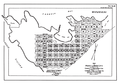
| Luogo | California, Stati del Pacifico | ||||
| Capitale | |||||
| Data di fondazione o creazione |
| ||||
| Popolazione |
| ||||
| Superficie |
| ||||
| sito web ufficiale | |||||
 | |||||
Sottocategorie
Questa categoria contiene le 11 sottocategorie indicate di seguito, su un totale di 11.
!
C
G
H
N
P
T
File nella categoria "Monterey County, California"
Questa categoria contiene 167 file, indicati di seguito, su un totale di 167.
-
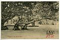
 08218-Monterey County-1906-Cypress Tree Monterey County-Brück & Sohn Kunstverlag.jpg 1 519 × 1 000; 598 KB
-
 08219-Monterey County-1906-Glimpse of Del Monte Hotel-Brück & Sohn Kunstverlag.jpg 1 491 × 1 000; 648 KB
-
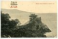 08220-Monterey County-1906-Midway Point, Monterey County-Brück & Sohn Kunstverlag.jpg 1 509 × 1 000; 493 KB
-
 2467 Garin Road-2009 - panoramio.jpg 2 848 × 2 134; 1,13 MB
-
 39. Mission San Antonio, Monteray co. California.jpg 1 000 × 722; 269 KB
-
 74bus.jpg 644 × 372; 51 KB
-
 A "Pui" Day.jpg 1 548 × 969; 454 KB
-
 Along the 101 - panoramio (1).jpg 3 648 × 2 736; 4,2 MB
-
 Animals of rock in Monterey County, California (14272472238).jpg 3 008 × 2 000; 1,94 MB
-
 Anne Hadden County Librarian at Los Burros.png 1 279 × 875; 1,08 MB
-
 Arctostaphylos hooveri.jpg 2 048 × 1 365; 1,88 MB
-
 Baird's Sandpiper - Flickr - GregTheBusker.jpg 5 184 × 3 456; 3,27 MB
-
 Barn along US Highway 101 near Salinas, California LCCN2011631683.tif 6 911 × 5 452; 215,63 MB
-
 BottchersGap.png 336 × 336; 189 KB
-
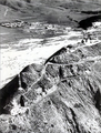
 Bulletin of the Geological Society of America (1900) (20262617530).jpg 3 153 × 2 141; 4,3 MB
-
 CA 68 approaching Monterey.jpg 3 081 × 2 400; 2,01 MB
-
 California - panoramio (2).jpg 4 608 × 3 456; 6,43 MB
-
 California Coastline - panoramio.jpg 3 888 × 2 592; 3,38 MB
-
 California Coastlines (4294608846).jpg 3 888 × 2 592; 3,62 MB
-
 California Cove (5015740781).jpg 3 088 × 2 048; 5,23 MB
-

-
 California Route 1 Highway - near Carmel - panoramio.jpg 3 264 × 2 448; 3 MB
-
 California Spring - panoramio.jpg 4 288 × 2 848; 3,15 MB
-
 California State Route 1 - Monterey County, California, USA - August 1995.jpg 7 500 × 4 999; 21,49 MB
-
 Carmel Beach (15397624709).jpg 4 762 × 3 170; 8,78 MB
-
 Carmelito plot map 1890.png 1 081 × 755; 313 KB
-
 Carmelo Coal Company coal mine.png 1 280 × 864; 1,12 MB
-
 CEMEX sand mine, Monterey Bay, CA Aug 2019 1.jpg 3 456 × 2 304; 3,11 MB
-
 CEMEX sand mine, Monterey Bay, CA Aug 2019 2.jpg 3 456 × 2 304; 3,39 MB
-
 Chalone Estate Chardonnay.jpg 5 184 × 3 456; 5,03 MB
-
 China Cove - panoramio.jpg 4 272 × 2 848; 1,69 MB
-
 Coastal Paradise (44143146).jpeg 1 920 × 1 080; 868 KB
-
 Coastal view - panoramio (1).jpg 4 160 × 3 120; 1,97 MB
-
 Coastal view - panoramio.jpg 4 160 × 3 120; 2,36 MB
-
 Common Gallinule (34056440806).jpg 2 615 × 2 092; 2,27 MB
-
 Common Loon, breeding adult (33501578750).jpg 4 876 × 3 251; 5,32 MB
-
 Cone Peak Lookout 1928.png 976 × 569; 418 KB
-
 Corral De Tierra gas station, Aug 2019.jpg 3 387 × 2 119; 2,73 MB
-
 Country Club West, Del Monte Forest, CA, USA - panoramio (4).jpg 4 000 × 3 000; 3,78 MB
-
 Country Club West, Del Monte Forest, CA, USA - panoramio (5).jpg 3 264 × 2 448; 2,85 MB
-
 Country Club West, Del Monte Forest, CA, USA - panoramio (6).jpg 3 264 × 2 448; 2,86 MB
-
 Country Club West, Del Monte Forest, CA, USA - panoramio.jpg 3 264 × 2 448; 1,87 MB
-
 Cows With A View (4293868119).jpg 3 289 × 2 592; 2,66 MB
-
 Cows With A View (5016351470).jpg 3 088 × 2 048; 4,65 MB
-
 Cruising on Highway 1 (44694961065).jpg 6 985 × 4 399; 35,72 MB
-
 CSUMB Fog.JPG 1 632 × 1 232; 733 KB
-
 Cute Rental Car (4349408765).jpg 3 888 × 2 592; 4,22 MB
-
 Dani Family 1900.jpg 2 552 × 1 967; 522 KB
-
 David Jack.jpg 839 × 975; 74 KB
-
 Day at lake San Antonio - panoramio.jpg 3 648 × 2 270; 2,95 MB
-
 Del Monte Forest, CA, USA - panoramio (1).jpg 3 872 × 2 592; 1,82 MB
-
 Del Monte Forest, CA, USA - panoramio (2).jpg 3 872 × 2 592; 1,79 MB
-
 Del Monte Forest, CA, USA - panoramio.jpg 3 872 × 2 592; 1,42 MB
-
 Del Monte Forest, United States (Unsplash).jpg 2 200 × 2 933; 3,55 MB
-
 Del Rey Oaks sign.jpg 4 592 × 3 064; 6,73 MB
-
 Douglas Osheroff photographing along CA-1 May 2011 002.jpg 3 600 × 2 700; 3,48 MB
-
 Earth from Space Soberanes Fire, Monterey County, CA, USA August 23rd (29100736252).jpg 2 983 × 3 704; 6,71 MB
-
 Earth from Space Soberanes Fire, Monterey County, CA, USA August 23rd (29100754952).jpg 2 983 × 3 704; 6,37 MB
-
 Earth from Space Soberanes Fire, Monterey County, CA, USA August 23rd (29130235841).jpg 2 983 × 3 704; 5,87 MB
-
 Earth from Space Soberanes Fire, Monterey County, CA, USA August 7th (28247514723).jpg 1 615 × 2 048; 2,17 MB
-
 Earth from Space Soberanes Fire, Monterey County, CA, USA August 7th (28757557642).jpg 3 978 × 4 935; 12,83 MB
-
 Earth from Space Soberanes Fire, Monterey County, CA, USA August 7th (28757565402).jpg 1 615 × 2 048; 2,17 MB
-
 Earth from Space Soberanes Fire, Monterey County, CA, USA August 7th (28786471601).jpg 3 978 × 4 935; 12,75 MB
-
 Earth from Space Soberanes Fire, Monterey County, CA, USA August 7th (28862115205).jpg 1 615 × 2 048; 2,61 MB
-
 Earth from Space Soberanes Fire, Monterey County, CA, USA August 7th (28862204765).jpg 3 978 × 4 935; 10,66 MB
-
 El Caminito Scene (189618851).jpeg 1 362 × 2 048; 950 KB
-
 Esalen Institute - Sarah Stierch.jpg 4 272 × 2 557; 5,42 MB
-
 FarmlandAtMossLanding3600ppx4.jpg 3 872 × 2 592; 2,9 MB
-
 Flag of Monterey County, California.gif 429 × 216; 24 KB
-
 Fr Farmer at Bshp Kip School.png 1 282 × 1 843; 3,46 MB
-
 Friends on a quiet beach (Unsplash).jpg 3 487 × 2 633; 11,12 MB
-
 Garin Road, Watsonville - panoramio.jpg 2 134 × 2 848; 1,02 MB
-
 Gem Saloon, Manchester, California 1880.jpg 994 × 707; 583 KB
-
 GMCR CARA-MIA Distribution Facility DSC02857.jpg 4 421 × 2 609; 7,43 MB
-
 Harlan home Lucia California 1922.png 1 285 × 865; 941 KB
-
 Heading North .. - panoramio.jpg 2 484 × 1 711; 631 KB
-
 Henry Miller Memorial Library - panoramio.jpg 3 456 × 2 304; 4,28 MB
-
-
 Hitchcock Ranch Big Sur 1890.png 1 142 × 683; 488 KB
-
 Hobbit House Carmel (15560568046).jpg 5 184 × 3 456; 11,05 MB
-
 House on 17 Mile Drive Near Pebble Beach - panoramio.jpg 1 028 × 1 552; 226 KB
-
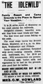 Idlewild Resort advertisement.png 443 × 859; 312 KB
-
 It's a bright day - panoramio.jpg 3 888 × 2 592; 3,26 MB
-
 J. Lohr Arroyo Seco Vineyard Rows.jpg 2 048 × 1 364; 775 KB
-
 J. Lohr Arroyo Seco Vineyard.jpg 2 048 × 1 364; 984 KB
-
 J. Lohr Winemaking Team.jpg 2 048 × 1 366; 315 KB
-
 Jade Cove BIg Sur California.jpg 4 000 × 3 000; 3,35 MB
-
 Jensen Rd (4131318066).jpg 5 616 × 3 744; 3,95 MB
-
 Junipero Serra Peak - panoramio.jpg 3 456 × 2 304; 4,46 MB
-
 Lion - panoramio (2).jpg 4 608 × 3 456; 6,3 MB
-
 Low Sun (173891143).jpeg 2 048 × 1 536; 1,04 MB
-
 MBUSGS.jpg 400 × 416; 65 KB
-
 Merlin - Flickr - GregTheBusker.jpg 3 072 × 2 304; 642 KB
-
 Milk on the Rocks (Unsplash).jpg 4 834 × 3 214; 6,52 MB
-
 Mission Drive - panoramio.jpg 1 600 × 1 200; 1,8 MB
-
 Monterey Bay 1.jpg 3 264 × 1 632; 5,88 MB
-
 Monterey Bay 2.jpg 3 264 × 1 632; 7,56 MB
-
 Monterey County Library branch, Lucia, California.png 973 × 663; 605 KB
-
-
 MontereyBayAquariumBackview.jpg 4 224 × 2 376; 4,63 MB
-
 More coast trees - panoramio.jpg 2 048 × 1 536; 739 KB
-
 Mountains - panoramio (34).jpg 3 456 × 2 304; 4,9 MB
-
 Mouth of Carneros Creek July 3, 2017.jpg 3 134 × 2 265; 5,17 MB
-
 Never ending pacific - panoramio.jpg 3 888 × 2 592; 4,26 MB
-
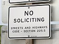 No soliciting rest area sign.jpg 600 × 452; 98 KB
-
 Ocean bay view from cliff (Unsplash).jpg 2 300 × 1 536; 1,03 MB
-
 Old Coast Road Big Sur California.png 756 × 997; 992 KB
-
 Old Coast Road, Central California.png 3 435 × 4 885; 29,78 MB
-
 Pacific Flowers (175924399).jpeg 2 048 × 1 152; 1,09 MB
-
 Pacific Valley School and Library Big Sur.png 1 500 × 875; 1,31 MB
-
 Palo Colorado Canyon Hoist.jpg 4 288 × 3 216; 7,39 MB
-
 Paradise Lost (173891119).jpeg 2 048 × 1 425; 1,17 MB
-
 Patch of the Monterey County Sheriff's Office.png 179 × 143; 48 KB
-
 Pebble Beach (56766434).jpeg 1 600 × 1 195; 314 KB
-
 Pfeiffer Ranch Sycamore Canyon.png 708 × 486; 718 KB
-
 Pinnacles West Entrance - panoramio.jpg 4 000 × 2 667; 1,63 MB
-
 Plaskett Rock, Big Sur, Monterey County - Flickr - pom'..jpg 3 000 × 3 000; 4,47 MB
-
 Pohlia robertsonii (6932739176).jpg 3 620 × 2 420; 11,43 MB
-
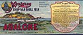 Point Lobos abalone label 1905.jpg 500 × 209; 154 KB
-
 Point Sur - panoramio.jpg 1 751 × 1 116; 633 KB
-
 Point Sur Lighthouse (43398334).jpeg 1 920 × 1 280; 695 KB
-
 Point Sur Lightstation and Naval Facility Point Sur 1969.png 763 × 1 007; 1,12 MB
-
 Post Ranch home 1930.png 1 325 × 900; 740 KB
-
 Precarious (5015754103).jpg 3 088 × 2 048; 5,22 MB
-
 Road in a pine forest (Unsplash).jpg 5 184 × 3 456; 5,39 MB
-
 Road Runs Along Coast - NARA - 543435.jpg 3 000 × 2 014; 1,21 MB
-
 Roads Wind Along California Coast - NARA - 543434.jpg 3 000 × 2 039; 1 MB
-
 Roads Wind Along Coast - NARA - 543433.jpg 3 000 × 1 994; 1,26 MB
-
 Rock formations - panoramio (3).jpg 3 456 × 2 304; 4,8 MB
-
 Rock formations - panoramio (4).jpg 3 456 × 2 304; 5,69 MB
-

-
 Santa Lucia Mountains - panoramio.jpg 3 456 × 2 304; 4,24 MB
-
 Santa Lucia Preserve Design.jpg 2 550 × 3 300; 1,19 MB
-
 SB Wikipedia Pic.jpg 600 × 600; 61 KB
-
Scm gif fullsize q10.ogv 8,0 s, 1 944 × 1 296; 1,31 MB
-
Scm gif q10 240p.ogv 6,0 s, 360 × 240; 72 KB
-
Scm gif q9 480p.ogv 6,0 s, 720 × 480; 221 KB
-
 Seal of Monterey County, California.png 1 443 × 1 443; 1,04 MB
-
 Somewhere at Route No. 1 - panoramio.jpg 2 365 × 1 472; 2,32 MB
-
 South coast Big Sur 1922.png 1 291 × 875; 647 KB
-
 Spanish Bay fog.jpg 4 032 × 3 024; 3,04 MB
-
 Spring in Big Sur (8611964669).jpg 4 000 × 3 000; 4,23 MB
-
 Stevenson Assembly.jpg 3 264 × 2 448; 1,97 MB
-
 Sunset (26950971).jpeg 2 048 × 1 536; 191 KB
-
 Surf and Turf - panoramio.jpg 3 888 × 2 592; 5,37 MB
-
 Sykes Hot Springs, United States (Unsplash).jpg 6 000 × 4 000; 15,73 MB
-
 Tassajara Hotel and cars 1920.jpg 500 × 358; 69 KB
-
 The American Museum journal (c1900-(1918)) (17972682860).jpg 1 936 × 886; 531 KB
-
 The Ghost Tree (Unsplash).jpg 3 264 × 2 448; 1,7 MB
-
 The pacific stretched on - panoramio.jpg 3 888 × 2 592; 5,21 MB
-
 The San Ardo Oil Field CA. From the Amtrak Coast Starlight - panoramio.jpg 3 061 × 1 840; 695 KB
-
 The Sun is low, the day was long - panoramio.jpg 3 888 × 2 592; 3,14 MB
-
 US Army 52731 Burn continues even after ignition stopped.jpg 4 288 × 2 848; 2,02 MB
-
 US Army 52732 Prescribed Burn smoke plume.jpg 4 288 × 2 848; 1,96 MB
-
 Usa (198958815).jpeg 2 048 × 1 536; 901 KB
-
 USA Monterey County, California age pyramid.svg 520 × 600; 8 KB
-
 Van (15584223995).jpg 2 802 × 2 186; 3,93 MB
-
 View North - panoramio (2).jpg 3 072 × 2 304; 2,72 MB
-
 View todard SW - panoramio.jpg 1 500 × 1 000; 386 KB
-
 View with CA poppies - panoramio.jpg 1 500 × 1 000; 870 KB
-
 West u.s.a 9 219 (14272430769).jpg 3 008 × 2 000; 1,55 MB
-
 West u.s.a 9 236 (14272464389).jpg 6 000 × 4 000; 7,36 MB
-
 West u.s.a 9 256 (14458019854).jpg 6 000 × 4 000; 9,97 MB
-
 West u.s.a 9 257 (14272552310).jpg 6 000 × 4 000; 10,44 MB
-
 Whaler's Cove, Point Lobos, June 2003 - panoramio.jpg 1 800 × 1 200; 850 KB
-
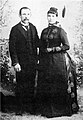 Wilbur Judson Harlan and Ada Dani wedding.jpg 677 × 981; 450 KB
-
 William Dugay Cruickshank 1915.jpg 1 256 × 1 901; 265 KB


.jpg)
.jpg)


_(20262617530).jpg)

.jpg)

.jpg)
.jpg)
_(14778464181).jpg)


.jpg)


.jpeg)
.jpg)

.jpg)
.jpg)


.jpg)
.jpg)
.jpg)

.jpg)
.jpg)
.jpg)

.jpg)


.jpg)
.jpg)

.jpg)


.jpg)
.jpg)
.jpg)
.jpg)
.jpg)
.jpg)
.jpg)
.jpg)
.jpg)
.jpeg)


.jpg)


.jpg)


.jpg)

.jpg)
.jpeg)


.jpg)


.jpg)


.jpg)


.jpeg)


.jpeg)

.jpeg)


.jpg)


.jpeg)


.jpg)
.jpg)


.jpg)
.jpg)


.jpg)

.jpeg)

.jpg)

)_(17972682860).jpg)
.jpg)


.jpeg)

.jpg)
.jpg)


.jpg)
.jpg)
.jpg)
.jpg)


