Category:Trinity County, California
Jump to navigation
Jump to search
Counties of California: Alameda · Alpine · Amador · Butte · Calaveras · Colusa · Contra Costa · Del Norte · El Dorado · Fresno · Glenn · Humboldt · Imperial · Inyo · Kern · Kings · Lake · Lassen · Los Angeles · Madera · Marin · Mariposa · Mendocino · Merced · Modoc · Mono · Monterey · Napa · Nevada · Orange · Placer · Plumas · Riverside · Sacramento · San Benito · San Bernardino · San Diego · San Joaquin · San Luis Obispo · San Mateo · Santa Barbara · Santa Clara · Santa Cruz · Shasta · Sierra · Siskiyou · Solano · Sonoma · Stanislaus ·Sutter · Tehama · Trinity · Tulare · Tuolumne · Ventura · Yolo · Yuba – Consolidated city-county: San Francisco
county in northwestern California, United States    | |||||
| Upload media | |||||
| Instance of | |||||
|---|---|---|---|---|---|
| Named after | |||||
| Location | California, Pacific States Region | ||||
| Capital | |||||
| Inception |
| ||||
| Population |
| ||||
| Area |
| ||||
| Different from | |||||
| official website | |||||
 | |||||
Subcategories
This category has the following 13 subcategories, out of 13 total.
Media in category "Trinity County, California"
The following 39 files are in this category, out of 39 total.
-
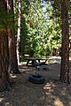 2013, Gemmill Gulch Picnic Area - panoramio.jpg 4,000 × 6,000; 10.25 MB
-
 2020-0728-Goes-West-Salmon Fire.jpeg 1,278 × 930; 239 KB
-
 Soils and vegetation of the French Gulch Quadrangle (24D-1,2,3,4) - Shasta and Trinity counties, California (IA CAT31118061).pdf 1,175 × 1,552, 58 pages; 3.72 MB
-
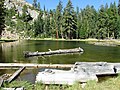
 Holland Lake, Trinity Alps.jpg 3,648 × 2,736; 2.95 MB
-
 Lewiston Bridge Alternate.JPG 3,008 × 2,000; 2.83 MB
-
 Little Marshy Lake - panoramio (1).jpg 3,456 × 2,592; 880 KB
-
 Little Marshy Lake - panoramio.jpg 3,456 × 2,592; 1.6 MB
-
 Local antique shop.JPG 3,008 × 2,000; 2.65 MB
-
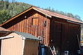 Local barn building closer.JPG 3,008 × 2,000; 2.4 MB
-
 Local barn building.JPG 3,008 × 2,000; 2.4 MB
-
 Local buildings.JPG 3,008 × 2,000; 2.67 MB
-
 Local Buildings.JPG 3,008 × 2,000; 2.75 MB
-
 Log in Granite Lake - panoramio.jpg 5,152 × 3,864; 5.47 MB
-
 Monument Fire Evac 080121.jpg 1,080 × 524; 60 KB
-
 Newer buildings.JPG 3,008 × 2,000; 2.94 MB
-
 Old Schoolhouse's Dictionary Alternate.JPG 3,008 × 2,000; 2.54 MB
-
 Old Schoolhouse's Dictionary.JPG 3,008 × 2,000; 2.47 MB
-
 Phacelia corymbosa.jpg 747 × 500; 189 KB
-
 Rainbow over the trees - panoramio.jpg 5,152 × 3,864; 7.63 MB
-
 Round Valley Seal.jpg 239 × 252; 14 KB
-
 Scenic view- logging in Northeast California LCCN2013635080.tif 7,360 × 4,912; 206.9 MB
-
 Scenic view- logging in Northeast California LCCN2013635081.tif 7,360 × 4,912; 206.9 MB
-
 Seal of Trinity County, California.png 596 × 569; 414 KB
-
 Seven Incense-cedars on Zenia-Covelo road (cropped).jpg 1,384 × 888; 600 KB
-
 Seven Incense-cedars on Zenia-Covelo road.png 800 × 700; 641 KB
-
 Small buildings.JPG 3,008 × 2,000; 2.93 MB
-
 Storefront of Antique Store Alternate 2.JPG 3,008 × 2,000; 2.99 MB
-
 Storefront of Antique Store Alternate.JPG 3,008 × 2,000; 3.14 MB
-
 Storefront of Antique Store.JPG 3,008 × 2,000; 2.93 MB
-
 Storefront of Market.JPG 3,008 × 2,000; 2.96 MB
-
 Storefronts.JPG 3,008 × 2,000; 2.93 MB
-
 The quicksilver resources of California (1903) (14783705265).jpg 2,992 × 1,742; 604 KB
-

-

-

-

-
Trinity County, California.ogv 37 s, 1,280 × 720; 7.7 MB
-

-
 USA Trinity County, California age pyramid.svg 520 × 600; 7 KB


.jpg)


.jpg)


_(14783705265).jpg)


