Category:Mount Lebanon
Jump to navigation
Jump to search
mountain range in Lebanon   | |||||
| Upload media | |||||
| Instance of | |||||
|---|---|---|---|---|---|
| Part of | |||||
| Made from material | |||||
| Location |
| ||||
| Width |
| ||||
| Length |
| ||||
| Highest point |
| ||||
| Area |
| ||||
| Elevation above sea level |
| ||||
| Different from | |||||
 | |||||
English: Mount Lebanon Range — a mountain range along the length of Lebanon, Western Asia.
- The mountains average above 2,200 metres (7,200 ft) in elevation.
Subcategories
This category has the following 7 subcategories, out of 7 total.
Media in category "Mount Lebanon"
The following 136 files are in this category, out of 136 total.
-
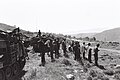 1982 Lebanon War LXII.jpg 3,000 × 2,007; 890 KB
-
 7th century convent - panoramio.jpg 3,264 × 2,448; 3.28 MB
-
 Aachkout Rock (Farther) - panoramio.jpg 6,797 × 2,301; 2.1 MB
-
 Aachkout Rocks - panoramio.jpg 6,936 × 2,129; 1.73 MB
-
 Aachout Rocks ^ Churches - panoramio.jpg 3,264 × 2,448; 3.23 MB
-
 Aachout- Panorama - panoramio.jpg 16,833 × 2,391; 8.24 MB
-
 Aackout - panoramio.jpg 3,264 × 2,448; 2.94 MB
-
 Above Faraya Near the Bekaa Valley - panoramio.jpg 3,264 × 2,448; 2.85 MB
-
 Adonis temple in the snow, Afqa, Faqra, Lebanon.jpg 4,032 × 3,024; 2.73 MB
-
 Beirut at dusk - panoramio.jpg 3,264 × 2,448; 2.07 MB
-
 Beirut from Aachout - panoramio.jpg 3,264 × 2,448; 2.28 MB
-
 Beyrouth-histoire1.jpg 361 × 285; 72 KB
-
 Bijdarfel - Batroun (2309089114).jpg 2,560 × 1,920; 859 KB
-
 Bikfaya Extended View - panoramio.jpg 13,153 × 1,909; 3.28 MB
-
 Fotografi på Zahle - Hallwylska museet - 104289.tif 4,279 × 3,354; 41.09 MB
-
 Buhturid Mount Lebanon.png 1,059 × 1,207; 2.54 MB
-
 Castle - panoramio (15).jpg 3,264 × 2,448; 3.34 MB
-
 Cedar and rock - panoramio.jpg 900 × 600; 365 KB
-
 Cedars and rocks - panoramio.jpg 900 × 599; 325 KB
-
 Cedars under the snow.jpg 758 × 509; 148 KB
-
 Cedars01(js).jpg 1,920 × 1,237; 2.08 MB
-
 Cedars03(js).jpg 871 × 1,250; 745 KB
-
 Chapel of Jouret Al Hachich - panoramio.jpg 3,264 × 2,448; 3.36 MB
-
 Chapels Steeple - panoramio.jpg 3,264 × 2,448; 4.47 MB
-
 Church of Mchati - panoramio.jpg 3,264 × 2,448; 5.48 MB
-
 Collines de Deir El Qamar-Camille Allam.jpg 640 × 480; 164 KB
-
 Cèdre à Tannourine.JPG 3,072 × 1,728; 857 KB
-
 Dead cedar struck by lightining - panoramio.jpg 900 × 599; 413 KB
-
 Deir Mar. Youssef - panoramio.jpg 3,264 × 2,448; 3.24 MB
-
-
 Aerial View of Ehden.jpg 583 × 380; 79 KB
-
 Ehden overview.jpg 420 × 280; 16 KB
-
 Extended Photo of Power Plant - panoramio.jpg 6,609 × 2,195; 1.86 MB
-
 Faraya - panoramio (1).jpg 3,264 × 1,832; 2.09 MB
-
 Faraya - panoramio.jpg 3,264 × 2,448; 2.3 MB
-
 Faraya Taken from road below - panoramio.jpg 3,264 × 2,448; 2.72 MB
-
 AFeghali.JPG 1,704 × 2,272; 2.06 MB
-
 Fidel Tower - panoramio.jpg 3,264 × 2,448; 3.04 MB
-
 Flintstones house - panoramio.jpg 900 × 599; 282 KB
-
 Foggy day - panoramio.jpg 3,264 × 2,448; 2.38 MB
-
 Foggy Mountain Mist - panoramio.jpg 3,264 × 2,448; 2.38 MB
-
 Francis Frith (English - The Largest of the Cedars, Mount Lebanon - Google Art Project.jpg 4,474 × 3,136; 3.49 MB
-
 From the Bickfaya Road - panoramio.jpg 3,264 × 2,448; 2.1 MB
-
 Front Entrance of the Crusader Cathedral - panoramio.jpg 3,264 × 2,448; 4.14 MB
-
 Ghosta - panoramio.jpg 3,264 × 2,448; 3.12 MB
-
 Golden Stone - panoramio.jpg 3,264 × 2,448; 3.85 MB
-
 Golden stone ^ Lush background - panoramio.jpg 3,264 × 2,448; 4.16 MB
-
 GraveStone - panoramio.jpg 3,264 × 2,448; 2.19 MB
-
 Hallways of the monastary - panoramio.jpg 3,264 × 2,448; 3.14 MB
-
 Harrisa (View of Jounieh) Lebanon - panoramio.jpg 8,150 × 2,342; 2.55 MB
-
 Harrisa - panoramio.jpg 3,264 × 2,448; 2.69 MB
-
 Harrisa 2010 Scenery - panoramio.jpg 4,000 × 3,000; 4.34 MB
-
 House of a Maronite Saint - panoramio.jpg 3,264 × 2,448; 3.39 MB
-
 Insta360 Pro 2 camera on top of Pau Saad's Car 1.jpg 4,032 × 3,024; 1.62 MB
-
 Insta360 Pro 2 camera on top of Pau Saad's Car at Bekaa Valley.jpg 8,256 × 5,504; 18.8 MB
-
 Insta360 Pro 2 camera on top of Pau Saad's Car.jpg 8,256 × 5,504; 28.48 MB
-
-
 Jesus and St. Charbel - panoramio.jpg 4,000 × 3,000; 4.37 MB
-
 Jisr el Sid-Mansourieh.jpg 448 × 299; 72 KB
-
 Jonieh - panoramio (1).jpg 3,264 × 2,448; 3.54 MB
-
 Jonieh - panoramio.jpg 3,264 × 2,448; 3.19 MB
-
 Jonieh from Harissa - panoramio.jpg 2,048 × 1,536; 1,018 KB
-
 Jounieh - panoramio.jpg 3,264 × 2,448; 2 MB
-
 Jounieh Bay Below (Mar Semaan Below) - panoramio.jpg 3,264 × 2,448; 2.42 MB
-
 Jounieh, what it should've looked like. -( - panoramio.jpg 3,264 × 2,448; 4.85 MB
-
 Kadisha Valley cross.jpg 3,137 × 1,821; 1.04 MB
-
 Kafno Hoayek.jpg 960 × 642; 168 KB
-
 Kfifane - panoramio.jpg 3,264 × 2,448; 2.77 MB
-
 Kfifane Convent - panoramio.jpg 3,264 × 2,448; 3.26 MB
-
 Kififane 7th Century Convent - panoramio.jpg 3,264 × 2,448; 3.51 MB
-
 L'autostrade - panoramio (1).jpg 3,264 × 2,448; 2.99 MB
-
 Lebanon (Unknown Location) - panoramio.jpg 12,452 × 2,301; 3.53 MB
-
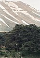
 Lebanon cedar forest.jpg 2,281 × 1,220; 837 KB
-
 LES Loueizeh Logo.png 796 × 793; 304 KB
-
 Leyaat- Lebanon - panoramio.jpg 6,013 × 1,967; 1.13 MB
-
 Libanonzeder.jpg 400 × 533; 97 KB
-
 Little Town Chapel - panoramio.jpg 4,000 × 3,000; 4.33 MB
-
 Long tunnel of darkness (Chekka mountain) - panoramio.jpg 3,264 × 2,448; 3.85 MB
-
 Looking down towards Jonieh - panoramio.jpg 3,264 × 2,448; 3.37 MB
-
 Looking into the Valley - panoramio.jpg 3,264 × 2,448; 2.95 MB
-
 Looking into the valley - panoramio.jpg 3,264 × 2,448; 3.68 MB
-
 Looking South From Fidar Tower - panoramio.jpg 3,264 × 2,448; 2.95 MB
-
 Looking toward Jounieh - panoramio.jpg 3,264 × 2,448; 2.82 MB
-
 Map of Mount Lebanon Sanjak Circa 1900.jpg 1,016 × 1,483; 664 KB
-
 Mlikh, Mleekh, South Lebanon.jpg 604 × 397; 46 KB
-
 Monastary in Bikfaya - panoramio.jpg 3,264 × 2,448; 3 MB
-
 Mont Liban ou Qornet es Sauda (3083m).jpg 3,648 × 2,736; 2.23 MB
-
 Mother Nature At Work - panoramio.jpg 3,264 × 2,448; 4.46 MB
-
 Mount Lebanon (4878995425).jpg 2,740 × 2,523; 1,011 KB
-
 Mount Lebanon from Saint George Bay.JPG 4,000 × 3,000; 2.84 MB
-

-
 Mount Sannine at its side - panoramio.jpg 3,264 × 2,448; 3.44 MB
-
 Mountains of Jounieh - panoramio.jpg 3,264 × 2,448; 2.4 MB
-
 Mt. Sannine - panoramio.jpg 3,264 × 2,448; 2.75 MB
-
 Mten and Kesourwan - panoramio.jpg 3,264 × 2,448; 2.41 MB
-
 Nihatown12.jpeg 500 × 375; 70 KB
-
 Old Dirt road - panoramio.jpg 3,264 × 2,448; 5.32 MB
-
 Old House - panoramio (13).jpg 3,264 × 2,448; 4.18 MB
-
 Old house from Ottoman Era - panoramio.jpg 3,264 × 2,448; 3.61 MB
-
 Old ottoman tunnel in the mountain of Chekka - panoramio.jpg 3,264 × 2,448; 3.74 MB
-
 On top of Stone Arch bridge - panoramio.jpg 3,264 × 2,448; 4.5 MB
-
 Orthodox Church - panoramio (1).jpg 3,264 × 2,448; 3.16 MB
-
 Ottoman tunnel 1 - Chekka - panoramio.jpg 1,200 × 799; 589 KB
-
 Ottoman Tunnel of Chekka - panoramio.jpg 3,264 × 2,448; 3.93 MB
-
 Over the Red Roof tops of Bikfaya - panoramio.jpg 3,264 × 2,448; 3.28 MB
-
 Power Plant of Jonieh... - panoramio.jpg 3,264 × 2,448; 3.29 MB
-
 R'as Al-matn pine forest-Lebanon.jpg 4,666 × 3,500; 1.98 MB
-
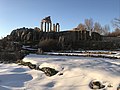
 Roman Columns - panoramio.jpg 3,264 × 2,448; 3.56 MB
-
 Satellite image of Lebanon in March 2002.jpg 584 × 744; 59 KB
-
 Scenic view of Al Rihan, Lebanon (2009).jpg 604 × 453; 52 KB
-
 Shaker Church, Mount Lebanon, N.Y. (3990101485).jpg 760 × 381; 43 KB
-
 Side view of the Monastary - panoramio.jpg 3,264 × 2,448; 2.7 MB
-
 Sinkhole - panoramio.jpg 900 × 600; 460 KB
-
 SL 1914 D078 cape of beirut viewed from mount lebanon.jpg 2,087 × 1,232; 554 KB
-
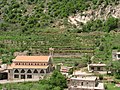
 Small-scale agriculture in Mount Lebanon.jpg 4,032 × 3,024; 1.18 MB
-
 St. Joseph Maronite Cathedral (originally a crusader cathedral) - panoramio.jpg 3,264 × 2,448; 3.13 MB
-
 St. Joseph Monastary - panoramio.jpg 3,264 × 2,448; 3.8 MB
-
 St. Pauls Cathedral - panoramio (4).jpg 3,264 × 2,448; 2.26 MB
-
 Stone Arch Bridge (closer view) - panoramio.jpg 3,264 × 2,448; 3.77 MB
-
 Stone Arch Bridge (farther view) - panoramio.jpg 3,264 × 2,448; 4.45 MB
-
 Stone Arch Bridge (Under) HQ - panoramio.jpg 3,264 × 2,448; 4.49 MB
-
 Sunset Near Byblos - panoramio.jpg 3,264 × 2,448; 2.92 MB
-
 Sunset of Lebanon - panoramio.jpg 3,264 × 2,448; 2.64 MB
-
 The Mediterranean Sea and its ruins - panoramio.jpg 3,264 × 2,448; 3.1 MB
-
 The road to the peak - panoramio.jpg 3,264 × 2,448; 3.33 MB
-
 The sacred mountains (1847) (14593345190).jpg 3,280 × 2,412; 1.59 MB
-
 The Terraces Of Bikfaya - panoramio.jpg 3,264 × 2,448; 3.28 MB
-
 Under the Stone Arch Bridge (Low Quality) - panoramio.jpg 640 × 480; 150 KB
-
 View of Mt. Sannine from plane - panoramio.jpg 3,264 × 2,448; 3.18 MB
-
 Virgin Mary - panoramio.jpg 3,264 × 2,448; 2.5 MB
-
 Zahle,Lebanon.JPG 3,264 × 2,448; 4.49 MB
-
 Meyer’s Universum Bd. 2. 1835 (138222515).jpg 4,260 × 3,140; 11.37 MB
-
 Aipichthys velifer 01.jpg 2,775 × 1,615; 1.31 MB
-
-
 Ливан (БЭАН).png 2,201 × 1,783; 210 KB
-
 Ligeti, Antal - Mount Lebanon and Anti-Lebanon (1855-60).jpg 1,000 × 502; 79 KB


.jpg)

.jpg)


.jpg)
.jpg)


.jpg)


.jpg)


_-_panoramio.jpg)


.jpg)


_-_panoramio.jpg)


.jpg)

.jpg)

.jpg)


.jpg)


.jpg)


.jpg)
.jpg)


_-_panoramio.jpg)

.jpg)
_-_panoramio.jpg)
_-_panoramio.jpg)
_HQ_-_panoramio.jpg)


_(14593345190).jpg)

_-_panoramio.jpg)


.jpg)

.jpg)
.png)
.jpg)
_-_panoramio.jpg)
_Lebanon_-_panoramio.jpg)
_-_panoramio.jpg)