Category:Municipality limit maps of communes in Manche
Jump to navigation
Jump to search
Departments of Metropolitan France: Ain [01] · Aisne [02] · Allier [03] · Hautes-Alpes [05] · Ardèche [07] · Ariège [09] · Aude [11] · Cantal [15] · Charente [16] · Charente-Maritime [17] · Corrèze [19] · Corse-du-Sud [2A]† · Haute-Corse [2B]† · Côte-d’Or [21] · Creuse [23] · Dordogne [24] · Doubs [25] · Drôme [26] · Eure-et-Loir [28] · Finistère [29] · Haute-Garonne [31] · Gers [32] · Gironde [33] · Hérault [34] · Ille-et-Vilaine [35] · Isère [38] · Landes [40] · Loir-et-Cher [41] · Loire [42] · Haute-Loire [43] · Lot [46] · Lot-et-Garonne [47] · Manche [50] · Marne [51] · Haute-Marne [52] · Mayenne [53] · Meurthe-et-Moselle [54] · Morbihan [56] · Moselle [57] · Nièvre [58] · Nord [59] · Oise [60] · Pas-de-Calais [62] · Puy-de-Dôme [63] · Pyrénées-Atlantiques [64] · Hautes-Pyrénées [65] · Bas-Rhin [67] · Haut-Rhin [68] · departmental district of the Rhône [69] · Rhône [69D]‡ · Metropolis of Lyon [69M]‡ · Saône-et-Loire [71] · Savoie [73] · Haute-Savoie [74] · Deux-Sèvres [79] · Somme [80] · Tarn [81] · Vienne [86] · Haute-Vienne [87] · Vosges [88] · Yonne [89] · Territoire de Belfort [90]
| NO WIKIDATA ID FOUND! Search for Municipality limit maps of communes in Manche on Wikidata | |
| Upload media |
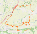
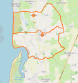
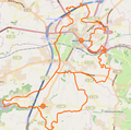
English: Limits of communes in the department of Manche.
Français : Limites communales dans le département de la Manche.

Media in category "Municipality limit maps of communes in Manche"
The following 62 files are in this category, out of 62 total.
-
 Bourgvallées - Frontière avec le Mesnil-Herman.png 575 × 306; 98 KB
-
 Carte Avranches (commune nouvelle).png 514 × 506; 404 KB
-
 Carte Bourgvallées (2019).png 573 × 552; 172 KB
-
 Carte Bourgvallées.png 781 × 743; 707 KB
-
 Carte Bricquebec-en-Cotentin.png 641 × 519; 175 KB
-
 Carte Buais-les-Monts.png 400 × 400; 197 KB
-
 Carte Canisy (commune nouvelle).png 601 × 563; 443 KB
-
 Carte Carentan-les-Marais (2017).png 552 × 472; 388 KB
-
 Carte Carentan-les-Marais (2019).png 571 × 571; 511 KB
-
 Carte Carentan-les-Marais - Commune nouvelle.png 525 × 525; 127 KB
-
 Carte Cherbourg-en-Cotentin.png 648 × 490; 343 KB
-
 Carte Conde-sur-Vire (commune nouvelle).png 322 × 381; 73 KB
-
 Carte Condé-sur-Vire (commune nouvelle, 2017).png 379 × 388; 166 KB
-
 Carte Ducey-Les Chéris.png 608 × 477; 391 KB
-
 Carte Gavray-sur-Sienne.png 785 × 719; 447 KB
-
 Carte Gonneville-Le Theil.png 678 × 689; 199 KB
-
 Carte Gouville-sur-Mer (commune nouvelle).png 617 × 423; 119 KB
-
 Carte Gouville-sur-Mer (commune nouvelle, 2019).png 1,056 × 691; 317 KB
-
 Carte Grandparigny.png 879 × 518; 203 KB
-
 Carte Hambye (commune nouvelle).png 1,006 × 709; 301 KB
-
 Carte Juvigny-les-Vallees - Commune nouvelle.png 432 × 351; 247 KB
-
 Carte La Hague (commune nouvelle).png 676 × 536; 239 KB
-
 Carte La Haye (Manche) - Commune nouvelle.png 775 × 482; 219 KB
-
 Carte Le Grippon (commune nouvelle).png 514 × 514; 315 KB
-
 Carte Le Parc.png 425 × 425; 101 KB
-
 Carte Le Teilleul (commune nouvelle).png 453 × 453; 182 KB
-
 Carte Lessay (commune nouvelle).png 418 × 447; 99 KB
-
 Carte Marigny-le-Lozon.png 337 × 375; 165 KB
-
 Carte Montsenelle - Commune nouvelle.png 682 × 427; 165 KB
-
 Carte Mortain-Bocage.png 535 × 525; 366 KB
-
 Carte Moyon-Villages - Commune nouvelle.png 748 × 748; 211 KB
-
 Carte Orval-sur-Sienne.png 676 × 510; 495 KB
-
 Carte Percy-en-Normandie.png 464 × 444; 276 KB
-
 Carte Picauville (commune nouvelle).png 547 × 540; 439 KB
-
 Carte Pont-Hébert (commune nouvelle).png 913 × 700; 707 KB
-
 Carte Pontorson (commune nouvelle).png 847 × 1,041; 1.07 MB
-
 Carte Port-Bail sur Mer.png 874 × 869; 298 KB
-
 Carte Quettehou (commune nouvelle).png 972 × 659; 209 KB
-
 Carte Quettreville-sur-Sienne (commune nouvelle).png 592 × 615; 477 KB
-
 Carte Quettreville-sur-Sienne (commune nouvelle, 2019).png 1,150 × 720; 358 KB
-
 Carte Remilly (commune nouvelle).png 611 × 444; 342 KB
-
 Carte Romagny-Fontenay.png 512 × 512; 380 KB
-
 Carte Saint-Amand-Villages.png 861 × 534; 542 KB
-
 Carte Saint-Hilaire-du-Harcouët (commune nouvelle).png 542 × 460; 393 KB
-
 Carte Saint-James (commune nouvelle).png 568 × 466; 437 KB
-
 Carte Saint-Jean-D'Elle - Commune nouvelle.png 946 × 588; 231 KB
-
 Carte Saint-Marie-du-Mont (commune nouvelle).png 504 × 504; 112 KB
-
 Carte Saint-Sauveur-Villages (commune nouvelle).png 1,000 × 760; 309 KB
-
 Carte Sainte-Mère-Église (commune nouvelle).png 560 × 422; 321 KB
-
 Carte Sainte-Mère-Église (commune nouvelle, 2019).png 739 × 628; 210 KB
-
 Carte Sartilly-Baie-Bocage.png 726 × 558; 523 KB
-
 Carte Sourdeval (commune nouvelle).png 556 × 519; 393 KB
-
 Carte Terre-et-Marais.png 612 × 477; 440 KB
-
 Carte Tessy-Bocage.png 725 × 724; 453 KB
-
 Carte Thèreval.png 767 × 525; 472 KB
-
 Carte Tirepied-sur-Sée.png 656 × 613; 183 KB
-
 Carte Torigny-les-Villes - Commune nouvelle.png 858 × 875; 321 KB
-
 Carte Tourneville-sur-Mer (commune nouvelle).png 715 × 757; 400 KB
-
 Carte Vicq-sur-Mer.png 873 × 499; 167 KB
-
 Carte Villedieu-Rouffigny.png 604 × 597; 169 KB
-
 Map Isigny-le-Buat et ses communes associées.png 711 × 526; 226 KB
-
 Map Pontorson et ses communes associées.png 473 × 483; 116 KB

.png)
.png)


.png)
.png)
.png)


.png)
.png)


.png)
.png)

.png)

.png)
_-_Commune_nouvelle.png)
.png)

.png)
.png)


.png)
.png)
.png)

.png)
.png)
.png)
.png)


.png)
.png)

.png)
.png)
.png)
.png)

.png)


.png)


