Category:Myland
Jump to navigation
Jump to search
English: Myland or Mile End is an area of Colchester and civil parish in the Colchester district, in the county of Essex, England.
civil parish in Essex  | |||||
| Upload media | |||||
| Instance of | |||||
|---|---|---|---|---|---|
| Location | Colchester, Essex, East of England, England | ||||
 | |||||
Subcategories
This category has the following 3 subcategories, out of 3 total.
Media in category "Myland"
The following 140 files are in this category, out of 140 total.
-
 302 207 east of Colchester, 1988 - geograph.org.uk - 4846704.jpg 640 × 427; 105 KB
-
 A12 - geograph.org.uk - 3259203.jpg 640 × 430; 36 KB
-
 A12 Ipswich Road ^ slip road - geograph.org.uk - 3644028.jpg 3,072 × 2,304; 1.3 MB
-
 A12 Ipswich Road, Mile End - geograph.org.uk - 3643884.jpg 3,049 × 2,086; 864 KB
-
 A12 Ipswich Road, Mile End - geograph.org.uk - 3644026.jpg 3,072 × 2,304; 1.29 MB
-
 A12 Ipswich Road, Mile End - geograph.org.uk - 4115288.jpg 2,065 × 2,155; 584 KB
-
 A12 Ipswich Road, Mile End - geograph.org.uk - 4115333.jpg 2,116 × 1,804; 593 KB
-
 A12 Ipswich Road, Mile End - geograph.org.uk - 4116540.jpg 2,126 × 1,900; 449 KB
-
 A12 overbridge carries Boxted Road - geograph.org.uk - 3546598.jpg 2,542 × 1,866; 584 KB
-
 A12 overbridge carries Severalls Lane - geograph.org.uk - 3546609.jpg 3,648 × 2,736; 1.64 MB
-
 A12 south of Horkesley Heath - geograph.org.uk - 3546568.jpg 3,238 × 2,434; 1.24 MB
-
 A12 westbound - geograph.org.uk - 4222798.jpg 640 × 480; 33 KB
-
 A12 westbound - geograph.org.uk - 4222799.jpg 640 × 480; 44 KB
-
 A12 westbound - geograph.org.uk - 4222801.jpg 640 × 465; 39 KB
-
 A12 westbound - geograph.org.uk - 4222803.jpg 640 × 471; 48 KB
-
 A12 westbound - geograph.org.uk - 4222808.jpg 640 × 478; 46 KB
-
 A12 westbound - geograph.org.uk - 4222815.jpg 640 × 480; 38 KB
-
 A12, eastbound - geograph.org.uk - 3259212.jpg 640 × 417; 38 KB
-
 A134 Nayland Road, Mile End - geograph.org.uk - 4962067.jpg 3,072 × 2,237; 2.41 MB
-
 Axial Drive Braiswick - geograph.org.uk - 6082337.jpg 1,024 × 678; 141 KB
-
 Axial Way sign - geograph.org.uk - 4567355.jpg 3,007 × 2,253; 3.24 MB
-
 Axial Way, Mile End - geograph.org.uk - 4566895.jpg 3,072 × 2,304; 1.83 MB
-
 Axial Way, Mile End, Colchester - geograph.org.uk - 4567291.jpg 3,072 × 2,304; 1.84 MB
-
 Axial Way, Mile End, Colchester - geograph.org.uk - 4567310.jpg 3,072 × 2,304; 1.78 MB
-
 Axial Way, Mile End, Colchester - geograph.org.uk - 4567311.jpg 3,072 × 2,304; 1.74 MB
-
 Axial Way, Mile End, Colchester - geograph.org.uk - 4567316.jpg 3,072 × 2,304; 1.93 MB
-
 Axial Way, Mile End, Colchester - geograph.org.uk - 4567340.jpg 2,879 × 2,157; 1.3 MB
-
 Beetle (No common name) Glischrochilus hortensis - geograph.org.uk - 3414730.jpg 1,024 × 643; 252 KB
-
 Boadicea's statue - geograph.org.uk - 2074592.jpg 640 × 480; 92 KB
-
 Boxted Road - geograph.org.uk - 2009101.jpg 3,008 × 2,000; 1.25 MB
-
 Boxted Road bridge seen from westbound A12 - geograph.org.uk - 4083234.jpg 1,600 × 1,200; 1.18 MB
-
 Boxted Road Bridge, A12 - geograph.org.uk - 2677870.jpg 640 × 430; 43 KB
-
 Boxted Road Bridge, A12 - geograph.org.uk - 3259206.jpg 640 × 430; 38 KB
-
 Boxted Road Bridge, A12 - geograph.org.uk - 3880957.jpg 640 × 377; 38 KB
-
 Braiswick Lane - geograph.org.uk - 6082358.jpg 1,024 × 678; 179 KB
-
 Bridge at new junction for Colchester stadium - geograph.org.uk - 4083227.jpg 1,600 × 1,200; 1.09 MB
-
 Bridge over A12 at Colchester Park and Ride - geograph.org.uk - 5436086.jpg 1,600 × 1,068; 666 KB
-
-
 Cants of Colchester Rose fields - geograph.org.uk - 2075736.jpg 640 × 448; 70 KB
-
 Cavaliers Cricket Club - geograph.org.uk - 2404772.jpg 640 × 428; 53 KB
-
 Co-op store Nayland Road Colchester - geograph.org.uk - 2942887.jpg 4,000 × 3,000; 2.23 MB
-
 Colchester Park ^ Ride - geograph.org.uk - 4566967.jpg 3,072 × 2,304; 1.76 MB
-
 Colchester Park ^ Ride - geograph.org.uk - 4566968.jpg 3,072 × 2,304; 2.15 MB
-
 Colchester Station Approach - geograph.org.uk - 3420486.jpg 640 × 480; 67 KB
-
 Colchester, Weston Homes Stadium seen across the A12 - geograph.org.uk - 5942174.jpg 1,600 × 1,200; 227 KB
-
 Cuckoo Farm - geograph.org.uk - 132822.jpg 640 × 480; 67 KB
-
 Cuckoo Farm Revisited - geograph.org.uk - 2404647.jpg 640 × 428; 76 KB
-
 Easter Park sign - geograph.org.uk - 4567319.jpg 3,072 × 2,304; 1.98 MB
-
 Electric trains, Colchester, 1988 - geograph.org.uk - 1997446.jpg 640 × 427; 109 KB
-
 Farmland near Braiswick golf course - geograph.org.uk - 6355832.jpg 4,896 × 3,672; 4.56 MB
-
 Field entrance off United Way - geograph.org.uk - 4568136.jpg 2,946 × 2,070; 1.85 MB
-
 Field in Myland near Braiswick golf course - geograph.org.uk - 5868773.jpg 1,024 × 768; 303 KB
-
 Football Courts at Western Homes Community Stadium - geograph.org.uk - 4568043.jpg 3,022 × 1,996; 1.66 MB
-
 Football Courts at Western Homes Community Stadium - geograph.org.uk - 4568076.jpg 3,072 × 2,304; 1.83 MB
-
 Footpath junction in Highwoods Country Park - geograph.org.uk - 1956408.jpg 4,000 × 3,000; 3.91 MB
-
 Ford's Lane - geograph.org.uk - 6082360.jpg 678 × 1,024; 204 KB
-
 Freight train waiting at Colchester - geograph.org.uk - 4363939.jpg 640 × 360; 75 KB
-
 Grey Squirrel (Sciurus carolinensis) - geograph.org.uk - 3413039.jpg 405 × 640; 162 KB
-

-
 High Woods CP, 1987 - geograph.org.uk - 6357971.jpg 983 × 799; 182 KB
-
-
 Houses on Defoe Crescent, Mile End - geograph.org.uk - 5018683.jpg 640 × 428; 76 KB
-
 Houses on Mill Road - geograph.org.uk - 4568179.jpg 3,072 × 2,304; 1.9 MB
-

-
 Junction off Axial Way - geograph.org.uk - 4567302.jpg 3,072 × 2,304; 1.78 MB
-
 Junction off Axial Way - geograph.org.uk - 4567350.jpg 3,072 × 2,304; 1.74 MB
-
 Lake in Highwoods Country Park Colchester - geograph.org.uk - 2118181.jpg 4,000 × 3,000; 3.73 MB
-

-
 Manhole cover in Highwoods Country Park - geograph.org.uk - 1956398.jpg 4,000 × 3,000; 4.63 MB
-
 Meander in highwoods (2) - geograph.org.uk - 2259620.jpg 640 × 480; 118 KB
-
 Meander in Highwoods stream (1) - geograph.org.uk - 2259610.jpg 640 × 480; 120 KB
-
 Meander in stream 10 - geograph.org.uk - 2259777.jpg 640 × 480; 119 KB
-
 Meander in Stream 11 - geograph.org.uk - 2259791.jpg 640 × 480; 119 KB
-
 Meander in stream 12 - geograph.org.uk - 2259801.jpg 640 × 480; 131 KB
-
 Meander in stream 13, The Grande Bend - geograph.org.uk - 2259837.jpg 640 × 480; 128 KB
-
 Meander In Stream 3 - geograph.org.uk - 2259669.jpg 640 × 480; 108 KB
-
 Meander in Stream 4 - geograph.org.uk - 2259643.jpg 640 × 480; 129 KB
-
 Meander in stream 5 - geograph.org.uk - 2259661.jpg 640 × 480; 122 KB
-
 Meander in stream 6 - geograph.org.uk - 2259674.jpg 640 × 480; 116 KB
-
 Meander in Stream 7 - geograph.org.uk - 2259755.jpg 480 × 640; 115 KB
-
 Meander in stream 8 - geograph.org.uk - 2259759.jpg 640 × 480; 110 KB
-
 Meander in Stream 9 - geograph.org.uk - 2259766.jpg 640 × 480; 118 KB
-
 Methodist Church, Mile End, Colchester - geograph.org.uk - 5018693.jpg 640 × 480; 104 KB
-
 Mile End Road, Colchester - geograph.org.uk - 3420494.jpg 640 × 480; 67 KB
-
 Mile End Road, Colchester - geograph.org.uk - 5018617.jpg 640 × 480; 121 KB
-
 Mile End, Colchester from a field - geograph.org.uk - 5323708.jpg 1,200 × 1,600; 413 KB
-
 Mill Road Water Tower - geograph.org.uk - 2404794.jpg 640 × 428; 50 KB
-
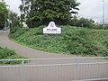
 Mill Road, Myland - geograph.org.uk - 2404745.jpg 640 × 428; 64 KB
-
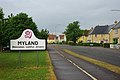
 Myland welcomes careful drivers - geograph.org.uk - 2074598.jpg 640 × 480; 93 KB
-
 New houses on Via Urbis Romanae - geograph.org.uk - 6079518.jpg 1,892 × 1,236; 916 KB
-
 New houses on Via Urbis Romanae - geograph.org.uk - 6079519.jpg 1,872 × 1,204; 900 KB
-
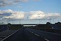 New Junction on the A12 - geograph.org.uk - 3259210.jpg 640 × 430; 35 KB
-
 New junction, A12 - geograph.org.uk - 2677874.jpg 640 × 326; 31 KB
-
 New roundabout - geograph.org.uk - 3299210.jpg 640 × 480; 54 KB
-
 North Station Roundabout, Colchester - geograph.org.uk - 6079515.jpg 1,920 × 1,280; 862 KB
-
 Old Trees and New Fence - geograph.org.uk - 6082361.jpg 678 × 1,024; 303 KB
-
 Orchard Cottage on Tower Lane - geograph.org.uk - 4568159.jpg 3,072 × 2,304; 1.99 MB
-
 Part of Cuckoo Farm - geograph.org.uk - 837787.jpg 640 × 480; 81 KB
-
 Part of the grounds of Severalls Hospital - geograph.org.uk - 837776.jpg 640 × 480; 123 KB
-

-
 Petrolea Close from ASDA roundabout - geograph.org.uk - 2073462.jpg 640 × 480; 64 KB
-
 Railway bridge over footpath in Highwoods Country Park - geograph.org.uk - 1956396.jpg 4,000 × 3,000; 4.15 MB
-
 Railway lines and depot at Colchester - geograph.org.uk - 4948938.jpg 714 × 424; 211 KB
-
 Raven Way, Mile End - geograph.org.uk - 3299227.jpg 640 × 480; 129 KB
-
 Road and Equity House, Mile End - geograph.org.uk - 5325449.jpg 640 × 480; 89 KB
-
 Road to nowhere - geograph.org.uk - 3299208.jpg 640 × 480; 59 KB
-
 Roadsign near the Service Area - geograph.org.uk - 4566973.jpg 2,291 × 3,046; 1.63 MB
-
 Roadsign on Axial Way - geograph.org.uk - 4567346.jpg 2,351 × 2,213; 1.16 MB
-
 Roadsign on the Roundabout - geograph.org.uk - 4566966.jpg 2,265 × 3,011; 1.68 MB
-
 Roadsign on United Way - geograph.org.uk - 4568128.jpg 3,046 × 2,282; 2.04 MB
-
 Roundabout at the junction with Axial Way - geograph.org.uk - 4566911.jpg 2,825 × 2,117; 1.7 MB
-
 Service Road at the Services - geograph.org.uk - 4051905.jpg 3,072 × 2,304; 963 KB
-
 Several Ways - geograph.org.uk - 2404739.jpg 428 × 640; 74 KB
-
 Severalls Lane Bridge, A12 - geograph.org.uk - 2677863.jpg 640 × 430; 54 KB
-
 Severalls Lane Bridge, A12 - geograph.org.uk - 3880972.jpg 640 × 371; 38 KB
-
 Shed in Colchester sidings - geograph.org.uk - 6069381.jpg 5,184 × 3,888; 5.85 MB
-
 Street sign Three Crowns Road - geograph.org.uk - 1956413.jpg 3,000 × 4,000; 2.33 MB
-
 Suicide Dash Across The A12 - geograph.org.uk - 6082366.jpg 678 × 1,024; 208 KB
-
 The Headway Centre, Severalls Hospital - geograph.org.uk - 2484990.jpg 640 × 480; 109 KB
-

-
 The Path to Braiswick Lane - geograph.org.uk - 6082357.jpg 678 × 1,024; 239 KB
-
 The Path to Little Braiswick - geograph.org.uk - 6082345.jpg 678 × 1,024; 253 KB
-
 Three Crowns Road, Colchester - geograph.org.uk - 1956415.jpg 4,000 × 3,000; 2.63 MB
-
 Towards Cordelia Drive - geograph.org.uk - 6082359.jpg 1,024 × 678; 179 KB
-
 Trains at Colchester, 1988 - geograph.org.uk - 4846674.jpg 640 × 427; 120 KB
-
 Turner Rise South sign, Highwoods Country Park - geograph.org.uk - 1956406.jpg 4,000 × 3,000; 4.74 MB
-
 United Way sign - geograph.org.uk - 4567362.jpg 2,970 × 2,225; 4.95 MB
-
 United Way, Mile End, Colchester - geograph.org.uk - 4567369.jpg 3,007 × 1,846; 1,016 KB
-
 United Way, Mile End, Colchester - geograph.org.uk - 4567384.jpg 2,522 × 1,944; 724 KB
-
 United Way, Mile End, Colchester - geograph.org.uk - 4567978.jpg 2,687 × 1,896; 1.22 MB
-
 United Way, Mile End, Colchester - geograph.org.uk - 4568097.jpg 3,072 × 2,122; 1.56 MB
-
 United Way, Mile End, Colchester - geograph.org.uk - 4568122.jpg 3,072 × 1,981; 1.55 MB
-
 United Way, Mile End, Colchester - geograph.org.uk - 4568163.jpg 3,072 × 2,304; 1.78 MB
-
 Upgraded Path - geograph.org.uk - 2404725.jpg 428 × 640; 98 KB
-
 Via Urbis Romanae sign - geograph.org.uk - 4567374.jpg 3,072 × 2,304; 1.82 MB
-
 Via Urbis Romanae, Mile End - geograph.org.uk - 6079516.jpg 1,920 × 1,280; 784 KB
-
 Via Urbis Romanae, Mile End - geograph.org.uk - 6079517.jpg 1,878 × 1,212; 1.13 MB
-
 Via Urbis Romanae, Mile End - geograph.org.uk - 6079520.jpg 1,920 × 1,280; 777 KB
-
 Via Urbis Romanae, Mile End - geograph.org.uk - 6079521.jpg 1,892 × 1,236; 902 KB
-


_Glischrochilus_hortensis_-_geograph.org.uk_-_3414730.jpg)


_-_geograph.org.uk_-_3413039.jpg)


_-_geograph.org.uk_-_2259620.jpg)
_-_geograph.org.uk_-_2259610.jpg)


