Category:Nagel (Fichtelgebirge)
Jump to navigation
Jump to search
municipality of Germany    | |||||
| Upload media | |||||
| Instance of |
| ||||
|---|---|---|---|---|---|
| Part of |
| ||||
| Location | Wunsiedel, Upper Franconia, Bavaria, Germany | ||||
| Head of government |
| ||||
| Population |
| ||||
| Area |
| ||||
| Elevation above sea level |
| ||||
| Different from | |||||
| official website | |||||
 | |||||
Subcategories
This category has the following 6 subcategories, out of 6 total.
!
B
- Buildings in Nagel (3 F)
E
- Einheitsbäume (Nagel (Fichtelgebirge)) (1 P, 22 F)
H
N
- Nagler See (19 F)
Media in category "Nagel (Fichtelgebirge)"
The following 35 files are in this category, out of 35 total.
-
 DEU Nagel COA.svg 512 × 526; 18 KB
-
 Wappen Nagel.png 220 × 232; 12 KB
-
 Drei-Landkreis-Eck - panoramio.jpg 4,608 × 3,456; 3.64 MB
-
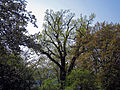 Eiche Nagel, 1.jpg 2,400 × 1,800; 1.81 MB
-
 Eiche Nagel, 2.jpg 1,800 × 2,400; 2.49 MB
-
 Gregnitzsteg - panoramio.jpg 4,608 × 3,456; 4.13 MB
-
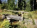
 Hans-König-Brunnen - panoramio.jpg 1,600 × 1,200; 850 KB
-
 Im alten Nageler Steinbruch - panoramio.jpg 2,048 × 1,536; 863 KB
-
 Informationstafel am Wurmlohpass.JPG 3,888 × 2,592; 3.81 MB
-
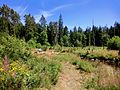
 Nagel (Fichtelgebirge), Feuchtgebiet-1.jpg 2,551 × 1,701; 1.58 MB
-
 Nagel (Fichtelgebirge), Feuchtgebiet-2.jpg 2,551 × 1,701; 1.59 MB
-
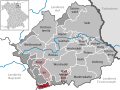
 Nagel im Landkreis Wunsiedel.png 470 × 392; 71 KB
-
 Nagel in WUN.svg 520 × 390; 529 KB
-
 Nagel, Blick zum Klausenturm.jpg 2,551 × 1,701; 833 KB
-
 Nagel, Landschaft südlich des Ortes-1.jpg 2,551 × 1,701; 715 KB
-
 Nagel, Landschaft südlich des Ortes-2.jpg 2,551 × 1,701; 972 KB
-
 Nagel, Landschaft südlich des Ortes-3.jpg 2,551 × 1,701; 1.23 MB
-
 Nagel, Landschaft südlich des Ortes-4.jpg 2,551 × 1,701; 1.23 MB
-
 Nagel, Landschaft südlich des Ortes-5.jpg 2,551 × 1,701; 1.16 MB
-
 Nageler Steinbruch 1 - panoramio.jpg 4,608 × 3,456; 2.91 MB
-
 Nageler Steinbruch 2 - panoramio.jpg 4,608 × 3,456; 2.73 MB
-
 Nageler Steinbruch 3 - panoramio.jpg 4,608 × 3,456; 2.84 MB
-
 Nagler-See im Sommer.jpg 4,032 × 3,024; 4.5 MB
-
 Oberölbühl (Brand), Blick auf Nagel und die Hohe Matze.jpg 2,551 × 1,701; 1.14 MB
-
 Oberölbühl (Brand), Blick auf Nagel.jpg 2,551 × 1,701; 1.03 MB
-
 Rastplatz "Petersruh" - panoramio.jpg 4,608 × 3,456; 12.55 MB
-
 Rastplatz bei Ölbühl - panoramio.jpg 4,608 × 3,456; 2.33 MB
-
 Steinlohbach in Nagel.JPG 3,872 × 2,540; 4.99 MB
-
 Steinlohe - panoramio.jpg 4,608 × 3,456; 2.53 MB
-
 Wasserscheide Schild Wurmloh Hohe Matze.jpg 1,920 × 2,560; 2.39 MB
-
 Wasserspielplatz in Nagel.jpg 2,400 × 1,600; 1.73 MB
-
 Watershed sign Wurmloh Hohe Matze.jpg 1,920 × 2,560; 1.82 MB
-
 Wurmlohpass Straßenschild 16-9.jpg 2,560 × 1,440; 1.46 MB
-
 Wurmlohpass Straßenschild 6x7.jpg 2,240 × 1,920; 1.64 MB
-
 Wurmlohpass Straßenschild.jpg 2,560 × 1,920; 1.91 MB


,_Feuchtgebiet-1.jpg)
,_Feuchtgebiet-2.jpg)


,_Blick_auf_Nagel_und_die_Hohe_Matze.jpg)
,_Blick_auf_Nagel.jpg)


