Category:Weißenstadter Forst-Süd
Jump to navigation
Jump to search
unincorporated area in Germany    | |||||
| Upload media | |||||
| Instance of |
| ||||
|---|---|---|---|---|---|
| Location | Wunsiedel, Upper Franconia, Bavaria, Germany | ||||
| Population |
| ||||
| Area |
| ||||
 | |||||
Media in category "Weißenstadter Forst-Süd"
The following 10 files are in this category, out of 10 total.
-
 Backöfele 1 - panoramio.jpg 4,068 × 3,052; 1.49 MB
-
 Backöfele 2 - panoramio.jpg 4,376 × 3,288; 1.89 MB
-
 Digitales Orthofoto von Weißenstadter Forst-Süd (Bayerische Vermessungsverwaltung).tif 17,500 × 20,000; 547.71 MB
-
 Granit, Holz und Beton - panoramio.jpg 4,608 × 3,456; 2.65 MB
-
 Habersteinsattel - panoramio.jpg 4,608 × 3,456; 8.55 MB
-
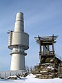 Schneeburg - Tower and Viewing platform in the Snow - panoramio.jpg 900 × 1,200; 194 KB
-
 Schneeburg Gate - Cold War - panoramio.jpg 1,680 × 539; 120 KB
-
 Schneeburg Tower in wintry conditions - panoramio.jpg 3,072 × 2,304; 1.1 MB
-
 Trail in the snow - panoramio.jpg 900 × 1,200; 361 KB
-
 Weißenstadter Forst-Süd in WUN.svg 520 × 390; 529 KB


